
Lorne, NSW
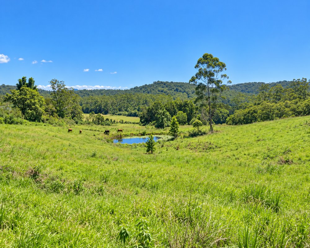
Lorne is a farming valley in the hills west of Kendall, about 30 minutes from Laurieton. It should not be confused with the seaside town in Victoria.
Known For
- A green valley beneath the Comboyne Plateau
- Dairy and beef farms
- A scenic back road
Things To Do in Lorne
There are no attractions here. Lorne Road winds up the valley through farms and forest and climbs to the Comboyne Plateau, a fine drive in dry weather.
Lorne Road to Comboyne
Lorne Road is the back way from Kendall up to the Comboyne Plateau, about 29 km in all. Council has been sealing and realigning the steep western end in a $10 million upgrade, but in late 2024 about 13 km was still gravel. It is a fine drive in a car in dry weather, but it is narrow with blind corners and is not a road for caravans.
Kerewong State Forest
The forested ranges at the head of the valley are part of Kerewong State Forest, crossed by forestry roads and trails. Check Forestry Corporation for closures after rain or during harvesting, and carry a map, as phone coverage is patchy.
Kendall
About 11 km east, Kendall has a Poets’ Walk honouring the poet Henry Kendall, picnic spots beside the Camden Haven River, the Kendall Craft Co-op and a School of Arts hall from 1908.
Where To Stay
We could not confirm any farm stay taking guests now. Kendall, Kew and Laurieton are the nearest places with accommodation.
Kew, about 13 km east, has The Royal, a restored heritage hotel with rooms. Laurieton, North Haven and Dunbogan, 20 to 25 km away, have holiday parks, motels and holiday houses on the river and the beaches, and Bago Maze & Wine, at Herons Creek, about 15 km north-east via Kendall, runs Mountain View Camp, a private off-grid hilltop site for tents, caravans, camper trailers and motorhomes. Lorne Road is sealed from Kendall into the valley, but tow only as far as you are sure you can turn around.
Eat & Drink
There are no shops. Kendall is the nearest village.
Kendall has Miss Nellies on River Street for a treat, The Kendall General for coffee and pies, and the craft co-op. Kew, a couple of minutes further on, has The Royal, a heritage pub with a big family beer garden and a restaurant. Laurieton, about 22 km away, has supermarkets, fuel, clubs and cafes along the Camden Haven River.
History
The Lorne Valley is on the Country of the Birpai people. Timber getters came into the Camden Haven hinterland first, with organised cutting from mills near Kendall from the 1860s, and selectors cleared the valleys for dairying from the 1880s. The Kendall district has long included Kew, Herons Creek, Lorne and Ross Glen, and Lorne has its own Rural Fire Service brigade.
Getting to Lorne
From Kendall follow Lorne Road west.
From Sydney it is about 350 km on the Pacific Highway to the Kendall exit, then about 11 km west on Lorne Road (about 13 minutes). The upper road to Comboyne is steep and partly gravel.
Experiences
- Rural/Country
- Self-Drive
Popular Activities
- Bush Walking
- Driving
- Sightseeing
About Lorne
- Locality: Rural locality
- Lorne Postcode: 2439
- State: New South Wales
- Region: North Coast NSW
- Latitude: -31.65756
- Longitude: 152.59167
- Elevation: 65m
- Population: 266
- Median Income: $27508
- Area (Sq/km): 50.722
- Timezone: Australia/Sydney
Accommodation In Lorne
Discover some of the accommodation in and around Lorne
