
Wooroonooran National Park, QLD
Wooroonooran National Park is a vast tract of World Heritage rainforest between Cairns and Innisfail, covering the Bellenden Ker Range and the country behind it as far as the Atherton Tableland. It contains the two highest mountains in Queensland, Bartle Frere at 1,622 metres and Bellenden Ker at 1,593 metres, and some of the wettest places in Australia. Rivers pour off the ranges in every direction, and the park is best known for its waterfalls and swimming holes.
Known For
- Josephine Falls and its natural rock slide
- Bartle Frere, the highest mountain in Queensland
- Waterfall walks and the Mamu Tropical Skywalk on the Palmerston Highway
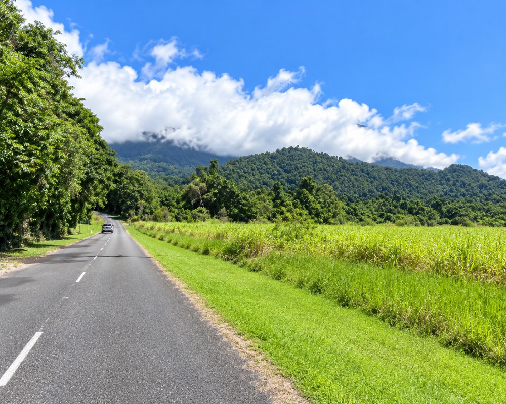
The park is too large and rugged to see in one visit, and there is no road through it. Instead it is entered at several separate points: Josephine Falls and the Goldsborough Valley on the coastal side, and the Palmerston section along the highway that climbs from Innisfail to the Tableland. The forest shelters cassowaries, tree kangaroos and many plants found nowhere else.
Things To Do in Wooroonooran National Park
Josephine Falls
A sealed path of about 700 metres leads through the rainforest to a series of cascades at the foot of Bartle Frere. At the lower pool, swimmers slide down a smooth, sloping rock into deep, cold water. It is one of the most popular swimming spots in the north, but the creek can rise without warning after rain on the mountain, so obey the signs and stay out of the closed top section.
Bartle Frere
The trail to the summit starts beside the Josephine Falls car park and climbs 1,500 metres in seven and a half kilometres. It is a very hard walk of ten to twelve hours return, or two days with a camp on the way, over roots, boulders and mud, and the top is in cloud more often than not. A second route comes up from the Tableland side. Only fit, well-prepared walkers should attempt it.
Palmerston Section
The Palmerston Highway, west of Innisfail, passes a string of short walks. Crawfords Lookout has a view deep into the North Johnstone gorge, tracks lead to Nandroya Falls, Tchupala Falls and Wallicher Falls, and there is a campground at Henrietta Creek, where platypus are sometimes seen. The Mamu Tropical Skywalk, an elevated walkway with a tall observation tower, gives a view over the canopy and the gorge.
Goldsborough Valley and the Goldfield Trail
Inland from Gordonvale, the Goldsborough Valley has a riverside campground on the Mulgrave River and a walk to Kearneys Falls. From here the Goldfield Trail, a 19 kilometre track first cut by gold prospectors in the 1930s, crosses a saddle of the range to the Boulders at Babinda.
Walshs Pyramid
The steep, isolated peak beside the highway at Gordonvale is also part of the park, with a tough track to its 922 metre summit.
Nandroya Falls Circuit
From the Henrietta Creek camping area, a circuit of about 6.5 km climbs through rainforest to Nandroya Falls, where Douglas Creek drops about 50 metres into a pool, passing smaller falls and cascades on the way. Allow about three hours and wear shoes with good grip, as the track is slippery after rain.
Where To Stay
Campgrounds at Henrietta Creek and Goldsborough Valley can be booked through the national parks service, and there are walkers’ camps on Bartle Frere.
Babinda, Innisfail and Millaa Millaa are the closest towns with rooms.
In the Palmerston section, Henrietta Creek camping area has 10 numbered grassy sites beside the creek and takes caravans, motorhomes and camper trailers; book with QPWS before you arrive. In the Goldsborough Valley, about 25 km south-west of Gordonvale, the Goldsborough Valley camping area has 12 sites beside the Mulgrave River (reached by conventional vehicle with care, not suited to caravans), with a second area at the Bora Ground. Tap water there is off until the end of January 2027 and the day-use toilets are closed until early February 2027, so bring all your water.
On Bartle Frere, the eastern approach, including the Big Rock and Eastern Summit camps, will close from 21 June to 25 August 2027. Outside the park, the Millaa Millaa Tourist Park is about 20 km west of Henrietta Creek, and Babinda, Innisfail and Gordonvale have caravan parks and motels for the coastal entrances.
Eat & Drink
There is nothing to buy in the park. Babinda has a bakery and pub close to Josephine Falls, and the Mamu Tropical Skywalk sells light refreshments such as cold drinks and ice creams.
There is no cafe inside the park. The Mamu Tropical Skywalk sells light refreshments such as cold drinks and ice creams. For Josephine Falls, Babinda is about 15 km north: the Babinda Independent Bakery on Munro Street (closed Sundays and Mondays), the Babinda State Hotel with its Bistro 1917, the Babinda Taverna for Italian food, and the Hey Mate Cafe. Near the Palmerston section, Mungalli Creek Dairy’s farmhouse cafe near Millaa Millaa serves meals made with its own dairy produce. Bring a picnic: the Josephine Falls amenities block is closed from 16 November 2026 to 28 February 2027 and its barbecue is out of service until the end of January 2027.
History
The ranges are the country of the Mamu, Ngadjon-Jii and Yidinji peoples, and Wooroonooran is an Aboriginal name for the Bellenden Ker Range. The explorer Christie Palmerston cut a track through this country in the 1880s, and the highway that bears his name follows his route. Bellenden Ker was made a national park in 1921. It was joined with the Palmerston park under the present name in the early 1990s, after the forests were given World Heritage listing.
Getting to Wooroonooran National Park
For Josephine Falls, turn off the Bruce Highway two kilometres south of Mirriwinni, about 75 kilometres south of Cairns. The Palmerston section begins 30 kilometres west of Innisfail. The Goldsborough Valley road leaves the Gillies Highway just west of Gordonvale.
Experiences
- Active
- Nature based
Popular Activities
- Bird Watching
- Bush Walking
- Caravan and Camping
- National Park
- Rainforest
- Swimming
- World Heritage
About Wooroonooran National Park
- Locality: Rural locality
- Wooroonooran National Park Postcode: 4860
- State: Queensland
- Region: Cairns & Great Barrier Reef
- Latitude: -17.3312
- Longitude: 145.8549
- Elevation: 91m
- Timezone: Australia/Brisbane
