Walcha, NSW
Walcha is located at the crossroads of the Thunderbolts and Oxley Highways. The Thunderbolts Way is a very scenic and much shorter road to take than the Pacific or New England Highways, when travelling north or south in from Raymond Terrace or Uralla. It saves about 1 hour’s drive time than the New England Highway.
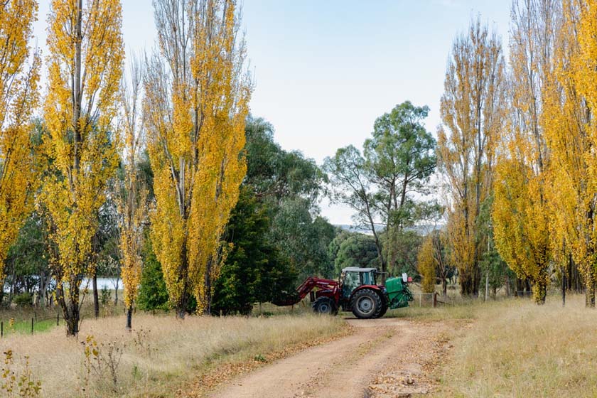
Known For
- Open-air sculptures and public art installations
- Apsley Falls in Oxley Wild Rivers National Park
- Scenic drives along Thunderbolts Way and Oxley Highway
Walcha NSW is fast becoming a destination for people wishing to escape the fast pace of city living, and offers an abundant array of activities for the whole family to enjoy. There are farm stays, B&B’s, great pubs, motels and a 4 star caravan park. 4WDing, fishing, motorcycling, mountain biking, and bushwalking are just some of the adventures on offer.
The Oxley Wild Rivers, Werrikimbi, Carrai, Cottan-bimbang, Nowendoc and Mummel Gulf National Parks are a few of these natural attractions that can be visited. They offer camping, great newly updated facilities, and Apsley and Tia Waterfalls offer access for Caravans.
Be sure to stop in and pick up a brochure at the Walcha Visitor Information Centre. Enquire about access into the bottom of one of Australia’s largest and deepest gorge systems, into either ‘Riverside’ or ‘Youdales Hut’.
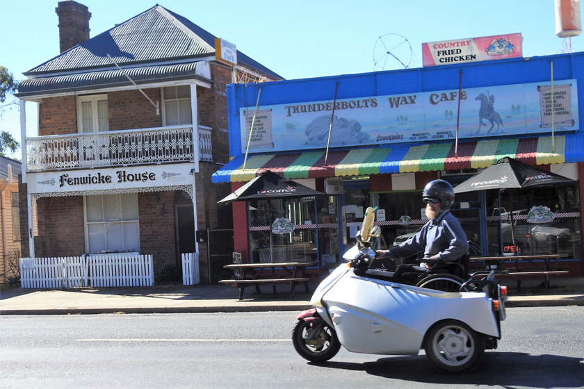
Walcha also is internationally known for its public artwork. There are 58 sculptures that can be found around this very picturesque and tidy town. Pick up a brochure from the Visitor Information Centre or download online at Art – Walcha NSW
Regional NSW is showcased in Walcha township with very friendly hospitality, great food and coffee, a fantastic pioneer cottage museum, and some excellent shops for locally produced art and timber products.
Where to Stay
From cozy cottages to boutique stays, Walcha caters to all types of visitors.
Red Hill Cottage offers a serene retreat surrounded by rolling hills, while the Walcha Motel provides a comfortable base within walking distance of local attractions. For those seeking a rural escape, farm invite guests to experience the charm of the countryside.
Eat & Drink
Walcha’s culinary scene is as welcoming as its community. Café Graze serves up hearty breakfasts, specialty coffees, and homemade treats in a cozy atmosphere. For a taste of the region’s produce, the Walcha Road Cafe offers hearty meals with a touch of rustic charm. Local markets and bakeries further highlight the town’s dedication to fresh, quality ingredients.
Walcha Area, NSW
Walcha (pronounced ‘Wolka’) is located in a beautiful area 1067 metres above sea level on the eastern slopes of the Great Dividing Range at the south eastern edge of the Northern Tablelands.
It is essentially a service centre to the surrounding area which has traditionally been associated with sheep, wool and cattle, although timber and timber-processing have been of increasing importance to the local economy since World War II.
The area is thought to have been occupied by the Ngayaywana and Dyangadi Aborigines prior to white settlement. In 1818 John Oxley camped beside the Apsley River very near the present townsite en route to the coast. He recorded the event in his diary that day: ‘We halted in a fine and spacious valley … watered by a fine brook, and at a distance of a mile we saw several fires at which appeared many natives.’
A road to Port Macquarie (the template of today’s Oxley Highway) was constructed in 1842 for the transportation of wool from New England to the coast.
In 1878 Walcha was gazetted as a town and a courthouse was built. A rail link opened to the west, at Walcha Road, in 1882. The town became a municipality in 1889.
Walcha’s Agricultural Show is held each year in March, the Walcha Antique Machinery & Truck Show in February and, in January, the Walcha Goldengate Campdraft & Rodeo.
Getting to Walcha
Walcha’s accessibility by road makes it an ideal stop on a road trip through New South Wales. Travelers from Sydney can enjoy a picturesque drive along Thunderbolts Way or the Oxley Highway, passing through stunning landscapes and quaint towns. For those relying on public transport, Walcha Road station, just 20 kilometers from the town, is serviced by daily NSW TrainLink services connecting Sydney and Armidale.
Up to date information on Walcha can be found on the Walcha NSW – where wild rivers run website.
Nearest Airport: ARMIDALE 56KM/Walcha (lightaircraft)
Popular Activities
- Bush Walking
- Caravan and Camping
- Cycling
- Fishing
- Golfing
- National Park
About Walcha
- Locality: Urban locality
- Walcha Postcode: 2354
- State: New South Wales
- Region: Country NSW
- Latitude: -30.99207
- Longitude: 151.59205
- Elevation: 1056m
- Population: 2553
- Median Income: $30784
- Area (Sq/km): 3239.086
- Timezone: Australia/Sydney