Mount Warning, NSW
This World Heritage rainforest partk (2210 ha) is located in far north-eastern NSW and can be reached by leaving the Pacific Highway at Murwillumbah and following the Kyogle road west for 12 km. Turn onto the Mount Warning Road and travel 5 km to the Korrumbyn Creek Picnic Area at the park entrance. Proceed another 1.5 km along the road to the Breakfast Creek parking area at the base of the mountain.
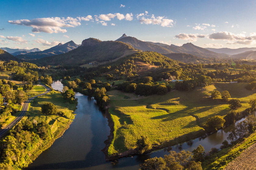
Mt Warning is a volcano which covered a massive 400 square kilometres and can be found within the Mt Warning national park. Given its name by Captain Cook, it was used as a warning to sailors of the dangerous Point Danger near Tweed Heads.
Mount Warning was added to the World Heritage list in 1975. Mount Warning at the heart of the park, is the remnant central plug of the Tweed shield volcano. The ‘Tweed Caldera’ is one of the largest and best examples of an erosion caldera in the world.
There are good walking trails through rainforest. Observant walkers, may see a variety of birds, mammals, reptiles and many threatened plant species. The trails can be steep in parts and take roughly 5 hours; so it may be worth setting aside a day or so. Things to note are: toilets are available only at the start of the walk, suitable footwear should be worn, temperature drops rapidly as you ascend, carry plenty of water, keep to the track and take all litter with you.
There is a campsite nearby.
Mount Warning
The northernmost stretch of coast in New South Wales is home to unspoilt beaches, volcanic mountains, lush countryside and three of the state’s most dramatic World Heritage-listed national parks.
Mount Warning, Nightcap and Border Ranges national parks cover some 42,000 hectares. The neighbouring Cape Byron is Australia’s most easterly point.
The parks attract eco-travellers from around the world. Many come to conquer the 1,100-metre Mount Warning, a once-active volcano. The 4.4-kilometre walk to the top takes about five hours there and back. Challenging tracks wind through rainforest communities, with a steep rock scramble near the summit. But once at the peak, you’re rewarded with stunning 360-degree views of the bowl-shaped Tweed Valley.
On Mount Warning’s caldera rim is the 31,683-hectare Border Ranges National Park, a habitat for threatened flora and fauna, such as the rare Albert’s lyrebird. Walking tracks offer stunning views from Bar Mountain, Blackbutt Lookout and Antarctic Beech. The park has picnic areas, shelter sheds, and camping areas at Sheepstation Creek and Forest Tops.
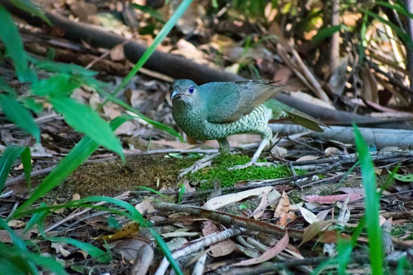
Koalas, red-legged pademelons and Albert’s lyrebirds are among the exotic wildlife of the 8,080-hectare Nightcap National Park, which contains significant populations of threatened plants and animals.
Highlights include the lush rainforests of Terania Creek, the breathtaking Protestors Falls and Minyon Falls, with its magnificent 100-metre waterfall. Nearby is the start of the scenic 30-kilometre Whian Whian forest drive.
Nearest Airport: Coolangatta
Where to stay?
About Mount Warning
- Locality: Rural locality
- Mount Warning Postcode: 2484
- State: New South Wales
- Region: North Coast NSW
- Latitude: -28.39783
- Longitude: 153.28779
- Elevation: 378m
- Population: 100
- Median Income: $21580
- Area (Sq/km): 54.187
- Timezone: Australia/Sydney