
Laurieton, NSW
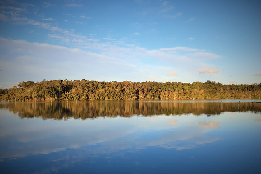
Laurieton is a town of about 2,000 people on the Camden Haven River, 35 minutes south of Port Macquarie. North Brother Mountain rises steeply behind the main street.
Known For
- The lookout on North Brother Mountain
- The Camden Haven River and its oysters
- A relaxed riverside town
Things To Do in Laurieton
A sealed road climbs to the top of North Brother, almost 500 metres up, in Dooragan National Park. The lookouts take in the river, two lakes and the coast from Crowdy Head to Port Macquarie, and it is one of the finest views in the state. Short rainforest walks start from the picnic area.
In town, a path follows the riverbank past the fishing boats and oyster sheds. The river is good for fishing, kayaking and cruising, and the surf beaches at North Haven and Dunbogan are five minutes away.
Laurieton Track
For a harder way up North Brother, the Laurieton Track climbs 3 km one way from Laurie Street through tall blackbutt forest, past old logging stumps, to the summit picnic area. Allow 1.5 to 2.5 hours. At the top, the short Rainforest Loop leads to a lookout towards Diamond Head, and on a good day hang gliders launch from the summit.
Bob Hope and the School of Arts
In August 1944 the American entertainer Bob Hope’s Catalina flying boat lost power and landed in the Camden Haven Inlet, and he put on a concert in the Laurieton School of Arts. The building, on the corner of Laurie and Bold streets, dates from 1911-12 and is on the State Heritage Register.
Riverwalk Markets
The Laurieton Riverwalk Markets are held beside the river on Tunis Street on the third Sunday of each month, with an extra market in January, with food stalls, local produce, plants and secondhand goods.
Where To Stay
Laurieton has pub rooms, a lakefront camping ground and holiday units. There are more at North Haven and Dunbogan.
The Laurieton Hotel on Bold Street has good-value rooms, and Visit NSW lists the Laurieton Lakefront camping ground, where you can also hire kayaks. Most caravan travellers stay across the river: Dunbogan Caravan Park, 3 km away, has powered sites, cabins, a pool and a dump point and takes pets; Reflections North Haven, at 109 The Parade, has powered and unpowered sites, cabins, tiny homes and glamping tents on 5 hectares of bush, takes dogs and has a dump point; and North Haven Holiday Village, at 85-89 The Parade, has cabins and powered sites, takes pets and has a dump point. Diamond Head campground in Crowdy Bay National Park, 12 km south, has 75 unpowered sites that take caravans, with toilets and showers; book with NPWS and pay park entry of $8 per vehicle per day. There is no council public dump point in the Camden Haven, so use the one at your park.
Eat & Drink
The main street has cafes, a bakery, a hotel and a large services club. Oysters are grown on the river, though the growers’ waterfront shop has closed for now.
The Laurieton Hotel serves pub meals and has a bottle shop, and the Laurieton United Services Club on Seymour Street, with the Boardwalk Bistro and the Deck Coffee Lounge, is the big club in the district, and it also runs the Kew Country Club, with a bistro and mini golf. Armstrong Oysters farms Sydney rock oysters on the river, but its shop under the bridge closed in 2026 during renovations. The fishermen’s co-op building burnt in January 2025, and Laurieton Seafoods moved to temporary premises in North Haven.
Delizioso on Bold Street cooks woodfired pizza, pasta and seafood (book ahead), and Blue Buffalo serves South Vietnamese street food, with sugar-cane juice and fresh coconuts. Grounded, on Lake Street near the river, is the early coffee stop, and Wiggly Tail, a butcher since 1948, still smokes its own ham and bacon. The Laurieton Hotel has two-for-one dinners on Mondays and bands on Saturday nights, and the Laurieton Riverwalk Markets are held on the third Sunday of the month.
History
James Cook named the Three Brothers on 12 May 1770 because the three mountains looked alike. By coincidence, the Birpai story of the mountains also tells of three brothers.
This is Birpai (Birrbay) Country, and the three mountains are Dooragan, Mooragan and Booragan. The area was known as Peach Orchard until the post office opened in 1875 under Joseph Laurie, whose family’s sawmill opened on the riverbank in 1876, and the town took his name. By 1886 four sawmills worked nearby, and ships were built here until about 1903.
Getting to Laurieton
Leave the Pacific Highway at Kew and drive seven kilometres east.
The road is sealed and suits caravans. From Port Macquarie you can also follow Ocean Drive south through Lake Cathie and Bonny Hills, about 35 km. XPT trains stop at Kendall, 11 km away.
Experiences
- Historic/Heritage
- Nature based
- Relaxation
Popular Activities
- Bush Walking
- Fishing
- Food and Wine
- Kayaking
- National Park
- Sightseeing
- Swimming
About Laurieton
- Locality: Suburb
- Laurieton Postcode: 2443
- State: New South Wales
- Region: North Coast NSW
- Latitude: -31.65023
- Longitude: 152.79818
- Elevation: 6m
- Population: 1986
- Median Income: $23244
- Area (Sq/km): 4.335
- Timezone: Australia/Sydney
Accommodation In Laurieton
Discover some of the accommodation in and around Laurieton
