Warialda, NSW
Historic Warialda was the Administrative Headquarters for the Gwydir Squatting District in the colony of New South Wales and site of the first Police Station in the region.

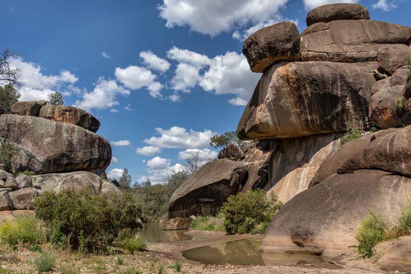
The town is surrounded by picturesque bushlands and has a great variety of wildflowers. There are numerous places to picnic and Cranky Rock nature reserve offers many hours of fossicking, bird watching and exploring.
The stones to be found locally in gravel quarries are petrified wood, jasper, chert, agate and chalcedony.
Warialda is part of “Fossickers Way”Tourist route , towns on this route include Nundle, Tamwoth, Manilla,
Barraba, Bingara, Warialda, Inverell, Glen Innes and Emmaville/Deepwater
Warialda is also the southern most town on the newly developed Rural Get-A-Way Tourist route running from Warialda to Mundubberra providing the most direct route from Sydney to Rockhampton.
Nearest Airport: INVERELL OR MOREE
Where to stay?
Popular Activities
- Golfing
About Warialda
- Locality: Urban locality
- Warialda Postcode: 2402
- State: New South Wales
- Region: Country NSW
- Latitude: -29.54118
- Longitude: 150.57617
- Elevation: 333m
- Population: 1590
- Median Income: $24700
- Area (Sq/km): 1196.856
- Timezone: Australia/Sydney
Accommodation In Warialda
Discover some of the accommodation in and around Warialda