
Taralga, NSW
Taralga is a small village in the high country of the Southern Tablelands, 45 km north of Goulburn and about 240 km from Sydney. At about 850 metres above sea level, it has cold winters and occasional snow. Its main street of bluestone and sandstone buildings has changed little in a century, and it is the usual approach to the Wombeyan Caves.
Known For
- A stone-built heritage village
- The Taralga Rodeo
- The road to Wombeyan Caves
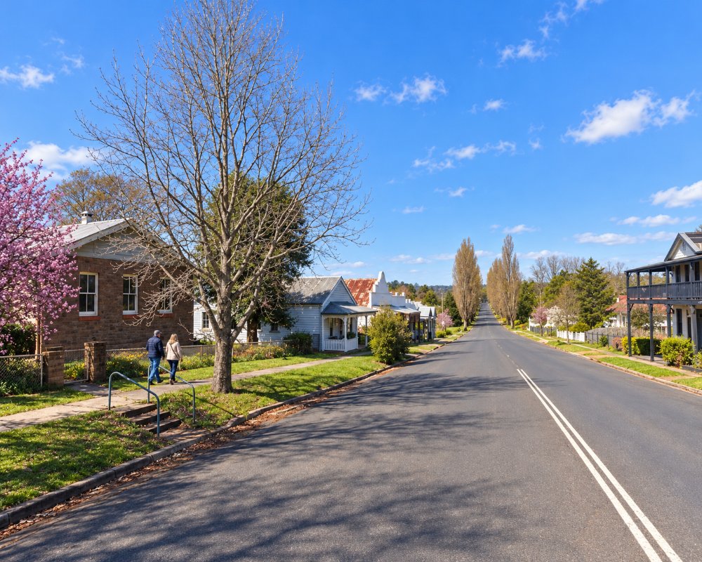
About 400 people live in Taralga. The surrounding plateau is open grazing land, known for fine wool, prime lamb, cattle and seed potatoes, with wind turbines on the ridges.
Things To Do
Village Walk
Orchard Street has old hotels, stores, banks and cottages built of local stone. The village has three churches, the largest being the Catholic church, which reflects the many Irish families who settled the district. The Taralga Historical Society museum, in the former Methodist church of 1868 and its grounds, opens to visitors; check the days before you go.
Taralga Rodeo
Held each year at the showground in late January around Australia Day, the rodeo is one of the oldest in southern New South Wales; the 60th rodeo is on 30 January 2027.
Wombeyan Caves
About 30 km north-east on a partly unsealed road, the Wombeyan Caves reserve has limestone show caves, walking tracks and camping. The road from Taralga is the main access. Check that the caves and road are open before travelling, as there have been long closures. Wombeyan Caves Road from Mittagong is closed after storm damage, so the caves can only be reached via Taralga or from Oberon.
Tablelands Way
The road north from Taralga crosses the Abercrombie River gorge and continues through forest and high farmland to Oberon, a scenic alternative route between Goulburn and the Blue Mountains.
History
Taralga is in the country of the Gundungurra people.
The explorer Charles Throsby passed through in 1819. The Macarthur family took up large holdings nearby in the 1820s, and convicts and free settlers followed. The village was laid out in the 1860s and grew as a centre for dairying, potatoes and wool. A branch railway from Goulburn operated from 1926 to 1957.
Where To Stay
Taralga has two hotels with rooms and a few cottages and bed and breakfasts.
The Argyle Inn on Orchard Street, the oldest hotel still trading in the village, has eight restored ensuite rooms open Thursday to Saturday nights. The Taralga Hotel, a stone pub of 1876, has pub rooms, but ring to check it is trading. The Taralga Showground takes tents, caravans and camper trailers and has powered sites, which helps on event weekends.
Goulburn has motels and caravan parks.
Crookwell Caravan Park, about 38 km west, has a dump point.
Eat & Drink
The hotels and the sports club serve meals, and the general store sells coffee, sandwiches and groceries.
The Argyle Inn’s dining room is the most ambitious in the village, with house-made sourdough and pasta, trout and duck, open from Friday lunch to Sunday breakfast; book ahead. The Taralga Sports Club on Cooper Street has a country kitchen for lunch and dinner. Fuel is limited to one small outlet in the village, so fill up in Goulburn or Crookwell before heading to Wombeyan.
The Argyle Inn is an 1875 stone inn with a kitchen-garden courtyard; it was offered for sale in 2026 but was still trading in late October. The Taralga Hotel, built in 1876, serves local beef and lamb and stone-fired pizzas (book at weekends), and the General Store doubles as the post office and sells local oils, jams and honey. The Australia Day Rodeo is the village’s biggest day.
Getting There
From Goulburn, follow the Taralga Road north, about 40 minutes. The road is sealed.
From Sydney it is about 235 km via the Hume Motorway to Goulburn, and the Taralga Road suits caravans. From Oberon it is about 100 km south on the Tablelands Way, which winds through the Abercrombie River gorge, and from Crookwell about 38 km on the Laggan road.
Experiences
- Historic/Heritage
- Rural/Country
- Self-Drive
Popular Activities
- Caravan and Camping
- Caving
- Driving
- National Park
- Sightseeing
About Taralga
- Locality: Urban locality
- Taralga Postcode: 2580
- State: New South Wales
- Region: Country NSW
- Latitude: -34.40557
- Longitude: 149.81868
- Elevation: 852m
- Timezone: Australia/Sydney
Accommodation In Taralga
Discover some of the accommodation in and around Taralga
