
Schofields and Riverstone, NSW
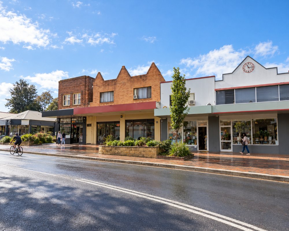
Schofields and Riverstone are neighbouring suburbs in the north-west of Sydney, about 45 kilometres from the city centre, on the railway line to Richmond. Riverstone is an old country town with a main street of early shopfronts. Schofields, to its south, was farmland until recently and is now one of the fastest-growing housing areas in the city.
Known For
- Riverstone’s old country town centre
- New parks and cycleways
- On the way to Windsor and the Hawkesbury
Both suburbs lie along the railway and Garfield Road, between Eastern Creek on the west and First Ponds Creek on the east. The metro terminus at Tallawong is close to Schofields, and Rouse Hill is a few minutes further east.
Things To Do in Schofields and Riverstone
Riverstone
Riverstone grew up around a large meatworks that operated from 1878 until it closed in 1992, and employed much of the town. Its main street still has shopfronts, churches and cottages from the late 1800s, and the Riverstone Museum at 81 Garfield Road East, run by the Riverstone & District Historical Society, opens on the first Sunday of each month except January, 11am to 2pm, with free entry.
Parks and Wetlands
New parks, playgrounds and cycleways have been built along the creeks as the area has developed, and remnant Cumberland Plain woodland survives in several reserves.
Nearby
Rouse Hill Estate, a colonial house museum with its original contents, and Rouse Hill Regional Park are ten minutes east. The historic Hawkesbury towns of Windsor and Richmond are about 15 minutes north, and Scheyville National Park is close by.
The Meatworks Town
On 9 October 1970 a fire at the meatworks killed six men who were trying to lead sheep to safety. The town was laid out on the old O’Connell estate, with streets named after London streets such as Piccadilly Street and Gladstone Parade, and Riverstone Terrace (1883) is the only block built of a planned row of terraces along Garfield Road. The level crossing and country-style station often stand in for country towns in films.
Where To Stay
There is very little visitor accommodation in either suburb.
Hotels can be found at Rouse Hill, the Norwest business park and Windsor.
Neither suburb has hotels or motels; the nearest are in Windsor, about 15 minutes north, around Norwest and Rouse Hill to the east, and at Rooty Hill. For caravans this corner is closer to the Hawkesbury than most of Blacktown City: NPWS’s Cattai National Park campground near Windsor has unpowered caravan sites and hot showers but no dump point, and Ingenia Holidays Sydney Hills at Dural has cabins and powered sites. Richmond Road, Windsor Road and Garfield Road suit caravans, but watch the low-lying roads west of Riverstone after heavy rain.
Eat & Drink
Riverstone has cafes and takeaways along Garfield Road and a club near the station. Schofields has new shopping centres with casual dining. Rouse Hill Town Centre has a much wider choice of restaurants.
The old centre on Garfield Road and around Riverstone station has cafes, bakeries and takeaways, and the shops opposite Schofields station include a Woolworths, with Coles and more shops in Schofields Village. The Marsden Brewhouse on Richmond Road, Marsden Park, about 10 minutes west, is the big local pub, with its own beers and a bistro, and Rouse Hill Town Centre has the widest choice of restaurants.
History
This is the country of the Dharug people. Riverstone began as part of a land grant made in 1810 to Maurice O’Connell, who named it Riverston after his birthplace in Ireland. Schofields is named after John Schofield, a convict who became a landowner here in the 1840s. A wartime airfield at Schofields later served as a naval air station and has since been redeveloped for housing.
Riverstone began as part of the 1803 government stock farm, the railway opened in 1864, and Riverstone Public School opened in January 1883; Schofields Siding was recognised as a stopping place in 1872. In 2020 the new suburbs of Nirimba Fields, Tallawong, Grantham Farm, Richards and Angus were cut out of Schofields and Riverstone.
Getting to Schofields and Riverstone
Trains on the Richmond line take about an hour from Central. By car, use the M7 motorway and Richmond Road or Windsor Road. Marsden Park, with its large retail precinct, is ten minutes west, and The Ponds and Quakers Hill are immediately to the south-east.
Experiences
- City
- Historic/Heritage
- Rural/Country
Popular Activities
- City Sightseeing
- Cycling
- Sightseeing
About Schofields and Riverstone
- Locality: Suburb
- Schofields and Riverstone Postcode: 2762
- State: New South Wales
- Region: Sydney
- Latitude: -33.6974
- Longitude: 150.8688
- Elevation: 22m
- Timezone: Australia/Sydney
