
Girilambone, NSW
Girilambone is a tiny village on the Mitchell Highway, about 45 km north-west of Nyngan on the long, straight road to Bourke. Most travellers pass through in a moment. It began as a copper-mining settlement in the 1880s, and the name, from the Wongaibon language, is usually translated as place of many stars.
Known For
- A copper-mining past
- Wide skies and starry nights
- A marker on the road to Bourke
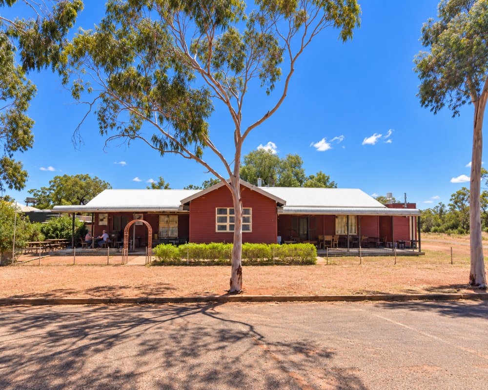
A few dozen people live in Girilambone, which has a handful of houses, a hall and the old railway station, restored and reopened in April 2025. The country is flat red soil with bimble box, mulga and wilga, grazed by sheep, cattle and goats. With no town lights for a long way, the night sky lives up to the name.
Things To Do
Copper Mining History
Copper was found here in the 1870s and mined from the early 1880s, when the village had several hundred people, hotels and stores. The old workings lie close to the settlement. Modern copper mines still operate in the district, their workers based mostly in Nyngan.
The Road to Bourke
This stretch of the Mitchell Highway is known for its emus, kangaroos and feral goats, and for the sense of space that marks the start of the outback. Coolabah, about 30 km further on, has a cafe and general store.
Nyngan
Nyngan, on the Bogan River, has a museum in its railway station, a helicopter monument recalling the 1990 flood, and a large solar farm.
Girilambone railway station
The 1884 station closed in 1986 and stood derelict for decades. Bogan Shire restored it with a $1.7 million grant, and it reopened in April 2025, with plans for a small museum and an Aboriginal art gallery; check with the Nyngan visitor centre for what is open.
Churches and cemeteries
Two former churches stand in Myall Street, now privately owned, and the newer cemetery holds the grave of Helena Kerz, one of the victims of Jimmy Governor at Breelong in 1900.
History
Girilambone is in the country of the Wongaibon people.
The railway from Nyngan to Bourke reached the village in 1884, and it was a busy stop while the copper mines were working. Mining stopped early in the twentieth century, resumed on a large scale in the 1990s and continues nearby.
Copper mining began about 1880 west of the present village, the main production ran from 1896 to 1901, and a violent storm in January 1901 wrecked many buildings. The deposit, now called Murrawombie, was mined again from 1993.
Where To Stay
There is no accommodation in Girilambone.
Nyngan has motels, hotels and a riverside caravan park.
Nyngan Riverside Tourist Park on the Bogan River has powered sites, cabins and a dump point, and the council’s free Nyngan Rest Area on Nymagee Street has toilets, water and a public dump point. The Upper Weir bush camp near Nyngan has toilets and fire pits. Bourke, about 156 km north, is the next town with a choice of caravan parks. Watch for kangaroos, emus and goats around dawn and dusk.
Eat & Drink
Bogan Shire Council lists a cafe and a hotel in the village; check before relying on them. Nyngan has cafes, pubs and supermarkets.
Getting There
Girilambone is on the Mitchell Highway, about half an hour from Nyngan and 160 km from Bourke.
Services are far apart, so leave Nyngan with a full tank.
Experiences
- Historic/Heritage
- Remote
- Rural/Country
- Self-Drive
Popular Activities
- Driving
- Outback
- Sightseeing
About Girilambone
- Locality: Rural locality
- Girilambone Postcode: 2831
- State: New South Wales
- Region: Country NSW
- Latitude: -31.24845
- Longitude: 146.90487
- Elevation: 197m
- Timezone: Australia/Sydney
