
Bramston Beach, QLD
Bramston Beach is a tiny seaside village on the coast between Cairns and Innisfail, at the end of a 17 kilometre road that winds from the Bruce Highway through cane fields and rainforest. It has a long, golden beach, a campground on the foreshore, and little else. It is the nearest thing to an undiscovered beach within an easy drive of Cairns.
Known For
- A long, quiet beach backed by rainforest
- Camping right on the foreshore
- Eubenangee Swamp and its birdlife on the way in
The beach curves for several kilometres between two creeks, with forested headlands at each end and the bulk of Bartle Frere and Bellenden Ker, the highest mountains in Queensland, rising behind. The village is a single street of houses, a few holiday units and a shop.
Things To Do at Bramston Beach
The Beach
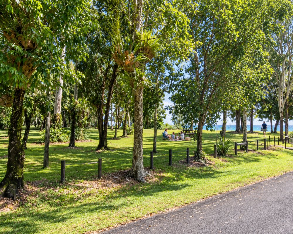
The sand is wide and clean, with shade from palms and beach almonds, and is seldom shared with more than a few other people. A stinger net is in place over summer. Crocodiles live in the creeks and are occasionally seen along the beach, so stay well clear of the creek mouths and follow the warning signs.
Fishing
Anglers fish from the beach and the rocks and launch small boats to reach the creek mouths and inshore reefs. Joyce Creek, at the northern end, is known for barramundi and mud crabs.
Eubenangee Swamp
Halfway along the road from the highway, a national park protects one of the most important wetlands in the wet tropics. A walk of about 20 minutes each way follows a creek through rainforest and climbs a grassy hill for a view over lagoons crowded with waterbirds, with the mountains behind. Jabirus, magpie geese, spoonbills and ducks are common, and crocodiles bask on the banks.
Waterfalls Nearby
Josephine Falls and the Boulders at Babinda are both within 35 minutes, so a day can combine a freshwater swim in the rainforest with an afternoon on the beach.
Russell River National Park
North of the village, a gravel road (about 5.5 km, then 1.5 km to the car park) and a 7.5 km beach walk lead into Russell River National Park towards Russell Heads, where the Russell and Mulgrave rivers reach the sea. The park has five bush camp sites for self-sufficient campers, with QPWS permits and fees and no facilities. Check park alerts first: planned burns closed the Graham Range camping area and access road on 11-13 November 2026.
Dolphins and Beach Fishing
The beach runs for about 11 km, and a small pod of Australian humpback dolphins is often seen cruising close inshore. Fishing straight off the sand is productive, and southern cassowaries are sometimes seen on the edge of the rainforest behind the village. The beach is also a turtle nesting area, so keep clear of marked nests.
Where To Stay
The council campground sits on the foreshore behind the beach, with powered and unpowered sites, toilets and showers.
There is also a small motel and a few holiday houses and units. Bookings are needed in winter.
The Bramston Beach Council Campground at 96 Evans Road is booked directly with the caretakers. Peak rates apply at Easter, in school holidays and from 1 July to 31 October, and stays of up to 12 weeks are allowed, so it is popular with winter visitors from the south. The Bramston Beach Resort on Dawson Street is a small motel of about seven rooms with a pool and garden, for those who would rather not camp.
Self-sufficient campers can use the five permit sites in Russell River National Park north of the village. If the beach is full, Babinda (about 25 km) has two free 72-hour camps: Rotary Park in town, with the nearest dump point and hot showers, and the Boulders camping area in the rainforest. Fishery Falls Holiday Park, about 45 km north, has cabins and powered sites. The road in from Mirriwinni is sealed and suits caravans.
Eat & Drink
The Bramston Beach Resort has a takeaway, but bring most supplies from Babinda or Innisfail. Bring whatever else you need from Babinda or Innisfail.
Eating out at Bramston Beach is very limited, so come stocked up. The Bramston Beach Resort on Dawson Street runs a takeaway tiffin service at lunch and dinner, with small and large tiffin boxes and biryani; allow about 30 minutes. For a pub meal, bakery or cafe, drive to Babinda, about 25 km away: the Babinda Independent Bakery on Munro Street for pies and bread (closed Sunday and Monday), Bistro 1917 at the Babinda State Hotel for breakfast, lunch and dinner (closed Tuesday and Wednesday), and the Babinda Taverna and Amore Ristorante for pizza and pasta. Zenna’s General Store in Babinda has groceries, bait, ice and fuel, and the nearest supermarkets are in Babinda and Innisfail, about 40 km south.
History
This is the country of the Yidinji and Mamu peoples. The beach is named after John Bramston, a Queensland politician of the 1860s and 1870s. Land in the district was opened to farmers early in the twentieth century, and the beach became a holiday spot for cane-growing families from Mirriwinni and Babinda. The village has been battered by several cyclones, including Larry in 2006.
Getting to Bramston Beach
Turn off the Bruce Highway at Mirriwinni, about 65 kilometres south of Cairns, and follow the Bramston Beach Road to its end. The drive from Cairns takes about an hour and a quarter.
Experiences
- Caravan and Camping
- Relaxation
Popular Activities
- Beach
- Bird Watching
- Caravan and Camping
- Fishing
- National Park
About Bramston Beach
- Locality: Rural locality
- Bramston Beach Postcode: 4871
- State: Queensland
- Region: Cairns & Great Barrier Reef
- Latitude: -17.3530
- Longitude: 146.0175
- Elevation: 18m
- Timezone: Australia/Brisbane
