
Woods Point, VIC
Woods Point is a tiny, remote gold-mining village in a steep valley of the Great Dividing Range, about 180 km east of Melbourne but reached only by winding, partly gravel roads. With a population of about 30, a pub, a small store and the ruins of a once-rich goldfield, it feels a world away from the city.
It is a favourite with 4WD and motorbike travellers, campers and anyone who loves a classic bush pub.
Known For
- A classic bush pub
- Gold-rush history and the A1 Mine Settlement
- Free camping on the Goulburn River
Things To Do in Woods Point
Commercial Hotel
The Commercial Hotel was named best bush pub in Victoria in 2024 and won a people’s choice award in 2025. It opens four days a week, from Thursday to Sunday, and has 12 rooms and a cabin; there is no fuel for sale in Woods Point. Check its Facebook page for opening days.
Gold History
Gold was found here in the early 1860s, and by 1864 the district had 36 hotels. The Morning Star mine was one of the richest in the area. The 1939 Black Friday fires almost destroyed the town.
A1 Mine Settlement and Gaffneys Creek
The A1 Mine Settlement, on the road to Jamieson, has been mining gold on and off since 1862, and nearby Gaffneys Creek dates from 1859 and 1860.
Goulburn River
The upper Goulburn River runs past the village, with swimming holes, fishing and a string of free camping reserves.
When To Visit
Summer and autumn are the best seasons, when roads are dry. Winter brings snow and closures on the high roads, and in summer check fire danger.
Getting Around
The roads to Woods Point are winding and partly gravel, and they can be slippery after rain or closed by snow and fallen trees. Motorbike and 4WD touring is popular, but check road conditions with the council or Parks Victoria before you go, carry spare fuel and water, and expect little or no phone coverage.
Star of the West Mine
On the Mansfield-Woods Point Road near Kevington, a 4WD track leads 3 km to a car park, and a 1 km walk from there reaches the Star of the West, the district’s richest mine, which produced 33,000 ounces of gold between 1863 and 1918. Mullock heaps, adits, shafts and furnace remains survive. Keep to the track, as there are unmarked shafts in the area.
The Old Petrol Station
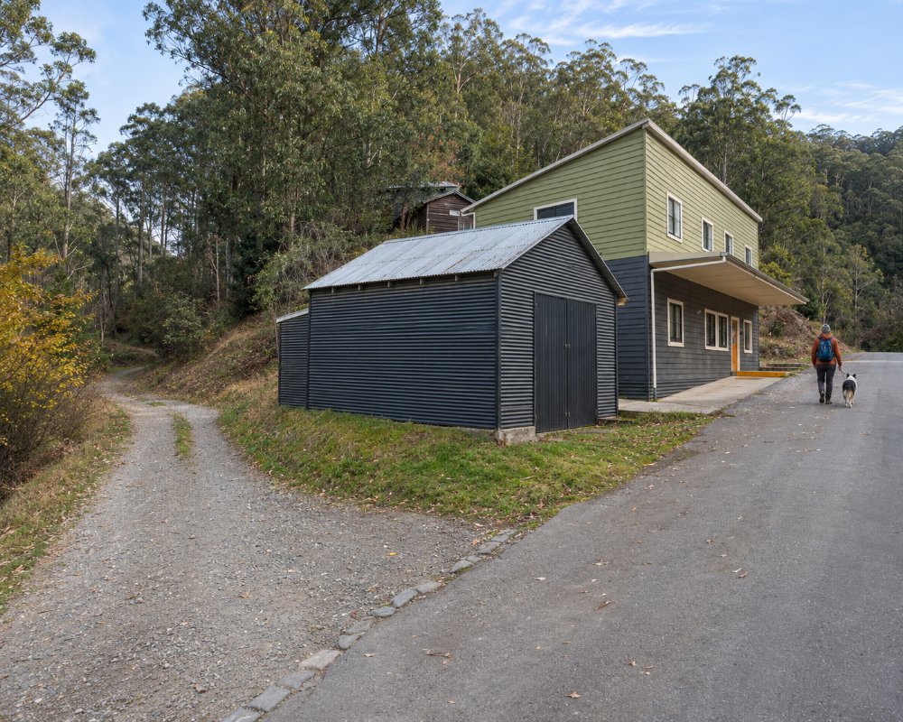
The tiny timber fuel stop on the main road dates from the town’s mining days and has come through two bushfires. It no longer sells fuel, but it is one of the most photographed buildings in the high country and a reminder that in the mid-1860s the town had about 50 working mines, six banks, dancing saloons and a newspaper.
Where To Stay
The Commercial Hotel has rooms and a cabin. For campers, the J. H. Scott Reserve charges a small fee, and free first-come reserves line the Goulburn, including Doctors Creek, Flour Bag, Tunnel Bend, Twelve Mile, Blue Hole, Picnic Point and Gaffneys Creek. The roads are gravel, narrow and winding, and big rigs and caravans are not advised.
The Commercial Hotel’s rooms all have private bathrooms, and the pub welcomes groups of 4WD drivers and motorcyclists; book ahead, as it closes early in the week. The nearest other beds are around Jamieson, about 55 km north, at the Jamieson Caravan Park, Emerald Park Holiday Farm and the Howqua Valley Holiday Park.
The Goulburn River reserves between Woods Point and Jamieson, among them Doctors Creek, Skipworth, Twelve Mile, Blue Hole, Picnic Point and Snake Edwards, are free and first-come, with pit toilets and fireplaces. Skipworth is a large flat area that suits caravans, just off the sealed section of road south of Jamieson, and Doctors Creek also takes vans. Bring drinking water or boil river water, take all rubbish out, and keep clear of old mine shafts.
The last stretch into Woods Point is gravel, narrow and steep in places from either direction, and the high roads can close with snow or fallen trees in winter. Leave big caravans at a riverside camp nearer Jamieson and come in with a camper trailer or 4WD. Fill up in Jamieson or Mansfield (or Warburton from the south), carry spare fuel and a good spare tyre, and expect no phone coverage for long stretches.
Eat & Drink
The Commercial Hotel serves meals on its opening days, and a small grocery store is over the bridge. Bring supplies, as it is a long way to the next town.
The Commercial Hotel is the only place to eat in Woods Point. On its opening days, Thursday to Sunday, it serves hearty home-cooked pub meals, with a bar full of mining memorabilia, a beer garden for summer and a fire for winter; ask for a glass of its own Tear Arse Gully Port. The small general store and post office over the bridge sells basic supplies, maps and souvenirs.
There is nothing else for a long way. Jamieson, about 55 km north, has the Courthouse Hotel and the General Store, and Mansfield is about 90 km away. Woods Point has no fuel and no supermarket, so fill up and stock up in Jamieson, Mansfield or Warburton before you come.
History
This is Taungurung Country. Woods Point was one of the richest goldfields in the high country, with dozens of hotels in the 1860s. Mining continued in the 20th century, but fires in 1939 nearly wiped out the town, and its population dwindled.
Getting to Woods Point
Woods Point is about 180 km east of Melbourne, more than 3.5 hours’ drive on winding roads, via Jamieson and Gaffneys Creek from Mansfield or via the Warburton to Woods Point road. A weekly bus runs to Mansfield.
Experiences
- Mountain
- Remote
- Rural/Country
- Self-Drive
Popular Activities
- Caravan and Camping
- Driving
- Fishing
- Sightseeing
About Woods Point
- Locality: Rural locality
- Woods Point Postcode: 3723
- State: Victoria
- Region: High Country
- Latitude: -37.5623
- Longitude: 146.3527
- Elevation: 969m
- Timezone: Australia/Melbourne
