
Jamieson, VIC
Jamieson lies in a deep valley where the Jamieson River joins the Goulburn, about 36 km south of Mansfield and around 2 hours 45 minutes from Melbourne. Born in a gold rush in the early 1860s, it is now a quiet village of old buildings, two rivers and holiday homes, close to the Jamieson arm of Lake Eildon.
It is a favourite with anglers, campers, horse riders and 4WD travellers, and the starting point of the gravel road south over the mountains to Licola.
Known For
- Two rivers and Lake Eildon
- The 1864 court house museum
- River camping and the high country
Things To Do in Jamieson
Jamieson Museum
The brick court house of 1864 now houses the Jamieson Museum, run by the historical society and open on weekends from Melbourne Cup to Easter.
Rivers and Fishing
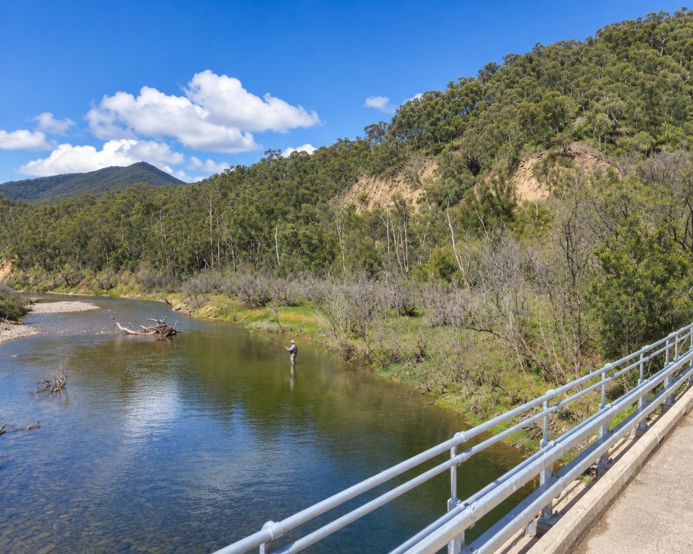
The Goulburn and Jamieson rivers are popular for trout fishing, swimming and kayaking; kayaks can be hired at the caravan park in the warmer months. The Jamieson arm of Lake Eildon is a few minutes away.
Mitchells Bridle Track
Mitchells Bridle Track is an advanced 24.5 km horse trail from Granny’s Flat to Mitchell’s Flat, one of several riding and 4WD routes into the surrounding forest.
Road to Licola
The gravel Jamieson to Licola road crosses the Great Dividing Range to Gippsland. It closes each winter beyond Mount Sunday Road (in 2026 from 11 June to 29 October).
Jamieson Autumn Festival
The village holds an autumn festival, and the warmer months bring campers to the rivers.
When To Visit
Summer and autumn are the best seasons for camping, fishing and the rivers. Winter is quiet, with snow on the ranges, and the Licola road closes.
Heritage Walk and The Island
A self-guided heritage walk links 25 signed sites around the village, past miners’ cottages such as Juddy’s Hut, St Peter’s Anglican Church in its ring of century-old oaks and the 1864 court house; maps are available from the Mansfield visitor centre. The walk reaches The Island, where the Jamieson River meets the Goulburn, a picnic spot with fruit trees planted in the 1860s, clear pools for a swim and a chance of seeing a platypus. Dogs may run off the leash there.
Jamieson Arboretum
The arboretum in Chenery Street was planted by the community in 1989 on an old pine plantation beside the school. A grassy path climbs to a pavilion with views over the village and the hills, and the trees are at their best in autumn.
Where To Stay
For caravans and campers, the Jamieson Caravan Park on Grey Street, beside the Jamieson River, has 26 powered sites, cabins, glamping tents and a pool. Free river camps line the Goulburn upstream in the Upper Goulburn reserves, and Granny’s Flat is beside the Jamieson River. Stock up on groceries in Mansfield, as the village shop is small. The road from Mansfield is sealed, but roads beyond Jamieson are gravel and narrow.
Emerald Park Holiday Farm, 2.5 km out on the Jamieson-Licola Road, is a working farm with four self-contained cabins sleeping up to six, where children can help feed the animals and collect eggs. About 10 minutes north towards Mansfield, the Howqua Valley Holiday Park on Lake Eildon has powered and unpowered sites for vans and motorhomes, cabins, a general store, a fuel bowser, a pool and a boat ramp, and Riverdowns on Howqua River Road rents a riverside house and a miner’s cottage.
Granny’s Flat, 7.5 km of gravel up the Jamieson River, has grassy sites with room for caravans to turn, plus toilets, tables and fire pits; the entrance has a short steep pinch that is slippery when wet, and the camp closes from the Thursday after the King’s Birthday to the Thursday before Melbourne Cup. Along the Goulburn towards Woods Point, Doctors Creek and Skipworth are free, first-come reserves that suit caravans, Skipworth being just off the sealed road south of Jamieson. Boil river water before drinking, and take all rubbish home. The Eildon-Jamieson road is sealed but narrow and winding, so allow extra time with a van. Fill up with fuel in Jamieson before heading south to Woods Point, and use the public dump point in Mansfield.
Eat & Drink
The Courthouse Hotel serves pub meals, and the Jamieson General Store does coffee, breakfasts and muffins. Jamieson Brewery and Grill, on the Goulburn just outside town, has its own beers and a play area for children; check opening hours.
The Courthouse Hotel, on the corner of Perkins and Nash streets opposite the Catholic church, is the village pub, open every day with open fires in winter and a bottle shop. The Jamieson General Store on Perkins Street is the place for coffee and a treat by the fire, and the Thursday community bus to Mansfield stops opposite. Jamieson Brewery and Grill, on the Eildon road beside the Goulburn, is a boutique brewery in the former Lakeside Hotel, the first hotel licensed on the shores of Lake Eildon, set in about 8 acres of parkland with play equipment and a kids’ area; it hosts live music on big weekends such as the football grand final.
Jamieson Berries, just outside town, sells frozen berries, jams and fruit wines all year, with fresh fruit from late November to Easter. The Howqua Valley Holiday Park, about 10 minutes north, has a general store and bottle shop.
Jamieson has fuel and a small store, but the nearest supermarkets are in Mansfield, about 36 km north, and Eildon, about 55 km west.
History
This is Taungurung Country. Prospectors reached the area in 1860, about 300 people were working the diggings by 1861, and the town was surveyed in 1862. By 1865 it had five hotels. The 1939 bushfires destroyed many of the mine workings, and Jamieson became a quiet farming and holiday village; the magistrates’ court closed in 1983.
Getting to Jamieson
Jamieson is about 220 km north-east of Melbourne by road, around 2 hours 45 minutes to 3 hours’ drive via Mansfield or via Eildon. A weekly bus runs between Woods Point and Mansfield.
Experiences
- Historic/Heritage
- Mountain
- Nature based
- Relaxation
- Rural/Country
Popular Activities
- Bush Walking
- Caravan and Camping
- Fishing
- Fishing - Trout/Fly
- Horse Riding
- Kayaking
- Off Road Driving
- Swimming
About Jamieson
- Locality: Rural locality
- Jamieson Postcode: 3723
- State: Victoria
- Region: High Country
- Latitude: -37.30072
- Longitude: 146.13588
- Elevation: 298m
- Timezone: Australia/Melbourne
