
Warburton, VIC
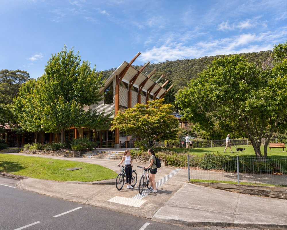
Warburton is a much-loved town on the upper Yarra River, about 76 km east of Melbourne, tucked into a narrow valley beneath the forested slopes of Mount Donna Buang. The river runs right through the town, crossed by swing bridges and lined with walking paths, and the main street is a relaxed mix of cafes, bakeries, galleries, a heritage pub and secondhand shops.
Once a gold town and later a guesthouse resort where Melbourne families came to escape the summer heat, Warburton is now best known as the end of the Lilydale to Warburton Rail Trail and, since 2025, as one of the country’s newest mountain bike destinations. Add the Redwood Forest, the snow on Donna Buang in winter and the rainforest walks of the Yarra Ranges, and there is plenty to fill a weekend.
Known For
- The Lilydale to Warburton Rail Trail and riverside walks
- The Redwood Forest and Mount Donna Buang
- Warburton Bike Park
Things To Do in Warburton
Lilydale to Warburton Rail Trail
The rail trail follows the old railway for about 38 km from Lilydale to Warburton through orchards, farmland and small towns, finishing near the main street. Many people cycle out and catch the bus back, or ride a section and return. Bike hire is available in town.
Warburton Bike Park
Warburton Bike Park opened in July 2025 with about 30 km of trails, and a second stage in April 2026 took it to more than 70 km, with shuttle services to the top of the runs. Trailheads are in Warburton and at Wesburn Park in neighbouring Wesburn. More trails opened later in 2026, taking the park to about 90 km, and the full 125 km southern network is due to be finished in 2027. The park already draws more than a thousand riders a week, and the AusCycling marathon nationals are booked for December 2027.
The Redwood Forest
At East Warburton, a few minutes from town, a plantation of Californian redwoods planted in the 1930s has grown into a tall, quiet forest of straight red trunks above a soft forest floor, now one of the most photographed spots in Victoria. A recent upgrade added more parking, an accessible toilet, a shelter and formal paths. Go early or on a weekday.
Mount Donna Buang and the Rainforest Gallery
Mount Donna Buang rises to 1,245 metres above the town, and the drive up Donna Buang Road climbs through mountain ash and myrtle beech forest to a 21-metre lookout tower at the summit. In winter it is the closest snow play to Melbourne, with toboggan runs when there is enough snow. About 10 minutes up the road, the Rainforest Gallery is a 40-metre walkway 15 metres above the forest floor over Cement Creek. Check Parks Victoria for road and track conditions.
River Walks
Paths follow both banks of the Yarra through town, with swing bridges, picnic spots and swimming holes in summer. The Warburton Water World pool opens in the warmer months, and La La Falls is a short forest walk from the edge of town.
O’Shannassy Aqueduct Trail
The O’Shannassy Aqueduct Trail follows an old water channel for about 30 km along the hillsides above the valley, an easy, mostly level walk or ride through forest with views over the town. It is sometimes closed at night for deer control.
The Waterwheel and Events
The Yarra Valley Waterwheel visitor centre, by the river on the main street, has information on walks and rides; it is now run by a volunteer committee. The Warburton Film Festival, held each June for more than 40 years, is one of the oldest community film festivals in Australia, and a market runs at the Waterwheel on the Australia Day weekend.
Where To Stay
Warburton has rooms above the historic Alpine Hotel, motels, riverside cottages and retreats in the hills, and it books out on busy weekends and in the snow season.
For caravans and campers, the Warburton Holiday Park on Woods Point Road has about 100 sites near the river, a short walk from the main street.
Upstairs at the Alpine Hotel there are 32 rooms. Some look over the river and the mountains, the ensuite rooms face the inner atrium, and solo travellers can take simpler rooms with shared bathrooms. Riders can lock their bikes up overnight. The Warby, on Donna Buang Road, is a refreshed 1960s-style motel with 12 motel rooms and larger holiday units, and suits families and groups of riders. At the western edge of town, Oscar’s on the Yarra is a country guesthouse on 12 acres of river frontage, with a Nordic sauna by the water.
The Canvas Barn on Old Warburton Road has a barn that sleeps eight, with a pizza oven, a tiny house for couples and Riverwood Cottage, which is set up for wheelchair users. Hazelwood Cottage at East Warburton, about 7 km away, is built for guests with disabilities, with a hoist and adjustable beds, and backs onto the national park.
Warburton Holiday Park has riverfront cabins with one to three bedrooms, villas, and powered and unpowered sites. Leashed dogs are allowed on sites and in some cabins, and the park has a camp kitchen, EV chargers and a dump point. If it is full, the family-run Yarra Valley Caravan Park on Tarrango Road at Yarra Junction, about 10 km west, takes dogs and allows campfires.
Eat & Drink
Warburton punches above its weight for food.
Pubs
The Alpine Hotel, built in 1885, is the heart of the town, with a big dining room, front bar and beer garden; it was named Pub of the Year at The Age Good Food Guide awards in October 2026.
Cafes and Restaurants
Babaji’s Kerala Kitchen serves South Indian banana-leaf feasts in an old riverside dance hall. Three Sugars, Cafe 3383 and Chookhouse are popular cafes on the main street, and Silva Coffee Roasters is known for its small-batch coffee, roasted at its own roastery in Wesburn. There are bakeries and takeaways for riders refuelling after the trail.
The Alpine Hotel is open seven days for lunch and dinner. It has a bistro, a front bar, more than 20 beers on tap and a beer garden for about 450 people, with the rail trail running behind it. Babaji’s Kerala Kitchen, at 3305 Warburton Highway, cooks the food of Kerala in South India: dosa, biryani, fresh fish, Malabar parotta and Kerala beef curry, with halal, vegan and gluten-free choices. Dogs are welcome at the outdoor tables, and booking is wise on weekends. Silva’s coffee bar opens daily on the main street. Yarra Valley Wine Co Store and Bar, at 3371 Warburton Highway, pours Yarra Valley wines by the glass for casual tastings, plus local beer and cider.
The Valley Market Warburton runs on the first Sunday of each month, from late morning to mid-afternoon, on the riverbank behind the Arts Centre on Thomas Avenue. It has crafts, plants, vintage clothes, honey, local produce, hot food and live music. For bread and pastries, the Yarra Valley Artisan Baker at Wesburn, about 6 km west, opens Wednesday to Sunday.
The town’s service station is at the eastern end of the main street, and it is the last fuel before the Woods Point road. The bigger supermarkets are at Yarra Junction.
History
This is Wurundjeri Woi-wurrung Country. Gold was found on the creeks around the town in 1859, and the mining camp took the name Warburton in 1863, after a local police magistrate. Timber mills followed, and the railway arrived in 1901, bringing tourists by the thousand.
In 1906 the Seventh-day Adventist Church moved its publishing house here, and its Signs Publishing works and the Sanitarium health food factory became major employers; the Sanitarium buildings in the main street are heritage-listed. By the 1920s the town had a dozen hotels and guesthouses, including the grand Chalet, which burned down in 1973. The railway closed in 1965.
Getting to Warburton
Warburton is about 76 km east of Melbourne, around an hour and 20 minutes’ drive via the Maroondah Highway to Lilydale and then the Warburton Highway. Bus 683 runs from Lilydale station to Warburton. Paid parking now applies in central Warburton on weekends and public holidays, with free permits for Yarra Ranges residents.
From Warburton, the Woods Point Road continues east past the Upper Yarra Reservoir towards Reefton and the high country.
Experiences
- Active
- Mountain
- Nature based
- Relaxation
- Rural/Country
Popular Activities
- Bush Walking
- Cycling
- Food and Wine
- Mountain Biking
- National Park
- Rainforest
- Sightseeing
- Swimming
About Warburton
- Locality: Urban locality
- Warburton Postcode: 3799
- State: Victoria
- Region: Yarra Valley & Dandenong Ranges
- Latitude: -37.75370
- Longitude: 145.68902
- Elevation: 155m
- Timezone: Australia/Melbourne
