
Menai and Woronora, NSW
Menai and Woronora lie in the western part of the Sutherland Shire, about 29 kilometres south-west of the centre of Sydney. Menai is a modern suburb on a plateau, with a large shopping centre and housing estates built since the 1980s. Woronora, in the deep valley below it, is a secluded village strung along a tidal river, with a character quite unlike anywhere else in the city.
Known For
- The hidden river village of Woronora
- Kayaking, swimming and riverside picnics
- Bushland and lookouts over the valley
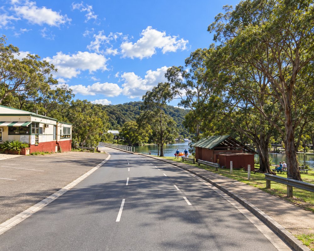
A high bridge carries the main road across the Woronora valley between Sutherland and Menai. Beneath it, an older low-level bridge and a narrow road serve the village, whose houses line both banks, some reached only by boat or footpath.
Things To Do in Menai and Woronora
Woronora River
The river is calm, clean and fringed with bush. Prince Edward Park, on the eastern bank, has lawns, a sandy beach, a playground, a boat ramp and a boatshed where kayaks, canoes and paddleboards can be hired. Paddling upstream leads into a narrowing gorge with sandstone cliffs and no houses at all. The park is a popular spot for swimming and picnics in summer.
The Needles
Further upstream, at the tidal limit near Engadine, the river runs over a rocky causeway into a deep freshwater pool that has been a local swimming hole for generations.
Bushwalks and Lookouts
Tracks and fire trails run along both sides of the valley, and lookouts on the rim at Menai and Bangor give long views down to the river. The area is rich in Aboriginal rock art and engraving sites, many of them unmarked.
Menai
Menai Marketplace is the main shopping centre for the western Shire, with a library, restaurants and a large park beside it.
The Boatshed Woronora
At 131 Prince Edward Park Road, the boatshed of 1946 rents canoes, kayaks, stand-up paddleboards and a pedal boat from 8am every day, life jackets included, first come first served. Time your paddle around high tide to get furthest up the gorge, and its cafe serves breakfast and lunch on weekdays from 8am to 3pm.
ANSTO at Lucas Heights
Australia’s only nuclear research reactor, OPAL, is at Lucas Heights on New Illawarra Road, a short drive south-west of Menai. ANSTO’s Discovery Centre runs Science Discovery Tours on set weekdays and Saturdays, and they can sell out, so book ahead on the ANSTO website.
The Needles
The Needles is the head of navigation on the Woronora River below Engadine, named for the sharp rocks just under the surface, and a footbridge links Engadine and Barden Ridge here. From the locked gate at Woronora Road and Carmel Place in Engadine it is a walk of about 20 minutes to small sandy banks and a rope swing. Take your rubbish home.
Where To Stay
Visitor accommodation is limited to Woronora Village, a riverside cabin park at 1 Menai Road.
Motels and hotels can be found at Sutherland, Miranda and Cronulla.
Woronora Village, running for more than 60 years, rents self-contained studio and two-bedroom cabins with kitchens and linen, from one night to six months; many guests are project workers, so book ahead. Rydges Cronulla Beachside is the main beach hotel in the Shire, and Hurstville, over the Georges River, has the Travelodge and pub rooms at the Meridian. Woronora Village does not take vans; the nearest van sites are at NPWS Bonnie Vale campground at Bundeena in Royal National Park, with 79 sites including powered caravan sites and hot showers (park entry is extra). River Road down to the old bridge is steep and winding, so leave big rigs on the main road.
Eat & Drink
Woronora has a riverside cafe at the boatshed and a small RSL club with a bushland beer garden, a lovely place for a drink at sunset. Menai has a wider range of cafes and restaurants around its shopping centre.
In Woronora, The Boatshed Woronora is a cafe on the river with an all-day brunch menu on weekdays, and Woronora River RSL has a bistro, regular entertainment and a beer garden in the bush beside the Shire’s only war memorial set in natural bushland. Menai’s shops are on Menai Road: Menai Marketplace with Woolworths, Big W and Bakers Delight beside the library, and the Menai Metro restaurant precinct on Allison Crescent. Fuel and supplies are in Menai and Sutherland.
History
The valley is Dharawal country, and Woronora is thought to mean black rock. Fishermen and weekenders built shacks along the river from the early 1900s, when the only access was by boat or steep tracks. Menai was first settled in the 1890s and called Bangor, after the Welsh home of its founder, then renamed Menai in 1910, after the Welsh town of Menai Bridge across the strait from Bangor, to avoid confusion with Bangor in Tasmania. In January 1994 bushfires swept through the area, destroying 14 homes around Menai and Bangor before a fireball crossed the Woronora River and destroyed 91 more in Como West and Jannali.
The name Woronora was first given to the river, which Mitchell spelt that way in 1835, then to the parish, the electorate and the suburb. Woronora’s primary school opened in 1942.
Getting to Menai and Woronora
Drive via the Princes Highway to Sutherland and follow River Road down to Woronora, or continue over the high bridge to Menai. Allow about 45 minutes from the city centre. Buses run from Sutherland station.
Experiences
- Active
- City
- Nature based
Popular Activities
- Bush Walking
- Fishing
- Fishing - Estuary
- Kayaking
- Sightseeing
- Swimming
About Menai and Woronora
- Locality: Suburb
- Menai and Woronora Postcode: 2234
- State: New South Wales
- Region: Sydney
- Latitude: -34.0126
- Longitude: 151.0146
- Elevation: 114m
- Timezone: Australia/Sydney
