
Sans Souci, Ramsgate and Dolls Point, NSW
Sans Souci, Ramsgate and Dolls Point occupy the low peninsula where the Georges River flows into Botany Bay, about 17 kilometres south of the centre of Sydney. They are unpretentious bayside suburbs with long, calm beaches, netted swimming baths, waterfront parks and a flat cycleway that runs for kilometres along the shore. The name Sans Souci, French for without care, suits them well.
Known For
- Calm Botany Bay beaches and netted baths
- A long bayside walking and cycling path
- Waterfront parks and fish and chips
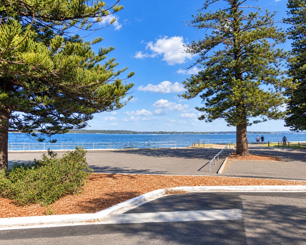
The eastern side of the peninsula faces Botany Bay, with a continuous beach backed by Cook Park. The southern tip, at Dolls Point, looks across the river mouth to Taren Point and the Sutherland Shire, and the western side faces the sheltered waters of Kogarah Bay. Shops are spread along Rocky Point Road and The Grand Parade.
Things To Do in Sans Souci, Ramsgate and Dolls Point
Beaches and Baths
Lady Robinsons Beach runs unbroken along the bay from here north to Brighton Le Sands. There is no surf, the water is shallow and several netted enclosures give safe swimming for children. Ramsgate Beach and Dolls Point Beach are the most popular spots, each with picnic shelters, playgrounds and kiosks behind the sand.
Cook Park Cycleway
A shared path follows the foreshore for about eight kilometres through Cook Park, flat and easy all the way, with views across the bay to the airport, the port and the headlands at Kurnell and La Perouse. It is ideal for families on bikes.
Water Sports
Steady breezes and shallow water make the bay off Dolls Point a favourite for kitesurfers and windsurfers. The Georges River side is used by sailing clubs and for fishing, with boat ramps at several points.
Parks
Peter Depena Reserve at Dolls Point is a large shady park on the point, with a playground and lawns reaching to the water. Along Kogarah Bay, smaller reserves have jetties and tidal baths.
St George Sailing Club
At 2 Riverside Drive on the Georges River side, the sailing club’s waterfront restaurant has two bars, a seafood-leaning bistro and decks built out over the water. It opens to visitors daily from 10.30am and is the best spot here for a long lunch looking across the river mouth to the Captain Cook Bridge.
Peter Depena Reserve and Dolls Point Beach
Rockdale Council bought this point in 1930 with profits from the Brighton baths, and in 1961 renamed Dolls Point Park after Peter Depena, the alderman who pushed for it. It has barbecues, playgrounds and picnic shelters, and the 550-metre Dolls Point Beach runs from the rock groyne past a small tidal pool to the sailing club, looking across the kilometre-wide river mouth to Towra Point.
Across the Bridge to Kamay
Over the Captain Cook Bridge, the Sutherland Shire side leads to Kurnell and Kamay Botany Bay National Park, where Cook landed in 1770. Bare Island at La Perouse, on the northern headland, is closed until late 2027.
Where To Stay
The suburbs are residential, with holiday rentals but no hotels; the nearest are at Brighton-Le-Sands.
Brighton Le Sands, a few minutes north, has a large beachfront hotel, and the airport hotels at Mascot are about 15 minutes away.
The nearest hotel is the bayfront The Brighton Hotel Sydney – MGallery Collection (formerly the Novotel Sydney Brighton Beach) at Princess Street and The Grand Parade, Brighton-Le-Sands, a few minutes north, with an outdoor pool and a Beach Club on the bay. The airport hotels at Mascot and Wolli Creek are about 15 minutes north, Hurstville has the Travelodge and pub rooms, and Rydges Cronulla Beachside is south over the bridge. For caravans, the nearest van sites are at NPWS Bonnie Vale campground at Bundeena in Royal National Park, with powered and unpowered sites and hot showers.
Eat & Drink
Fish and chips eaten on the grass is the classic meal here. Ramsgate Beach has a small strip of cafes and restaurants facing the park, and the sailing and motor boat clubs on the river have bistros with water views. Ramsgate has also been known for its Greek and Italian food shops.
Fish and chips on the grass in Cook Park is the local classic, and The Grand Parade at Ramsgate Beach has a small strip of cafes and takeaways facing the park. St George Sailing Club at 2 Riverside Drive has a seafood-leaning bistro, two bars and decks over the water. The Coles on Ramsgate Road is closed for redevelopment until about 2027, and Brighton-Le-Sands, five minutes north, has a supermarket as well as Greek restaurants and seafood along the promenade.
Ramsgate Beach House, on the beach side of the surf club, serves Mediterranean-leaning food, with a kiosk selling fish and chips and tacos onto the sand. The St George Motor Boat Club has Marina’s Edge upstairs and the dog-friendly Baybreeze Cafe downstairs, and the Bass and Flinders Pavilion, a floating restaurant on the Georges River for more than 40 years, does breakfast and long lunches. Ramsgate RSL has a grill and an Asian restaurant.
History
The peninsula is the country of the Bidjigal and Gweagal people. Sans Souci was named after a grand house that the wool merchant Thomas Holt built on Rocky Point Road, on land he bought in 1853, itself called after the summer palace of Frederick the Great. In the 1880s Thomas Saywell, who developed Brighton Le Sands, extended his attentions here, and a steam tram from Kogarah brought day-trippers to the beaches. The Captain Cook Bridge across the river to the Shire opened in 1965.
The whole shore was Seven Mile Beach until 1874, when it was renamed Lady Robinsons Beach after the governor’s wife. Catherine Cooper’s 1830 grant at Rocky Point later held a distillery, and Ramsgate was named after the English seaside resort. The government steam tram from Kogarah, opened in 1887, and the trolleybuses that replaced it from 1937 to 1959 made the beaches a day-trip spot for the city.
Getting to Sans Souci, Ramsgate and Dolls Point
Buses run from Kogarah and Rockdale stations, which are about 20 minutes from the city by train. By car it is around 30 minutes from the city centre via the Princes Highway. Cronulla is 15 minutes south across the bridge.
Experiences
- City
- Nature based
- Relaxation
Popular Activities
- Beach
- Cycling
- Fishing
- Fishing - Estuary
- Food and Wine
- Sightseeing
- Swimming
- Wind Surfing
About Sans Souci, Ramsgate and Dolls Point
- Locality: Suburb
- Sans Souci, Ramsgate and Dolls Point Postcode: 2219
- State: New South Wales
- Region: Sydney
- Latitude: -33.9906
- Longitude: 151.1331
- Elevation: 10m
- Timezone: Australia/Sydney
