
Ku-ring-gai Chase National Park, NSW
Ku-ring-gai Chase National Park covers about 150 square kilometres of sandstone plateau, forest and drowned river valleys on the northern edge of Sydney, between the upper north shore and the mouth of the Hawkesbury River. Declared in 1894, it is the second-oldest national park in New South Wales. It is only 25 kilometres from the city centre, yet it holds some of the finest water views, Aboriginal rock art and bushwalking in the region.
Known For
- West Head lookout over Pittwater and Broken Bay
- Aboriginal rock engravings and art sites
- Bobbin Head, Cowan Creek and bush tracks
The park is cut into two main sections by Cowan Creek. The western part, around Bobbin Head, is reached from the north shore suburbs near Hornsby. The eastern part, the Lambert Peninsula, is reached through Terrey Hills and runs out to West Head, with Pittwater on one side and Cowan Creek on the other. A vehicle entry fee applies in most areas.
Things To Do in Ku-ring-gai Chase
West Head Lookout
The road along the Lambert Peninsula ends at a sandstone terrace high above the water. The view is one of the best in the state: Barrenjoey Headland and its lighthouse straight ahead, Palm Beach and Pittwater to the right, Lion Island in the middle of Broken Bay and the Central Coast beyond. Tracks drop from the lookout to small beaches, including Resolute Beach, and to a wartime gun battery.
Aboriginal Heritage
The park protects hundreds of engraving sites, cave paintings, axe-grinding grooves and middens left by the Guringai people. Two of the most accessible are on the West Head road: the Basin Track engravings, a large rock platform carved with figures of people, fish and wallabies, and the Red Hands Cave, with ochre hand stencils. The Aboriginal Heritage Walk links several sites near the lookout.
Bobbin Head
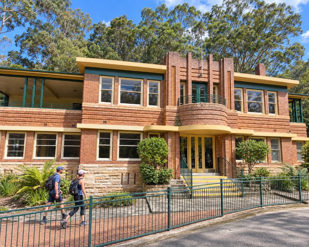
At the bottom of a winding road from North Turramurra, Bobbin Head is a sheltered bend of Cowan Creek with picnic lawns, a marina with runabout hire, pedal boats on Cockle Creek, and a cafe and the NPWS visitor centre in the 1930s Bobbin Inn. A boardwalk loops through the mangroves, and several good walking tracks start here. Apple Tree Bay, around the corner, has a boat ramp and more picnic areas.
Bushwalks
Tracks range from short strolls to full-day walks. Popular choices include the track from the Sphinx Memorial down to Bobbin Head, the America Bay track to a waterfall above Cowan Creek, and the walk to Flint and Steel Beach near West Head. In late winter and spring the ridges are covered with wildflowers, including waratahs.
On the Water
Cowan Creek, Coal and Candle Creek and Pittwater are ideal for kayaks, small boats and houseboats, with marinas at Bobbin Head and Akuna Bay. The Basin, on Pittwater, has a sheltered lagoon for swimming and is reached by ferry from Palm Beach or on foot.
America Bay Track
The 1.8 km return track leaves West Head Road, passes Aboriginal rock engravings on a sandstone shelf and drops through scribbly gum and bloodwood to a small waterfall above America Bay, looking across Cowan Water.
Great North Walk, Cowan to Brooklyn
The park’s section of the Great North Walk runs 11 km one way from Cowan station past Jerusalem Bay, then climbs steeply to Brooklyn, where walkers catch the train home from Hawkesbury River station. It is hard going and boggy after rain.
Where To Stay
The Basin is the only campground in the park and must be booked ahead. There is also a hostel on the western shore of Pittwater, reached by ferry from Church Point.
Hotels and motels are found in Hornsby and on the Northern Beaches.
The Basin campground has 114 unpowered, unmarked tent sites with toilets, hot showers, drinking water and barbecues, reached only by a 2.8 km walk from West Head Road or by ferry or water taxi from Palm Beach; book through NPWS. YHA Pittwater Eco at Morning Bay, reached by ferry from Church Point, is the only other place to stay in the park. Caravans and campervans cannot stay in the park; the nearest tourist park is BIG4 Sydney Lakeside Holiday Park at North Narrabeen.
Eat & Drink
Cafes operate at Bobbin Head and at the Akuna Bay marina, and the waterfront restaurant at Cottage Point, deep inside the park, is a popular destination by car, boat or seaplane. Otherwise bring a picnic. Barbecues and tables are provided at the main picnic areas.
At Bobbin Head, the Bobbin Inn Cafe sits beside the visitor centre and the Waterside Bistro at the marina serves waterfront breakfast and lunch. Cottage Point Inn serves tasting menus for lunch from Thursday to Monday and dinner on Friday and Saturday. There are no shops or fuel in the park, so stock up at Hornsby, Turramurra, Terrey Hills or Mona Vale.
History
The park is named after the Guringai people, whose country it is. In the early 1890s a local resident, Eccleston du Faur, persuaded the government to set the land aside for public recreation, and it was first run by trustees who built the roads, boat sheds and picnic pavilions at Bobbin Head. It became a national park under state management in 1967.
Getting to Ku-ring-gai Chase
For Bobbin Head, drive via the Pacific Highway and Bobbin Head Road through Turramurra, or from Mount Colah. For West Head, take Mona Vale Road to Terrey Hills and follow McCarrs Creek Road. Each is about 45 minutes to an hour from the city centre. Public transport is limited, though trains stop at Mount Kuring-gai, Berowra and Cowan on the western edge, where walking tracks enter the park. The river village of Brooklyn lies just to the north.
Experiences
- Active
- Cultural
- Eco Tourism
- Nature based
Popular Activities
- Bird Watching
- Bush Walking
- Caravan and Camping
- Fishing
- Fishing - Estuary
- Kayaking
- National Park
- Sightseeing
About Ku-ring-gai Chase National Park
- Locality: Rural locality
- Ku-ring-gai Chase National Park Postcode: 2084
- State: New South Wales
- Region: Sydney
- Latitude: -33.6300
- Longitude: 151.2200
- Timezone: Australia/Sydney
