
Chambigne, NSW
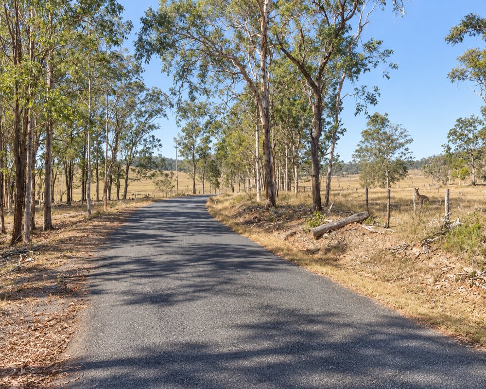
Chambigne is a sparsely settled locality about 20 kilometres south-west of Grafton, where farmland gives way to dry forest and sandstone ridges.
Known For
- Chambigne Nature Reserve
- Sandstone ridges and dry forest
- Back roads towards the Nymboida River
Things To Do in Chambigne
Chambigne Nature Reserve protects rugged sandstone country with spring wildflowers and good birdlife. It has no marked tracks or facilities, so it suits self-reliant walkers. The Old Glen Innes Road continues west from here towards the Nymboida and Boyd rivers.
Chambigne Nature Reserve
The reserve, created in 1999 and covering about 800 hectares, protects dry forest and heath on the ridges, with 259 plant species recorded. It is the only home of the endangered Chambigne bertya, a shrub of the eastern escarpment. In 2011 a further 760 hectares next door became Chambigne State Conservation Area.
On to Buccarumbi and Dalmorton
The Old Glen Innes Road continues west to Buccarumbi, where it crosses the Nymboida, and on to the gold-rush site of Dalmorton and its rock tunnel. It turns to gravel at Buccarumbi and is unsuitable for towing caravans beyond.
Where To Stay
There is no accommodation at Chambigne. Grafton and South Grafton are the nearest bases.
There is no camping in the nature reserve. South Grafton has highway motels, and the BIG4 Big River Holiday Park & Ski Lodge at Seelands, near Grafton, has powered and unpowered sites, cabins, riverfront villas and a dump point. NPWS Dalmorton campground, about 45 km further west, has 10 unpowered sites with no water, suited to tents and camper trailers, and Nymboida Camping and Canoeing on Armidale Road has powered and unpowered sites, cabins and Wagtails Cafe.
Eat & Drink
There are no shops. Buy supplies in South Grafton before you leave.
South Grafton has supermarkets, bakeries and several service stations on the Gwydir Highway, and The Coutts Crossing Tavern on Armidale Road, 18 km from Grafton, serves pub meals, and Coutts Crossing has a general store and a service station. Beyond Chambigne there is nothing to buy for about 100 km, so carry water, food and spare fuel.
History
Chambigne is in Gumbaynggirr Country, and the conservation area is recognised for its Aboriginal cultural heritage. The Old Glen Innes Road through the district follows a bullock track of the 1840s and was the main road from Grafton to New England for almost a century, until the Gwydir Highway opened in 1960.
Getting to Chambigne
From South Grafton follow the Gwydir Highway west and turn on to the Old Glen Innes Road. Allow about 25 minutes.
The road is sealed through Chambigne and fine for a car or campervan.
Experiences
- Nature based
- Rural/Country
Popular Activities
- Bird Watching
- Bush Walking
- Driving
- Sightseeing
About Chambigne
- Locality: Rural locality
- Chambigne Postcode: 2460
- State: New South Wales
- Region: North Coast NSW
- Latitude: -29.76373
- Longitude: 152.75273
- Elevation: 57m
- Population: 55
- Median Income: $24128
- Area (Sq/km): 193.979
- Timezone: Australia/Sydney
