
You Yangs Regional Park, VIC
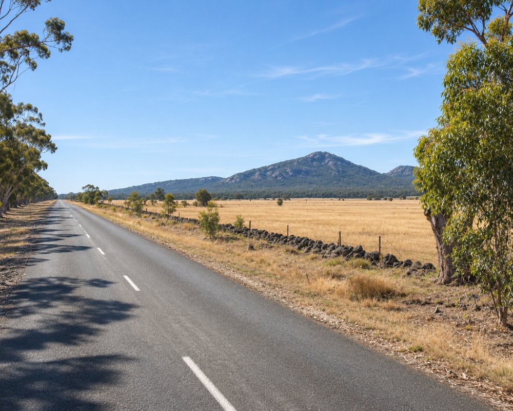
The You Yangs are a range of granite peaks rising abruptly from the volcanic plains between Melbourne and Geelong, about 55 km from Melbourne and 22 km north of Geelong. Protected in the You Yangs Regional Park, they are one of the most popular outdoor spots in the region, with a famous summit walk, a huge Aboriginal-inspired geoglyph, mountain bike trails, picnic grounds and wild koalas.
Known For
- The Flinders Peak walk
- The Bunjil geoglyph
- Mountain biking and koalas
Things To Do in the Park
Flinders Peak
The walk to Flinders Peak, the highest point, is about 3.2 km return with about 450 steps, taking about an hour from the Turntable car park. The summit is steep and windy, with views across Corio Bay to Geelong and, on a clear day, the Melbourne skyline. Matthew Flinders climbed the peak in 1802.
Bunjil Geoglyph
The Bunjil Geoglyph, by the artist Andrew Rogers, was made for the 2006 Commonwealth Games from 1,500 tonnes of rock. With a wingspan of about 100 metres, it depicts Bunjil, the Wadawurrung creator spirit, and is best seen from the Flinders Peak lookout or reached from the Branding Yard Walk.
Mountain Biking
The park has an extensive network of mountain bike trails for all levels, one of the most popular riding areas near Melbourne.
Walks and Wildlife
The East-West Walk and other tracks wind through the woodland, and wild koalas live in the park. The Big Rock picnic area is a favourite spot; check Parks Victoria for any track closures.
When To Visit
Autumn, winter and spring are the best times for walking and riding, with clear views from Flinders Peak on crisp days. Summer days can be very hot on the exposed granite, so go early and carry water, and the park may close on days of high fire danger.
Stockyards and Kurrajong Bike Areas
The park’s two mountain bike areas hold more than 50 km of trails. The Stockyards area has technical downhill and cross-country tracks for experienced riders, the Kurrajong Plantation area has flatter, family-friendly trails for beginners, and there is a pump track for practice. Bikes are not allowed on walking tracks or management tracks outside these two areas.
Rock Climbing and Horse Riding
Big Rock, Gravel Pit Tor and other granite outcrops are used for rock climbing and abseiling; groups must book, individuals should check site availability with the park office, and some sites have seasonal closures. Horse riders have three looped trails in the Western Plantation, starting from the car park off Sandy Creek Road, and the Great Circle Drive takes cars on a loop around the range.
Where To Stay
There is no camping in the park. Geelong has motels, hotels and caravan parks, and Lara, 10 minutes away, has pubs and places to eat.
The park is open from 7 am to 8 pm daily and the front gate is closed to vehicles at night, so plan to stay elsewhere. Central Geelong, about 30 km south, has the most choice, from the Crowne Plaza on the waterfront to Rydges Geelong and Quest Geelong Central, and Bayside Geelong Hotel and Apartments has an indoor pool. Caravans and campervans are best based at Belmont, where the Geelong Holiday Park, Discovery Parks Geelong and Tasman Holiday Parks Geelong sit side by side on Barrabool Road beside the Barwon River, about 35 km south via the Geelong Ring Road, all with powered sites and cabins.
Lancemore Mansion Hotel at Werribee Park, about 25 km north-east, has rooms in the grounds of the 1870s mansion. Campers who want to stay in the bush can book the Boar Gully or Fridays campgrounds in the Brisbane Ranges National Park, about 40 minutes north-west through Anakie; camping there must be booked ahead.
Eat & Drink
There are no cafes in the park, so bring a picnic. Lara and Geelong have plenty of places to eat.
The park’s nine picnic areas have free gas barbecues and room for your own, and drinking water is available at the park office fountain, so bring a picnic and take your rubbish home. The nearest meals are in Lara, about 10 km south: the Lara Hotel on Hicks Street has a bistro open every day, Founders & Co on Station Lake Road serves all-day meals seven days, and the Lara Sporting Club bistro on Mill Road looks back towards the You Yangs.
History
This is Wadawurrung Country, and the name You Yangs is thought to come from a Wadawurrung word for a big hill. Matthew Flinders climbed the peak that now bears his name in 1802, the first European to do so. The regional park protects the granite range and its woodland.
Getting to the Park
The You Yangs are about 55 km south-west of Melbourne, around 50 minutes’ drive via the Princes Freeway and Lara, entering from Branch Road. The park is open daily; there is no public transport to it.
Experiences
- Active
- Mountain
- Nature based
- Self-Drive
Popular Activities
- Bird Watching
- Bush Walking
- Mountain Biking
- National Park
- Rock Climbing
- Sightseeing
About You Yangs Regional Park
- Locality: Regional park
- You Yangs Regional Park Postcode: 3211
- State: Victoria
- Region: Geelong & the Bellarine
- Latitude: -37.9580
- Longitude: 144.4280
- Timezone: Australia/Melbourne
