
Brisbane Ranges National Park, VIC
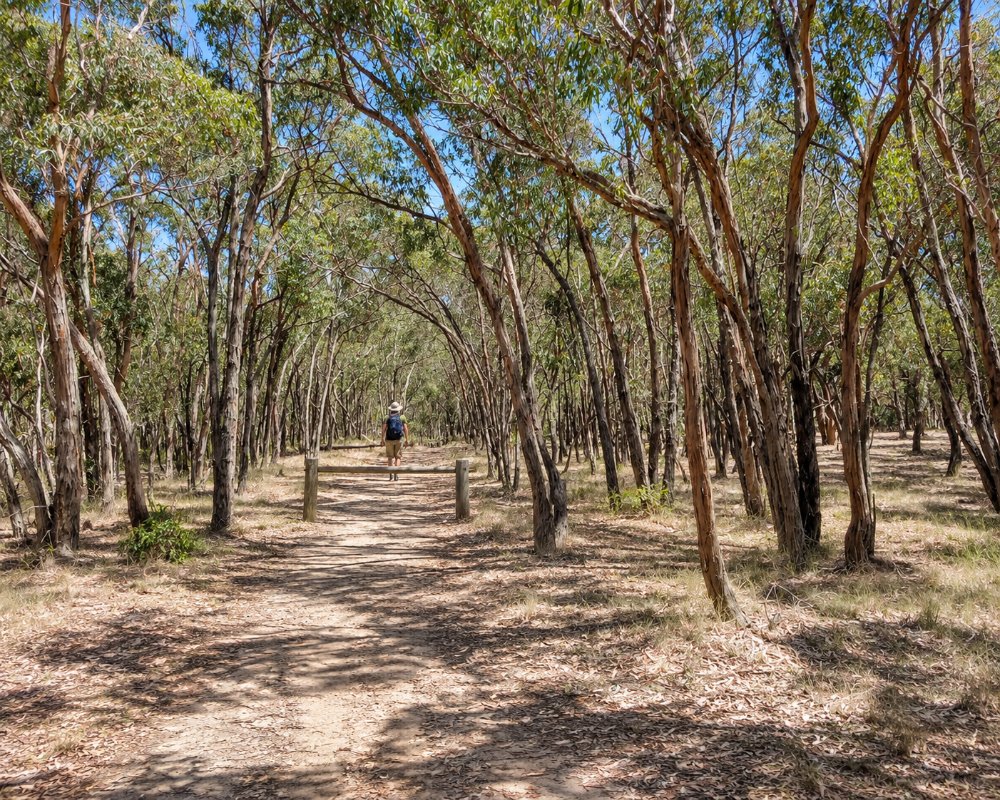
The Brisbane Ranges National Park protects about 7,700 hectares of rugged hills, gorges and dry forest about 80 km west of Melbourne and 35 km north-west of Geelong, near Anakie and Steiglitz. It is known as one of the richest wildflower areas in Victoria, and its gorges and gullies are home to koalas, wallabies and many birds.
Known For
- Spring wildflowers
- The Anakie Gorge walk and koalas
- Bush camping and the Burchell Trail
Things To Do in the Park
Wildflowers
In spring the park bursts into flower, with orchids, wattles, heaths and grevilleas, and Parks Victoria describes it as the state’s richest wildflower habitat.
Anakie Gorge Walk
The Anakie Gorge Walk, the most popular in the park, follows Stony Creek through a rocky gorge, with koalas often seen in the trees.
Other Walks
The Ted Errey Nature Circuit, the Wadawurrung Walk, Beards Gully, Grahams Creek and the Steiglitz Circuit are other good walks, and the three-day Burchell Trail links the campgrounds. Picnic areas include Anakie Gorge, Fridays, Grahams Creek, Sapling Gully and Stoney Creek.
Steiglitz
The gold-rush ghost town of Steiglitz, with its 1875 courthouse and gold panning in the creek, is on the western edge of the park.
When To Visit
Spring, from August to November, is the peak season for wildflowers, the best in Victoria. Autumn and winter are good for walking, with cool, clear days and koalas easier to spot. Summers are hot and dry, and the park closes on days of catastrophic fire danger.
Nearby
Fairy Park at Anakie, the You Yangs, the wineries of Bannockburn and the Moorabool Valley and Geelong are all within 30 to 45 minutes.
The Burchell Trail
The Burchell Trail is a 40 km, three-day walk between Fridays Campground in the south and Boar Gully in the north. It is marked with orange arrows and follows walking tracks, management tracks and quiet roads. Walkers camp at the Old Mill hike-in site, a day’s walk north of Fridays, and at Little River, a day’s walk south of Boar Gully. Both hike-in sites must be booked, and walkers should carry all their drinking water, because the tank water is not fit to drink.
Rare Plants and Birds
About 620 native plant species grow in the ranges, roughly a fifth of Victoria’s total, among them the Brisbane Ranges grevillea, which is found only along the Rowsley Fault, and the rare velvet daisy-bush. Around 170 bird species have been recorded. Look for the yellow-tufted honeyeater by day and listen for the white-throated nightjar after dark. Kangaroos, wallabies, echidnas, possums and gliders also live in the park.
Rock Climbing at Staughton Vale
The Staughton Vale climbing face, off Staughton Vale Road on the eastern side of the park near the Stony Creek Picnic Area, is the park’s rock climbing area. It suits climbers with their own gear and experience, and newcomers can book a trip with one of the licensed tour operators who work in the park. Like the rest of the park, it closes on catastrophic fire danger days.
Where To Stay
For campers, Boar Gully Campground at the northern end and Fridays Campground near Steiglitz are booked ahead online, and Old Mill is a walk-in site on the Burchell Trail. Geelong, Bacchus Marsh and Bannockburn have motels and caravan parks.
Fridays Campground, about 2 km north of Steiglitz on Durdidwarrah Road, has ten unpowered sites, two of them set aside for camper trailers or caravans. Boar Gully, off Brisbane Ranges Road at the northern end, has six tent sites and one site for a camper trailer or van. Each site takes up to six people, and both campgrounds have non-flush toilets, picnic tables and communal fireplaces. Bring your own firewood, since collecting wood in the park is not allowed, and carry all your drinking water, as the tank water is not fit to drink even if treated. Expect gravel and potholes on the final stretch in, so the camps suit camper trailers, campervans and small vans driven with care, while big vans and fifth-wheelers are better based at a caravan park.
There is no power, no showers and no dump point in the park, and dogs are not allowed. Fees apply and every site, including the Burchell Trail hike-in sites, must be booked before you arrive. The nearest fuel is at the Anakie General Store on the Geelong-Ballan Road, which sells unleaded and diesel and is closed on Sundays, with more choice at Bacchus Marsh and Geelong.
Eat & Drink
There are no cafes in the park. del Rios winery at Anakie serves food from Friday to Sunday, and Geelong and Bannockburn have more choice.
There is no cafe or kiosk anywhere in the park, so pack lunch and plenty of water; the Anakie Gorge and Stony Creek picnic areas have barbecues, tables and toilets. The Anakie General Store, a few kilometres south of the gorge on the Geelong-Ballan Road, sells food and fuel from Monday to Saturday, and Fairy Park nearby has the Hungry Knight Eatery on its open days. Bacchus Marsh, about 20 km from Boar Gully, has cafes, bakeries and supermarkets, and at the Steiglitz end, Meredith Farm Produce, the Meredith Dairy cafe in Meredith, is about 14 km west of Fridays Campground.
History
This is Wadawurrung Country. The ranges were cut for timber and mined for gold from the 1850s. The national park was gazetted in 1973, and in January 2006 a large fire burned about 6,700 hectares.
Getting to the Park
The park is about 80 km west of Melbourne, a little over an hour’s drive via the Princes Freeway and Anakie or via Bacchus Marsh. Dogs are not allowed, and the park closes on catastrophic fire danger days.
Experiences
- Eco Tourism
- Nature based
- Self-Drive
Popular Activities
- Bird Watching
- Bush Walking
- Caravan and Camping
- National Park
- Wildlife
About Brisbane Ranges National Park
- Locality: National park
- Brisbane Ranges National Park Postcode: 3213
- State: Victoria
- Region: Geelong & the Bellarine
- Latitude: -37.8600
- Longitude: 144.2400
- Timezone: Australia/Melbourne
