
Wallendbeen, NSW
Wallendbeen is a village of about 260 people at the junction of the Olympic Highway and the Burley Griffin Way, 20 km north-east of Cootamundra and about 20 km west of Harden. The farming country around it is some of the richest in the district.
Known For
- A highway crossroads
- The Wallendbeen Hotel
- Wheat and canola country
Things To Do in Wallendbeen
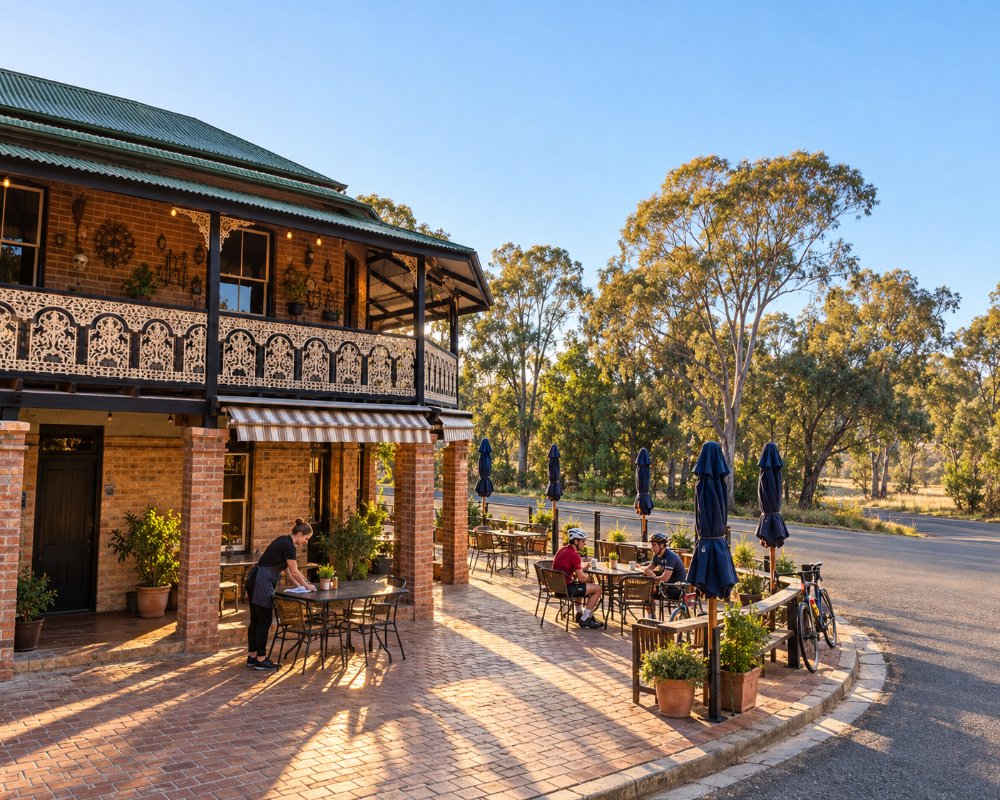
The Wallendbeen Hotel was trading by 1892 and was a Cobb and Co stop. The village has a memorial hall and a few old buildings, and in spring the paddocks around are yellow with canola.
Yeo Yeo and the Bradman Farm
Between Wallendbeen and Stockinbingal is the Yeo Yeo district, where Don Bradman’s family farmed until they moved to Bowral in 1911. The shell of the old Yeo Yeo schoolhouse stands beside the road a few kilometres from Stockinbingal, and Bradman’s Birthplace and the Captains Walk are 20 km away in Cootamundra.
A Tiny Municipality
From 1895 to 1935 Wallendbeen had its own council and mayor, one of the smallest municipalities in the state. The oval has hosted a cricket club since 1887 and each year holds a sports carnival for small primary schools in the area.
Where To Stay
There is no caravan park. Cootamundra and Harden both have one.
The council lists the MacKay Park rest area, at the highway crossroads, as a free overnight stop; facilities and a stay limit are not published, so arrive self-sufficient. Wallendbeen Park Farm, on Cullinga Road, is a council-listed farm stay in the old school house, with a fireplace, farm animals and walking tracks. The nearest dump point is in Apex Park, Cootamundra.
Eat & Drink
The hotel serves meals.
The two-storey Wallendbeen Hotel on Hoskins Street is the only venue in the village; ring ahead to check which days the kitchen is open. No store or fuel was confirmed, so stock up in Cootamundra, 20 km away, which has pubs, bakeries, cafes and an IGA.
History
Wallendbeen is on Wiradjuri country, and its name is said to come from an Aboriginal word for stony hill. The Main Southern railway reached it in 1877, and the post office opened in 1885. By 1892 the hotel was trading, with a Cobb and Co office and stables. From 1895 to 1935 the village had its own municipal council, and wheat has always been the mainstay.
Getting to Wallendbeen
Wallendbeen is on the Olympic Highway.
From Sydney it is about 365 km via the Hume Highway to Bowning and the Burley Griffin Way through Binalong and Harden, sealed and fine for caravans. Young is about 30 km north, and the nearest XPT stop is Cootamundra.
Experiences
- Historic/Heritage
- Rural/Country
- Self-Drive
Popular Activities
- Caravan and Camping
- Driving
- Sightseeing
About Wallendbeen
- Locality: Rural locality
- Wallendbeen Postcode: 2588
- State: New South Wales
- Region: Country NSW
- Latitude: -34.52432
- Longitude: 148.16016
- Elevation: 472m
- Population: 260
- Median Income: $35880
- Area (Sq/km): 218.055
- Timezone: Australia/Sydney
Accommodation In Wallendbeen
Discover some of the accommodation in and around Wallendbeen
