
Tucabia, NSW
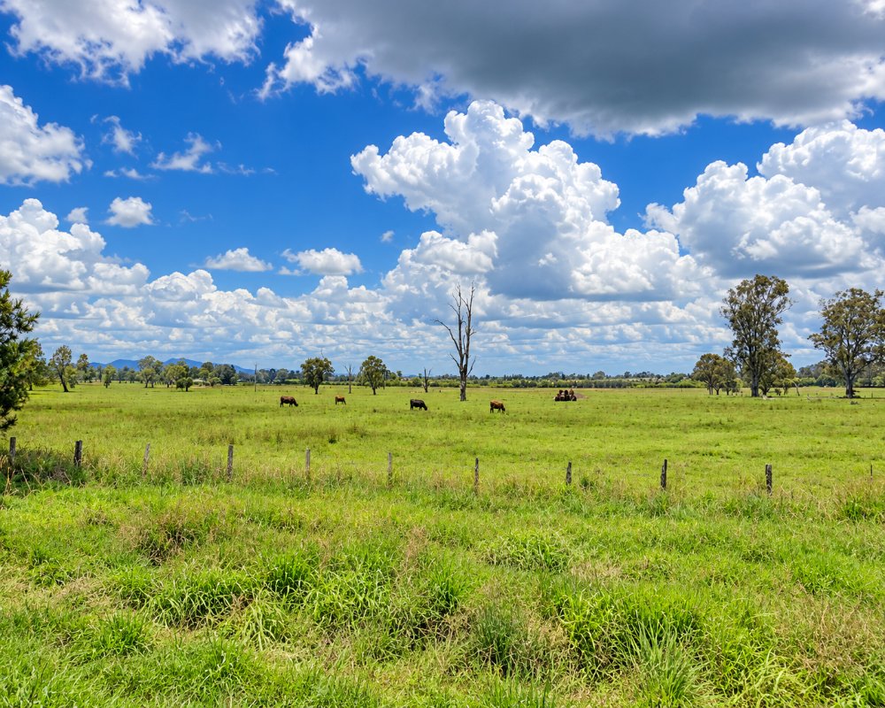
Tucabia is a small village on the Coldstream River, about 20 minutes east of Grafton. It sits among cattle paddocks and wetlands on the back road to the Yuraygir coast.
Known For
- The Coldstream River and wetlands
- A quiet country village
- The back road to Wooli and Minnie Water
Things To Do in Tucabia
The Coldstream wetlands around the village are among the best places in the valley for waterbirds, especially after rain. The river is fished for bass, and it is an easy drive from here to the beaches at Minnie Water and Wooli.
Ulmarra
Ulmarra, about 10 km north-west, is a heritage river town with old shopfronts and verandahs along the main street, and the Ulmarra Hotel has a beer garden looking over the Clarence.
The back road to the coast
From Tucabia, Wooli Road runs south-east through cattle country and Pillar Valley into Yuraygir National Park, reaching the Minnie Water turn-off after about 25 km and Wooli after about 35 km. It is sealed and suits caravans.
Where To Stay
There is no regular accommodation in Tucabia. Ulmarra, Grafton and the coast villages have places to stay.
The Ulmarra Hotel has pub rooms with shared bathrooms, and Grafton, about 25 km away, has the widest choice of motels. On the coast, Minnie Water Holiday Park, Wooli Holiday Park and BIG4 Solitary Islands Resort have powered sites and cabins. BIG4 Big River Holiday Park at Seelands, about 15 minutes beyond Grafton, has powered and unpowered sites, cabins and pet-friendly options, and NPWS Illaroo campground at Minnie Water has 70 bookable sites with drinking water.
Eat & Drink
The village has a small general store with fuel. Ulmarra, ten minutes away, has a riverside pub.
The store on Cordini Street sells groceries, basics and fuel, useful before heading to the coast villages. Grafton has supermarkets, bakeries, cafes and pubs. On the coast, Wooli has The 383 Wooli, Emilio’s Bistro and Pizzeria at the Wooli Hotel Motel and Harry’s Chinese Restaurant at the bowling club.
History
Tucabia lies on the lower Clarence floodplain, in country that Clarence Valley sources identify with the Yaegl people. Farming families settled along the Coldstream River in the 19th century, and Tucabia Public School opened around 1891.
Getting to Tucabia
From Ulmarra, on Big River Way (the old Pacific Highway), head east on Coldstream Street to Tucabia, about ten minutes.
From the motorway, take the Ulmarra exit, or leave at the Glenugie interchange and come in from the south via Eight Mile Lane and Wooli Road. Grafton’s station is the nearest XPT stop. From Sydney it is about 615 km, sealed all the way.
Experiences
- Nature based
- Relaxation
- Rural/Country
- Self-Drive
Popular Activities
- Bird Watching
- Driving
- Fishing
- Kayaking
- Swimming
About Tucabia
- Locality: Rural locality
- Tucabia Postcode: 2462
- State: New South Wales
- Region: North Coast NSW
- Latitude: -29.66904
- Longitude: 153.10728
- Elevation: 7m
- Population: 367
- Median Income: $24752
- Area (Sq/km): 35.062
- Timezone: Australia/Sydney
