
Strzelecki National Park, TAS
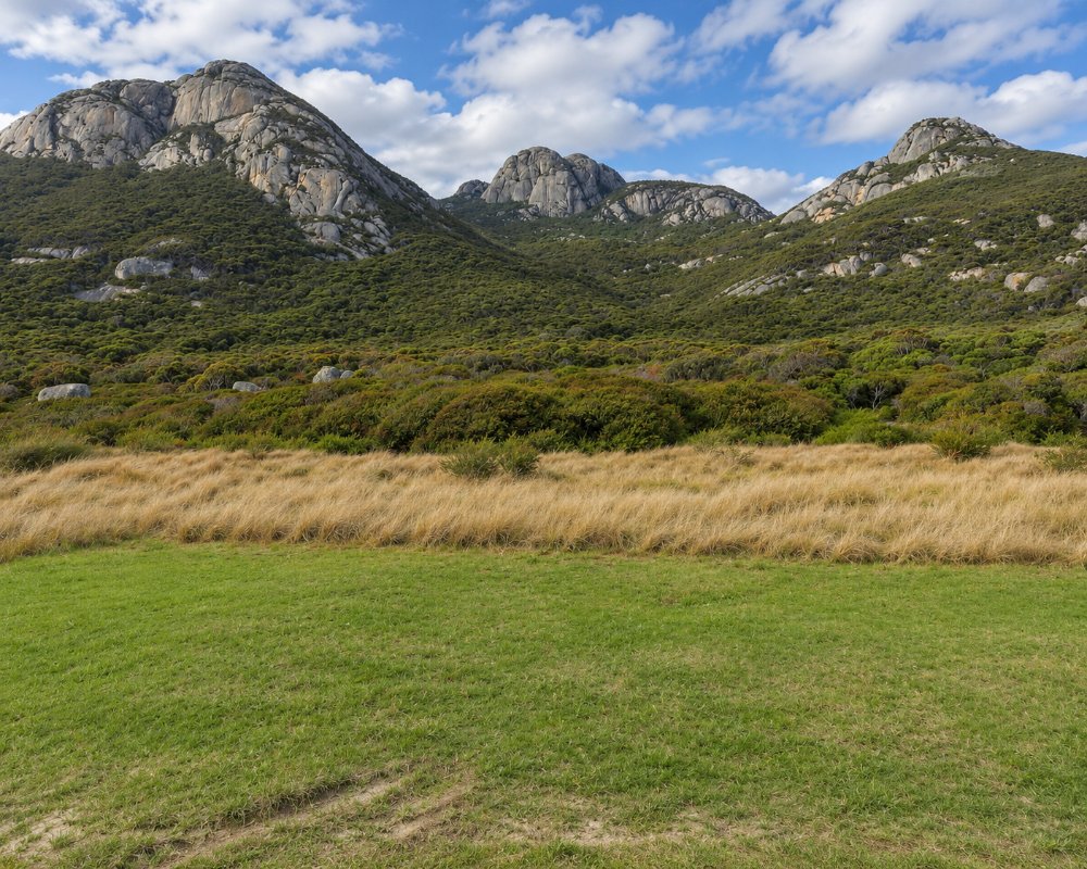
Strzelecki National Park takes in more than 4,000 hectares in the south-west corner of Flinders Island, about 20 minutes from Whitemark. Its granite peaks rise to 756 metres straight from the sea and can be seen from most of the island.
Below them is Trousers Point, a sheltered beach of white sand, orange-lichened rock and clear water, with the park’s campground behind it.
Known For
- The Strzelecki Peaks walk
- Trousers Point beach
- Free camping by the sea
Things To Do in the Park
Strzelecki Peaks Walk
The track to the summit is 5.6 km return and takes four to five hours. It is steep the whole way, climbing from almost sea level to 756 metres, and is graded 4. The top has unfenced cliff edges and is often cold, windy and in cloud, so take warm clothes and water. The walk starts at a sign and stile on the road, 12.5 km from Whitemark.
Trousers Point Beach
The beach is sheltered and good for swimming and snorkelling. The picnic area has a free gas barbecue, tables, toilets and changing sheds, and a new path and steps lead to the sand.
Trousers Point Walk
An easy two-kilometre circuit, one of Tasmania’s Great Short Walks, goes around the headland to Fotheringate Bay. Allow an hour and a half.
Fotheringate Bay
This bay is well protected and suits families with small children. None of the beaches is patrolled.
Where To Stay
The Trousers Point campground is 100 metres past the picnic area, with a toilet, a rainwater tank, picnic tables and a fireplace. There is no camping fee and no booking, though a national parks pass is needed. Passes are sold at Service Tasmania in Whitemark and by the car hire firms.
The campground was upgraded in 2025, but it has mainly been a tent ground. If you have a campervan or caravan, ring the Parks office on the island, (03) 6359 2217, to ask what will fit. Campfire bans apply in the warmer months, when only gas stoves may be used.
Eat & Drink
There is nothing to eat in the park. Whitemark is the nearest place for food, fuel and drinking water.
History
The peaks are named after the explorer Paul Edmund de Strzelecki. The national park was declared in 1967 and took its present name in 1972. The campground and the beach access at Trousers Point were rebuilt in 2025.
Getting to the Park
From Whitemark, drive south on the main road and turn on to Trousers Point Road, about 16 km in all. Wallabies and wombats are on the road at dusk and after dark.
Experiences
- Eco Tourism
- Nature based
Popular Activities
- Bush Walking
- National Park
- Wildlife
About Strzelecki National Park
- Locality: Rural locality
- Strzelecki National Park Postcode: 7255
- State: Tasmania
- Region: Flinders Island
- Latitude: -40.25712
- Longitude: 148.08163
- Timezone: Australia/Hobart
