
Sandon River, NSW
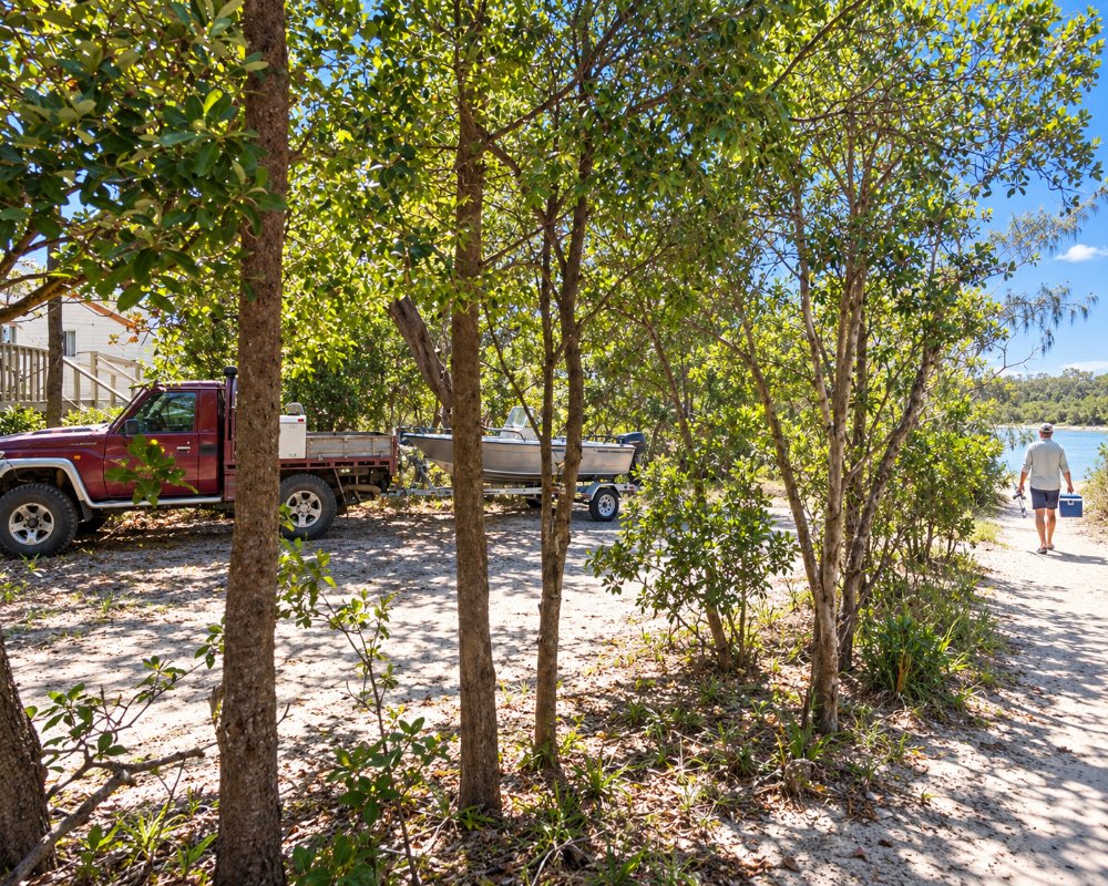
Sandon River is a remote spot in Yuraygir National Park, about 12 kilometres by road south of Brooms Head. A clear, shallow river runs out to sea here between sandbars and a rocky point, with a national park campground on the northern bank.
Known For
- A clear river mouth in Yuraygir National Park
- Camping beside the water
- Fishing, kayaking and birdlife
Things To Do in Sandon River
The river is ideal for kayaks, paddleboards and children, and the flats are fished for whiting, flathead and bream. Shorebirds feed on the sandbars. The Yuraygir Coastal Walk passes through, and walkers heading south have to arrange a boat across the river.
Sandon village
Across the river, the settlement of Sandon is a cluster of houses and fishing shacks, reached only along the beach from Minnie Water or by boat. Sandon River is also the northern limit of the Solitary Islands Marine Park, so check the zoning rules before you fish.
Plover Island
At low tide you can cross to Plover Island, a place of great cultural significance for the Yaegl people, where middens and artefacts are explained on signs. Leave everything where you find it.
Where To Stay
The national park campground has unpowered sites, toilets and no showers. Book ahead with the national parks service, and bring drinking water. Brooms Head has a caravan park and holiday houses.
The campground on the north bank has 29 marked sites for tents, camper trailers and caravans, with toilets, barbecues and a boat ramp but no drinking water; add the $8 daily park entry fee. The 10 km gravel road varies and may not suit every caravan after rain. Brooms Head Holiday Park, 12.5 km north, run by Clarence Coast Holiday Parks, has powered and unpowered sites, large RV sites, cabins and villas and a dump station, but takes no pets.
Eat & Drink
There are no shops. Brooms Head has a general store and a bowling club.
There are no shops, cafes or fuel, so bring everything, including water. Brooms Head’s corner store sells takeaway and groceries, and Maclean, about 35 km away, has supermarkets and fuel.
Brooms Head to Illaroo walk
Sandon is the halfway lunch stop on the 18 km Brooms Head to Illaroo section of the Yuraygir Coastal Walk. Walkers need help to cross the river, so arrange a crossing well ahead with the contact NPWS lists.
History
The Sandon coast is Yaegl Country, and middens on Plover Island show thousands of years of use. Fishing families later built the small shack settlement on the south bank, and the river mouth became part of Yuraygir National Park when the park was created in 1980.
Getting to Sandon River
From Maclean drive to Brooms Head and follow the unsealed Sandon River Road south for about 20 minutes.
From the Pacific Highway, leave at the Maclean interchange. Grafton is about 75 km away.
Experiences
- Active
- Caravan and Camping
- Nature based
- Relaxation
- Remote
- Self-Drive
Popular Activities
- Beach
- Bird Watching
- Bush Walking
- Caravan and Camping
- Fishing
- Kayaking
- National Park
- Off Road Driving
- Outback
- Surfing
- Swimming
- Wilderness
- Wildlife
About Sandon River
- Locality: Urban locality
- Sandon River Postcode: 2463
- State: New South Wales
- Region: North Coast NSW
- Latitude: -29.674976
- Longitude: 153.326485
- Elevation: 5m
- Timezone: Australia/Sydney
Accommodation In Sandon River
Discover some of the accommodation in and around Sandon River
