
Pyree, NSW
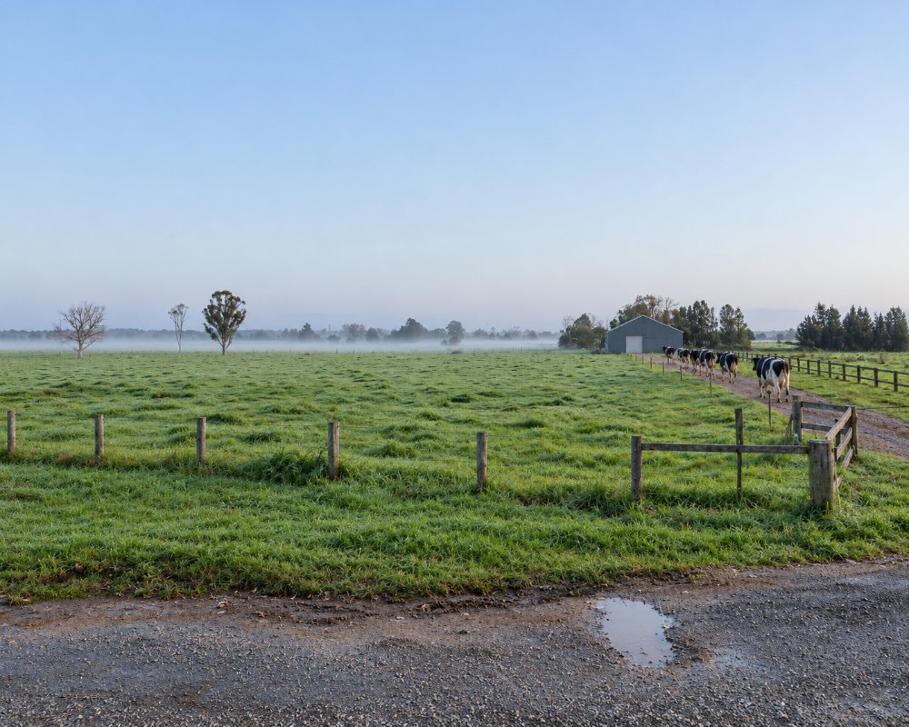
Pyree is a farming district on the river flats about nine kilometres south-east of Nowra, on the road to Greenwell Point.
Known For
- An 1830s mill with craft and antique shops
- A monthly market in the village hall
- Dairy country near the river
Things To Do in Pyree
The old Jindyandy Mill, a convict-built flour mill dating from the 1830s, stands beside the road with a group of craft, antique and food shops around it. The Pyree hall holds a market on the fourth Sunday of the month and houses a family history centre. A former butter factory nearby has been used for weddings and functions; we could not confirm that it still takes bookings.
Jindyandy Mill shops
Alexander Berry’s convicts built the three-storey brick grain mill in 1830, and it is said to be the first convict-built brick building south of Sydney. The heritage-listed mill, at 719 Greenwell Point Road, now anchors a small shopping village of about 30 stalls of local goods and gifts, with shops including The Junk and Disorderly Antiques Shop, Past & Present Vintage, The Mill Store, Vons Vintage Cafe and I’m In Heaven Lollies, Toys and Gifts.
Shoalhaven Family History Society
The society’s research centre at 888 Greenwell Point Road holds more than 3,500 books, microfiche, films and CDs on local and overseas family history. Non-members can use it for $10 a session with a volunteer’s help, and visitors are welcome at its meetings at 1:30pm on the first Saturday of the month, except January.
Greenwell Point
Six kilometres on, the fishing village sits where the Crookhaven River meets the sea, known for fish and chips at Pelican Rocks and oysters sold straight from the leases. As Berry’s Wharf, it was where Archer, the first Melbourne Cup winner, was shipped from in the early 1860s.
Where To Stay
There are a few farm stays. Nowra and Greenwell Point have motels and holiday parks.
Pyree has no caravan park or motel. The nearest parks are Coral Tree Lodge Tourist Park at Greenwell Point, about 6 km east on the Crookhaven River, with grassy van sites, waterfront units, a pool and a boat ramp, and Shoalhaven Caravan Village at Terara, about 9 km north-west on the river, with powered and unpowered sites and cabins. Holiday Haven Culburra Beach, a council park about 15 km south-east, has powered sites and cabins near the surf. In Nowra, North Nowra Riverfront Caravan Park has riverside sites, and the council’s Nowra Showground Campground (caravans and campervans only) has a dump point. Greenwell Point Road is sealed, flat and fine for caravans, though it floods in big floods.
Eat & Drink
Vons Vintage Cafe at the Jindyandy Mill serves coffee and light meals, and I’m In Heaven next door sells old-fashioned lollies. The market at Pyree Hall on the fourth Sunday of the month has local produce and baking. Greenwell Point, 6 km east, is the place for seafood, with fish and chips at Pelican Rocks, oysters from Jim Wild’s Oyster Service and a general store. For supermarkets, fuel, pubs and clubs, go to Nowra; there is no fuel at Pyree.
History
Pyree is in the country of the Jerrinja people of the Yuin nation, and the name is said to mean a place of box trees. The district was leased to Alexander Aberdeen in 1852 and opened up for tenant dairy farms. The first public school opened on Greenwell Point Road in 1860 and was replaced in 1877 by a brick school that ran until 1976. A post office opened in May 1869, a cricket club in 1888 and a football club in 1890. Officially the district was Swamp Paddock until 1910, when it was renamed Pyree, though the name was in use from at least 1867.
Getting to Pyree
From Nowra, follow Greenwell Point Road east for about ten minutes.
From Sydney it is about 170 km, around two hours, by the M1 and the Princes Highway to Nowra. The road is sealed all the way, and Greenwell Point is 6 km further on. The nearest railway station is Bomaderry.
Experiences
- Historic/Heritage
- Rural/Country
Popular Activities
- Driving
- Food and Wine
- Shopping
- Sightseeing
About Pyree
- Locality: Rural locality
- Pyree Postcode: 2540
- State: New South Wales
- Region: South Coast
- Latitude: -34.91167
- Longitude: 150.68469
- Elevation: 5m
- Population: 101
- Median Income: $32604
- Area (Sq/km): 21.925
- Timezone: Australia/Sydney
