
Powelltown, VIC
Powelltown is a small timber town in the forested hills of the Upper Yarra, about 80 km east of Melbourne and 15 km south-east of Yarra Junction on the road to Noojee. It sits in a quiet valley on the Little Yarra River, surrounded by mountain ash forest, and for more than half a century it was one of the busiest sawmilling towns in Victoria.
Today it is a peaceful village with a pub, a general store and a handful of houses, and the old tramway formations that once carried timber out of the forest are now walking tracks leading to giant trees, tunnels and old mill sites.
Known For
- The Ada Tree, one of Victoria’s tallest
- Timber tramway walks and the Bump Tunnel
- A quiet forest drive towards Noojee
Things To Do in Powelltown
The Ada Tree
The Ada Tree, south-east of Powelltown, is a giant mountain ash about 75 metres tall and more than 300 years old, one of the largest trees in Victoria. A walking loop of about 5 km from the Ada Tree picnic area leads through tree ferns and tall forest to the tree, which has a viewing platform at its base.
Walk into History
The Walk into History is a long-distance track following the old timber tramways between Warburton and Powelltown, about 50 km over several days, or about 43 km from Big Pats Creek. Highlights include the High Lead incline, which drops about 500 metres in 2 km, the 313-metre Bump Tunnel dug in 1925, old mill sites and hike-in campsites. It is a hard walk; shorter sections can be done from Powelltown and Starlings Gap.
Powelltown Tramway Rail Trail
An easier walk or ride follows the old tramway formation from the town through the forest, with timber trestle remains and interpretive signs telling the story of the mills.
Scenic Drives
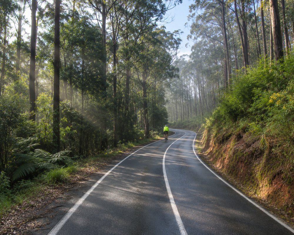
The road south from Powelltown climbs through forest to Noojee in West Gippsland, and the back roads east lead to Starlings Gap and the Ada River. These are mostly gravel forest roads, best in dry weather.
Reids Tramline Walk
The Reids Tramline walk starts and finishes at the Powelltown picnic area, which has toilets, a sheltered table and barbecues. It passes the working sawmill and the old workers’ cottages, then follows the tramline east to the site of Reids Mill. Horses and later steam engines once hauled logs along this line. The loop is about 6 km and takes around two and a half hours, crossing the Little Yarra River three times. The way back, by Big Bertha’s Track, is steeper. Dogs are allowed on a lead.
Where To Stay
There is no hotel in town, but there are bush campsites: drive-in camping at Starlings Gap and hike-in sites near the Ada Tree and at the Federal Mill on the Walk into History. Yarra Junction and Warburton, 15 to 25 minutes away, have more accommodation, and the nearest caravan park is the Yarra Valley Caravan Park at Yarra Junction.
Starlings Gap, on the forest roads north-east of town, is a free tent-only campground on the Walk into History. It has picnic tables, fire pits, toilets and a shelter, and needs no booking, but there is no reliable water, so bring your own. On the Warburton side of the range, the Big Pats Recreation Area has a few free sites by the creek, with a drop toilet. Dogs are allowed and there is no booking, though it fills up in the holidays. Towards Noojee, the Latrobe River campground is a base for the Ada Tree and Seven Acre Rock, reached by a mostly sealed road.
The forest roads to Starlings Gap and the Ada Tree are gravel, narrow and slippery after rain. They suit cars and small campers but not big caravans. There is no fuel in Powelltown, so fill up at Yarra Junction, about 15 km north.
At Yarra Junction, the Yarra Valley Caravan Park on Tarrango Road takes dogs and allows campfires. Langbrook Farm on Stephensons Lane has a self-contained cottage and units with a tennis court and hot tub. Mount View Estate on Milners Road is a luxury house for up to 10 guests, with a pool and spa.
Eat & Drink
The Powelltown pub, known locally as the Powelly, serves burgers, steaks and cold drinks, with a beer garden. The general store has basic supplies. Yarra Junction has bakeries, a pub and supermarket.
Powelltown is a pie-and-a-beer stop rather than a dining town. The pub and the general store share one site on Little Yarra Road. Bring a picnic for the forest: the Powelltown picnic area at the start of the Reids Tramline walk has barbecues, fireplaces and a sheltered table, and Starlings Gap has picnic tables and fire pits. Carry water on the forest walks.
For more choice, head north to Yarra Junction, about 15 km away, which has bakeries, cafes, a pub, supermarkets and fuel. In Warburton, about 25 km away, the Alpine Hotel serves lunch and dinner every day, Babaji’s Kerala Kitchen cooks South Indian food, and Silva Coffee Roasters’ coffee bar opens daily. Hoddles Creek Estate, on Gembrook Road west of Gladysdale, makes cool-climate chardonnay and pinot noir, but check its cellar door hours before you go.
Fill up before you leave Yarra Junction, as there is no fuel in Powelltown or in the forest beyond.
History
This is Wurundjeri Woi-wurrung Country. A sawmill opened here in 1901, when the settlement was called Blake’s. In 1912 it was renamed after the Powell Wood Process, a method of preserving timber by boiling it in a solution of molasses and arsenic, and in 1913 the Victorian Powell Wood Process Company finished a large mill and a tramway to the railway at Yarra Junction. The tramway carried timber until 1944, and the main mill burned down in 1976.
Getting to Powelltown
Powelltown is about 80 km east of Melbourne, around an hour and 25 minutes’ drive via Lilydale, the Warburton Highway to Yarra Junction, and then the Yarra Junction to Noojee road. There is no public transport.
Experiences
- Eco Tourism
- Historic/Heritage
- Nature based
- Rural/Country
- Self-Drive
Popular Activities
- Bush Walking
- Caravan and Camping
- Off Road Driving
- Rainforest
- Sightseeing
About Powelltown
- Locality: Urban locality
- Powelltown Postcode: 3797
- State: Victoria
- Region: Yarra Valley & Dandenong Ranges
- Latitude: -37.86366
- Longitude: 145.75361
- Elevation: 192m
- Timezone: Australia/Melbourne
