
Pinnaroo, SA
Pinnaroo is a farming town on the Mallee Highway, 243 kilometres east of Adelaide and only a few kilometres from the Victorian border. For travellers on the direct road between Adelaide and Sydney it is the first or last town in South Australia, and a natural place to break the journey.
About 700 people live here, in a district of wheat, barley and irrigated potatoes. The railway that created the town in 1906 no longer runs, and its station has become one of the best small museums in the region.
Known For
- The Mallee Tourist and Heritage Centre and printing museum
- Wetlands, an animal park and a pool beside the caravan park
- The border town on the Mallee Highway
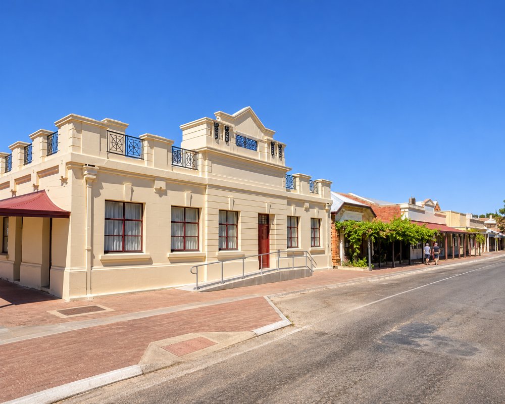
Things To Do in Pinnaroo
Mallee Tourist and Heritage Centre
Housed in the old railway station and a purpose-built hall, the centre brings together several collections. The Letterpress Printing Museum has working presses and cases of type from the days of the Pinnaroo Border Times. The Wurfel Grain Collection displays more than a thousand varieties of cereal, and the Gum family collection has restored engines, tractors and household goods. Volunteers open the centre from Monday to Saturday mornings.
Wetlands
A former railway dam near the roadhouse has been turned into a wetland with walking paths and mosaics made by local people.
Animal Park
The Lions Club keeps kangaroos, emus and aviary birds in a small park opposite the caravan park, a good leg-stretch for children.
Karte and Peebinga Conservation Parks
Karte, 30 kilometres north-west, has steep sand dunes up to 40 metres high and a 1.5 kilometre loop walk, with three bush campsites that must be booked. Peebinga, 42 kilometres north, is undeveloped mallee where malleefowl live.
Pinnaroo Show
The show and field day is held on the Wednesday after the October long weekend.
Pinnaroo Village Green
The town’s central park has been redeveloped with a caravan and RV rest area, a new playground and shared paths for walking and cycling, a short stroll from the main street cafe. It is the easiest place in town for a picnic or a run-around after a long drive. The town pool opens over the summer months.
Ngarkat by Four-Wheel Drive
Pinnaroo is the starting point for the best-known day trip in Ngarkat Conservation Park. Rosy Pine Road leads south to Pine Hut Soak, from where short walks reach the restored Nanam Well and the Fishponds, and the Centre Track carries on to Pertendi Hut, with its interpretive trail, before the sealed Ngarkat Highway brings you back. The tracks are for four-wheel drives only, there is no phone coverage, and park entry must be paid online before you go.
Where To Stay
The Pinnaroo Motel is on the highway and the Golden Grain Hotel is the town’s main pub.
The Pinnaroo Caravan Park has powered sites, cabins, a camp kitchen and a pool, and takes big rigs by arrangement. Self-contained vehicles can stay free for up to 96 hours at the RV stop on the corner of South Terrace and the main street, and there is a dump point with water at the wetlands. Ngarkat Conservation Park, 28 kilometres south, has bush camping.
The Pinnaroo Motel at 10-12 Mallee Highway sits between the two roadhouses, about five kilometres from the border, and is set up for early starts, with 24-hour check-in, a laundromat and off-road parking for large vehicles. Rooms range from budget to executive and are all non-smoking. Behind the motel, eight budget cabins each have an ensuite, a fridge, a kettle and reverse-cycle air conditioning, with linen supplied.
Karte Conservation Park, about 30 kilometres north-west on the road to Loxton, has three bush campsites with picnic tables, toilets and fire pits, and the walk up the dunes starts from the campground. In Ngarkat, Pertendi Hut takes caravans and camper trailers on three sites, Comet Bore, just off the Ngarkat Highway, suits tents and camper trailers in dry weather, and Pine Hut Soak, reached by four-wheel drive along Rosy Pine Road, has room for 12 vehicles, toilets and tables. All must be booked online before arrival.
Lameroo, about 38 kilometres west, has a hotel motel and a lakeside caravan park.
Eat & Drink
The Pinnaroo Bakery Cafe on Railway Terrace is the usual stop, the Golden Grain Hotel serves meals, and the roadhouses on the highway sell fuel and food at all hours.
The Groundsman at 27 Railway Terrace South, about 200 metres off the highway, is the coffee stop that brings travellers into town. It makes award-winning cold brew, has a following among travellers from the eastern states, and cooks healthy food fresh each day, with lawn, family-friendly seating and takeaway. Check its opening days, as it keeps shorter weekend hours. The two roadhouses on the Mallee Highway, either side of the motel, sell meals, groceries and fuel, and one stays open 24 hours.
For a pub meal and a cellar door, the Lameroo Hotel Motel, about 38 kilometres west, serves lunch and dinner from Monday to Saturday, and Mallee Spirit near Lameroo pours small-batch gins in a shearing shed; ring ahead. Pinnaroo has a supermarket in town, a short walk from the RV stop.
History
Pinnaroo is on Ngarkat country, and the name is said to mean big man. The town was established in 1904 and the railway from Tailem Bend opened in 1906. The Golden Grain Hotel began life that year as the Land of Promise Hotel. The last grain train ran in 2015.
Getting to Pinnaroo
Pinnaroo is on the Mallee Highway, about 145 kilometres east of Tailem Bend and three hours from Adelaide. Murrayville, in Victoria, is 27 kilometres east. Travellers coming in from Victoria must not carry fresh fruit or fruiting vegetables into South Australia; there is a quarantine station and disposal bins on the highway just inside the border, and fines apply.
Experiences
- Caravan and Camping
- Environmental
- Farm/Station
- Historic/Heritage
- Nature based
- Remote
- Rural/Country
- Self-Drive
Popular Activities
- Bird Watching
- Bush Walking
- Caravan and Camping
- Driving
- Golfing
- National Park
- Off Road Driving
- Sightseeing
- Wildlife
About Pinnaroo
- Locality: Urban locality
- Pinnaroo Postcode: 5304
- State: South Australia
- Region: Murray River Lakes and Coorong
- Latitude: -35.26037
- Longitude: 140.90861
- Elevation: 110m
- Population: 712
- Median Income: $32136
- Area (Sq/km): 799.961
- Timezone: Australia/Adelaide
Accommodation In Pinnaroo
Discover some of the accommodation in and around Pinnaroo
