Pacific Palms, NSW
The Pacific Palms area, just south of Forster and 287 km north of Sydney, is a holiday and retirement area with a laid-back ambience.
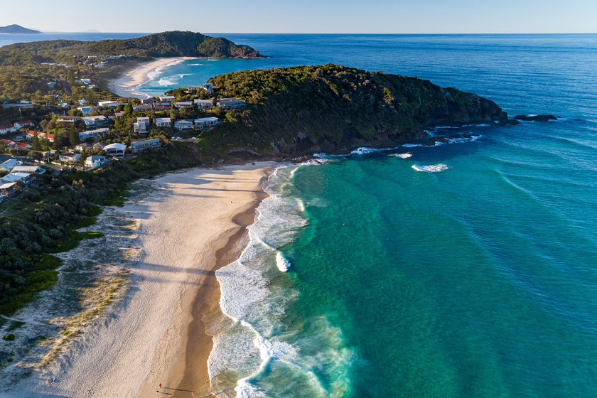
Pacific Palms is a region that consists of several small towns and beaches, such as Blueys Beach, Boomerang Beach, Elizabeth Beach, Charlotte Bay, Smiths Lake, Sandbar, Booti Booti and Tiona.
The Lakes Way, a beautiful coastal route from Bulahdelah to Forster, serves as the primary route of access. The Pacific Palms Visitors’ Centre is a lovely structure on the outskirts of the shopping centre off of Boomerang Drive.
Several of the best surfing beaches in the world are located here. Boomerang Beach, Blueys Beach, and Elizabeth Beach are the three most popular beaches, and all are convenient to get to. Boomerang Beach, located to the north of Boomerang Point, is a well-liked surfing spot with easy access via Boomerang Drive. Blueys Beach may be found to the south of the point.
There are picnic areas, a boat launch, and a surf club at Elizabeth Beach. As the only beach in the Pacific Palms area to have its own surf lifesaving club, Elizabeth Beach has become the go-to spot for families in the region. Paths can be found at the south-east end of Elizabeth Beach that lead to the more intimate Shellys Beach.
Pacific Palms Visitor Information Centre
Boomerang Drive, Blueys Beach
Tel: (02) 6554 0123
Nearest Airport: Taree
Where to stay?
Experiences
- Rural/Country
- Nature based
- Relaxation
Popular Activities
- Trail bike riding
- Bird Watching
- Bush Walking
- Cycling
- Horse Riding
- Sightseeing
- Swimming
- Fishing
- Fishing - Beach
- Beach
- Surfing
About Pacific Palms
- Locality: Urban locality
- Pacific Palms Postcode: 2428
- State: New South Wales
- Region: North Coast NSW
- Latitude: -32.34768
- Longitude: 152.53525
- Elevation: 19mm
- Timezone: Australia/Sydney
Accommodation In Pacific Palms
Discover some of the accommodation in and around Pacific Palms