
Nudgee Beach, QLD
Nudgee Beach is a tiny bayside community on the northern edge of Brisbane, about 16 kilometres from the city centre and only a few minutes from the airport. Hemmed in by creeks and the Boondall Wetlands, it feels remarkably remote for its location, and it offers a mangrove boardwalk, bird hides, a canoe trail and wide tidal flats on the shore of Moreton Bay.
Known For
- A mangrove boardwalk and bird hides
- The Boondall Wetlands, the largest in Brisbane
- Tidal flats, kayaking and the end of the Kedron Brook bikeway
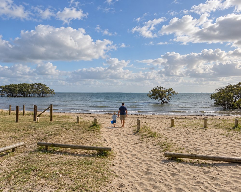
A single road crosses the wetlands to reach the settlement, a few streets of houses facing a foreshore park. Nudgee Creek runs along its western side and Kedron Brook enters the bay to the south. There is one small shop and little else.
It is a place for nature lovers, cyclists and anyone curious to see the bay shoreline as it was before the city grew.
Things To Do in Nudgee Beach
The Mangrove Boardwalk
A short boardwalk loop beside Nudgee Creek leads through tall grey mangroves to a bird hide overlooking the tidal flats. Signs explain how the mangroves grow and what lives among them, and at low tide the mud is alive with crabs and mudskippers. Take insect repellent, as mosquitoes and sandflies can be fierce.
Boondall Wetlands
The wetlands cover more than 1,100 hectares of tidal flats, mangroves, salt marsh, melaleuca swamp and open forest, protected as part of the Moreton Bay Ramsar site. Walking and cycling tracks cross them, linking Nudgee Beach with an environment centre at Boondall and on to Shorncliffe. Along the way are Aboriginal art totems marking places of cultural significance.
Birdwatching
From September to March the flats off Nudgee Beach host thousands of migratory shorebirds that have flown from Siberia, China and Alaska, among them eastern curlews, godwits and tattlers. Resident birds include mangrove kingfishers, herons, egrets, spoonbills, kites and sea eagles. The bird hides and the foreshore are best on a rising tide.
Canoe Trail
A marked canoe and kayak trail follows Nundah Creek through the mangroves, starting from the O’Quinn Street ramp near the boardwalk. It is calm, sheltered paddling, best done around high tide, and offers a close look at the wetland from the water.
The Foreshore and Bikeway
The foreshore reserve has picnic tables, barbecues, a playground and an off-leash area. At low tide the bay retreats for a long way, leaving firm sand flats for walking. The Kedron Brook bikeway, one of the longest off-road paths in the city, ends here after following the brook for about 20 kilometres from the western suburbs.
Boondall Wetlands Environment Centre
The council’s environment centre on Paperbark Drive, Boondall, on the far side of the wetlands, has interactive displays on tidal wetlands, resident crevice skinks and a programme of nature events and outdoor sessions. It is closed on Mondays and opens only in the mornings on weekends. From the centre, three easy walking trails of 100 metres to 2 kilometres lead into the forest and mangroves, and the Anne Beasley Lookout looks out over the wetlands to Moreton Bay.
Where To Stay
There is no visitor accommodation at Nudgee Beach.
The nearest hotels are around Brisbane Airport, ten minutes away, where several modern hotels serve travellers. Sandgate and Shorncliffe, 15 minutes north, have guesthouses and bed and breakfasts with more character.
The hotels of the city centre are 25 minutes away by car, so the beach is an easy outing from anywhere in Brisbane.
Several of the airport hotels sit in the Skygate and DFO precinct, about 10 km by road from the beach. Pullman Brisbane Airport is the most upmarket, Novotel Brisbane Airport suits families and business travellers, and the ibis Brisbane Airport and ibis budget Brisbane Airport are the cheaper choices. A free Skygate bus links the precinct with both terminals and the hotels run a shuttle loop, so an early flight can easily follow a morning walk on the boardwalk.
There is no caravan park at Nudgee Beach. The nearest council-run park is Bells Caravan Park at Clontarf on the Redcliffe peninsula, about 25 km north over the Houghton Highway bridge, with a waterfront walk and the fishing platform on the old Hornibrook Bridge close by. The peninsula also has a public dump point on Thurecht Parade at Scarborough, open around the clock.
For a longer stay on the northern bay, the cottages and bed and breakfasts of Sandgate and Shorncliffe are close enough to ride to Nudgee Beach along the Boondall Wetlands bikeway, a 13 km return trip through the mangroves and open forest.
Eat & Drink
Facilities are minimal. A small kiosk and store near the foreshore sells drinks, ice creams and takeaway food, with limited hours. Most visitors bring a picnic to eat in the park.
For a meal, head to the cafes and seafood shops of Sandgate, or to the shopping and dining precincts near the airport.
The only food at Nudgee Beach is Pam’s Cafe 88 on O’Quinn Street, a small family-run cafe and store that has traded here for about 25 years. It is best known for fish and chips in a crisp, golden batter, alongside burgers, takeaway favourites and dishes that draw on the owners’ Vietnamese heritage, and it also sells milk, pantry basics, cold drinks and bait for anglers heading out on the bay. Check opening hours before you go.
For a sit-down meal close by, the Cribb Island Beach Club at the ibis Brisbane Airport serves bistro meals and drinks about 10 km away, its name recalling the bayside suburb that was cleared for the airport. The Skygate and DFO precinct around it has cafes and casual places to eat. Sandgate, about 10 km north, has the widest choice of cafes, seafood takeaways and waterfront dining on this part of the bay.
The playground park on Fortitude Street has barbecues, shaded picnic tables and toilets near the car park. There is no supermarket or fuel at Nudgee Beach; the nearest shops and fuel are at Nudgee, Banyo and the airport precinct.
History
Nudgee Beach is in the country of the Turrbal people. The name Nudgee is thought to come from a word meaning the place of black ducks, and a bora ring and waterhole in the district were important ceremonial and gathering sites.
A small fishing and holiday settlement grew up on the shore in the early 1900s, reached by a rough track across the swamp. Plans to develop the surrounding land were resisted, and the wetlands were protected as a reserve in 1990.
Getting to Nudgee Beach
By car Nudgee Beach is about 25 minutes from central Brisbane, by the Gateway Motorway and Nudgee Road. Parking at the foreshore and the boardwalk is free.
The nearest railway stations are Nudgee and Banyo on the Shorncliffe line, each about five kilometres away, with a limited bus service. Cyclists can ride in along the Kedron Brook bikeway.
Experiences
- Nature based
- Relaxation
- Self-Drive
Popular Activities
- Bird Watching
- Bush Walking
- Cycling
- Fishing
- Kayaking
About Nudgee Beach
- Locality: Suburb
- Nudgee Beach Postcode: 4014
- State: Queensland
- Region: Brisbane
- Latitude: -27.34749
- Longitude: 153.10555
- Elevation: 5m
- Timezone: Australia/Brisbane
