
Murchison, WA
Murchison is Western Australia’s only shire without a town. The small Murchison Settlement on the Carnarvon-Mullewa Road, about 200 km north of Mullewa and 300 km north-east of Geraldton, holds the Shire offices, a roadhouse and caravan park and a small museum, and serves the vast cattle and sheep stations around it.
This is Wajarri Yamaji country. The shire is also home to one of the world’s great science projects: CSIRO’s Inyarrimanha Ilgari Bundara observatory and the SKA-Low radio telescope are being built on Boolardy Station, inside a radio quiet zone. The site is not open to visitors, but the remote landscapes, river pools and gorges make the drive worthwhile for well-prepared travellers.
Known For
- The SKA-Low radio telescope and CSIRO observatory
- The Murchison Oasis Roadhouse
- The remote Carnarvon-Mullewa Road
Things To Do in Murchison
Murchison Settlement Museum
The rammed-earth museum building tells the stories of Yamaji people, pastoral families and life on the stations.
Ballinyoo Bridge
The original Ballinyoo Bridge over the Murchison River, built in 1929 and 1930, was one of the first concrete bridges in the state. A new bridge opened in 2016, and one span of the old bridge has been kept as a memorial.
Natural sights
Bilung Pool, Errabiddy Bluff, Wooleen Lake and the gorges of the Wooramel River are among the natural highlights of the shire. Ask at the roadhouse about access, as most are on station roads.
The radio telescope
The SKA-Low telescope released its first image in March 2025, and science observations are due from around 2028. The observatory is not open to the public, but CSIRO offers an online virtual tour. Travellers near the site may be asked to limit radio use.
Where To Stay
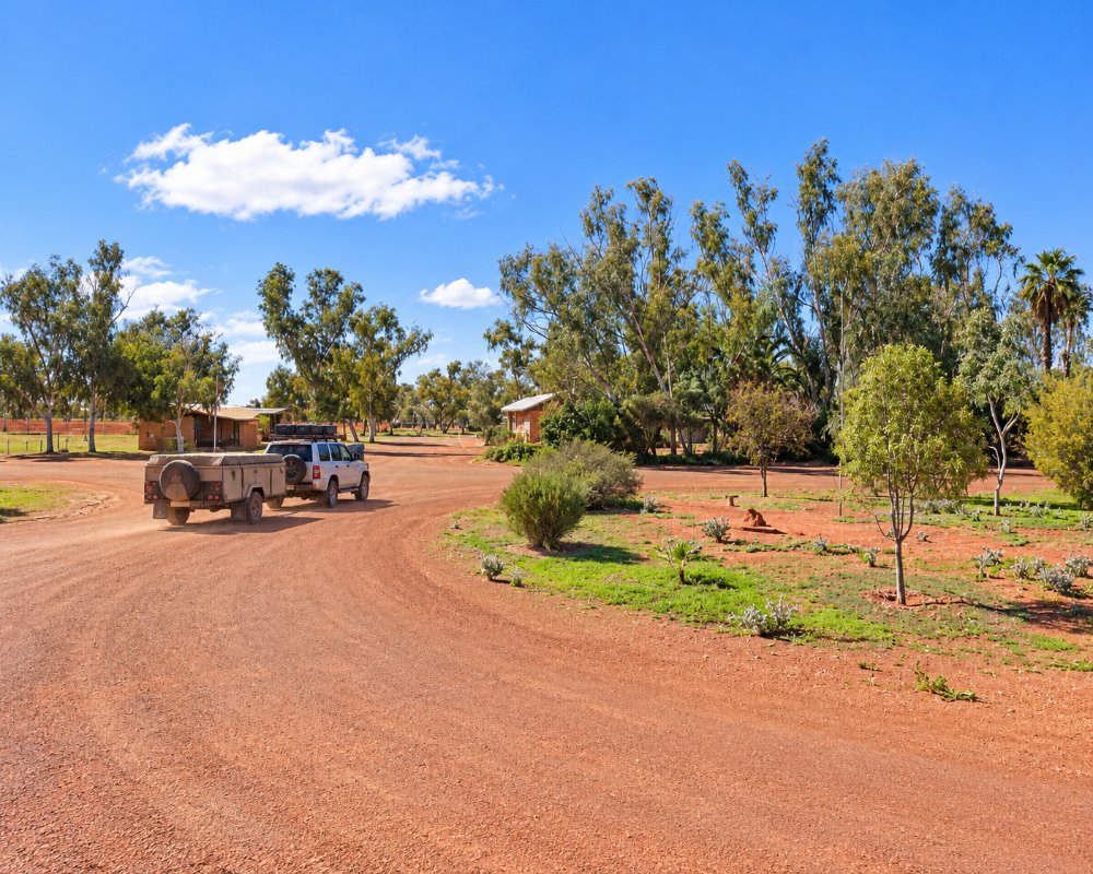
The Murchison Oasis Roadhouse and Caravan Park, run by the Shire, has caravan and camping sites and six motel rooms. It sells fuel, fast food and basic groceries, but hours depend on staff, so ring ahead, and it is closed on Christmas Day.
The Carnarvon-Mullewa Road is the main access, and long sections are gravel. It is a serious outback drive, so carry water, spare tyres and enough fuel, and check road conditions after rain. Off-road caravans are the best choice.
Eat & Drink
The Murchison Oasis Roadhouse, beside the Shire office and museum, is the only place to buy food and drink in the shire. It sells fast food, basic groceries and the only fuel on the long Carnarvon-Mullewa Road, but hours depend on staff, so ring ahead. Bring supplies from Geraldton, Mullewa or Carnarvon.
History
Surveyor H.F. Johnston recorded the Ballinyoo crossing in 1876, and pastoral stations spread across the area from the late 1800s. The bridge was built in 1929 and 1930. In 2009, CSIRO bought Boolardy Station for the radio astronomy observatory, and the new bridge opened in 2016.
Getting to Murchison
The Murchison Settlement is about 200 km north of Mullewa on the Carnarvon-Mullewa Road, and about 300 km north-east of Geraldton. Gascoyne Junction is further north. There are no regular flights.
The best time to visit is May to September, when days are mild. Wildflowers appear after winter rain, and summers are very hot.
Experiences
- Caravan and Camping
- Farm/Station
- Historic/Heritage
- Remote
- Rural/Country
Popular Activities
- Caravan and Camping
- Driving
- Sightseeing
About Murchison
- Locality: Rural locality
- Murchison Postcode: 6630
- State: Western Australia
- Region: Esperance & the Golden Outback
- Latitude: -26.8875
- Longitude: 115.9547
- Elevation: 292m
- Population: 62
- Median Income: $39624
- Area (Sq/km): 23446.445
- Timezone: Australia/Perth
Accommodation In Murchison
Discover some of the accommodation in and around Murchison
