
Mount Hotham, VIC
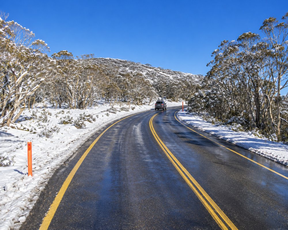
Mount Hotham stands at about 1,860 metres on the crest of the Great Dividing Range, about 380 km north-east of Melbourne. Unusually, its village sits along the ridge top, with the ski runs falling away below it, and the Great Alpine Road runs right through the resort between Harrietville and Omeo.
Hotham is known for some of the most challenging skiing in Australia, and in summer it is the starting point for the Razorback walk to Mount Feathertop and the end of the Falls to Hotham Alpine Crossing.
Known For
- Challenging alpine skiing
- The Razorback walk to Mount Feathertop
- The Great Alpine Road across the top
Things To Do in Mount Hotham
Skiing and Snowboarding
Vail Resorts has run the lifts since 2019, and the resort is on the Epic Australia Pass. Fourteen lifts serve about 320 hectares and more than 70 trails, the longest being Spargo’s at about 2.5 km, with 35 km of cross-country trails. The 2026 season closed early on 6 September after a record-warm winter. A resort entry permit is needed for all vehicles in the snow season.
Dinner Plain
The alpine village of Dinner Plain, 12 km east, has a beginners’ hill, a tube park and lodges, and a bus links it with Hotham in the snow season.
The Razorback and Mount Feathertop
In summer, the Razorback ridge leads from near Diamantina Hut to Mount Feathertop, Victoria’s second-highest peak, about 22 km return. Mount Loch is a shorter walk with wide views.
Falls to Hotham Alpine Crossing
The Falls to Hotham Alpine Crossing, 37 km over three days from Falls Creek, finishes at the Mount Loch car park near the village, with campsites to be booked along the way.
Hotham Airport
Hotham’s airport, sold by Vail in 2023, has no scheduled flights and is used by charter and private aircraft.
When To Visit
For snow, come from late June to August and check conditions first. Summer brings wildflowers, cool days and the best walking. The Great Alpine Road is open year round but can close in storms.
Where To Stay
Hotham has apartments, chalets and lodges, including Zirky’s, the Arlberg Hotham with its pool and sauna, Schnapps, and club lodges in Davenport Village, booked through Hotham Holidays. Many close outside winter.
For caravans and campers, stay at Harrietville, Bright or Omeo. The climb from Harrietville is unsuitable for towing in the snow season, vehicles that cannot fit chains may not enter the resort in winter, and there is no caravan park on the mountain.
The Lawlers Apartments complex, above the Corral car park, houses two of the village’s eating places, so guests there have dinner on the doorstep. Hotham Holidays and the resort’s accommodation search handle most apartments and club lodges, and booking early matters in July and August. Outside the snow season the quietest and most reliable choice is Dinner Plain, 11 km east, where Hotel High Plains opens all year and many lodges and chalets are let through the village’s booking agents. For caravans and campers, Harrietville Caravan Park, about 30 km down the Great Alpine Road towards Bright, is the closest park on the western side, and Omeo, about 55 km east, has the nearest services on the Gippsland side.
In summer, walkers can camp at Federation Hut on the Razorback below Mount Feathertop, and Parks Victoria’s JB Plain camping ground, just west of Dinner Plain, has a fire pit and drop toilet. Within the Alpine National Park, bookings and fees apply only on the Falls to Hotham Alpine Crossing; elsewhere bush camping is free. There is no fuel at Hotham or Dinner Plain, so fill up in Bright or Omeo.
Eat & Drink
In winter, The Bird Bar at the Summit, Zirky’s, the Arlberg Bar and Bistro, home of the Mount Hotham Brewery, and Miss Mary’s at Hotham Central are popular, along with Jack Frost and The General at Davenport. In summer few places open, so bring supplies or eat at Dinner Plain, Harrietville or Omeo.
In the snow season, The Bird Cafe and Bar, on the Great Alpine Road across from Hotham Central, is known for its food, coffee and craft beer. Zirky’s opens early for coffee, with its bistro from noon through to après and dinner. The Arlberg Bar and Bistro brews its own beer and cider on the mountain as the Mount Hotham Brewery (try the White Out Pale Ale), with pizzas and bar meals at night. Sir Loins, an offshoot of the Bright steakhouse, cooks steak dinners seven nights a week in winter in the Lawlers Apartments behind the medical centre, with a barista cafe there in the mornings. Other winter favourites include Jack Frost, Wabi Sabi, the Hotham Hotel and Chill Bar and Cafe.
Viva Alpina, the Italian restaurant downstairs at Hotham Central, did not open for the 2026 season. Two places keep going after the snow melts: The General, open every day of the year for coffee, meals, pizza and takeaway, with live music, a general store and a post office, and the First Run Cafe and Bar at Lawlers Court, which opens Friday to Sunday all summer for baking, coffee and weekend dinners. The Bird also opens from Friday to Monday in summer for coffee and lunch. The Hotham Central Supermarket in the White Crystal building opens only over winter.
History
This is the Country of the Gunaikurnai, Jaithmathang, Dhudhuroa and Taungurung peoples. The mountain was named after Sir Charles Hotham, Governor of Victoria. Cattlemen grazed the high plains from the 1850s, and the road over the top carried coaches between Bright and Omeo. Skiing began in the 1920s, and the resort grew after the Second World War.
Getting to Mount Hotham
Mount Hotham is about 380 km north-east of Melbourne via Wangaratta, Bright and Harrietville, around 4.5 hours’ drive, or about 460 km via Bairnsdale and Omeo. In winter, HothamBus and other coaches run from Melbourne, Albury, Bright and Harrietville, and chains must be carried. A free village bus runs in the snow season.
Experiences
- Active
- Mountain
- Nature based
- Rural/Country
Popular Activities
- Adventure
- Bush Walking
- Cycling
- Driving
- Mountain Biking
- National Park
- Sightseeing
About Mount Hotham
- Locality: Urban locality
- Mount Hotham Postcode: 3741
- State: Victoria
- Region: High Country
- Latitude: -36.98543
- Longitude: 147.14680
- Elevation: 1745m
- Timezone: Australia/Melbourne
