
Alpine National Park, VIC
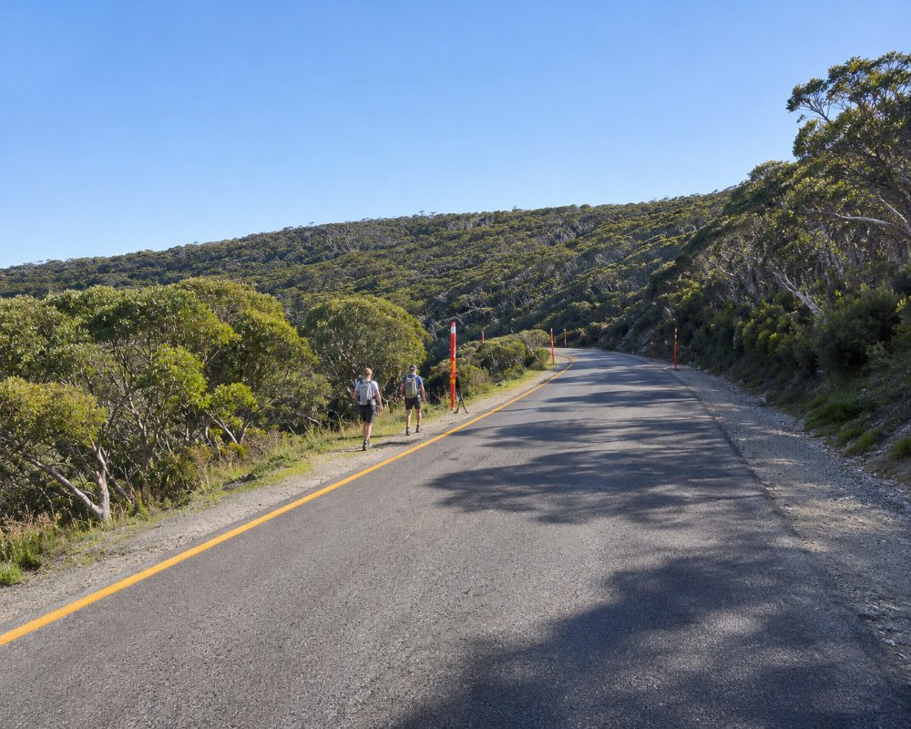
The Alpine National Park covers about 660,000 hectares of Victoria’s high country, from central Gippsland to the New South Wales border, where it joins Kosciuszko National Park. It is the largest national park in Victoria, a world of snow gums, high plains, deep valleys and the state’s highest peaks, Mount Bogong and Mount Feathertop.
It surrounds the ski resorts of Falls Creek and Mount Hotham, and can be reached from Bright, Mount Beauty, Harrietville, Mansfield, Licola, Dargo and Omeo.
Known For
- Victoria’s highest mountains
- The Bogong High Plains and historic huts
- The Falls to Hotham Alpine Crossing
Things To Do in Alpine National Park
Bogong High Plains
The Bogong High Plains, around Falls Creek, are a rolling plateau of snow grass, wildflowers and snow gums, crossed by walking tracks and dotted with huts, including Wallace’s Hut of 1889, the oldest cattlemen’s hut in the park.
Mount Feathertop and the Razorback
Mount Feathertop, Victoria’s second-highest peak, is reached by the Razorback ridge from Mount Hotham or by the Bungalow Spur from Harrietville, one of the finest walks in the state.
Falls to Hotham Alpine Crossing
The Falls to Hotham Alpine Crossing is a three-day walk across the high plains between the two resorts.
Dandongadale Falls and the Remote Valleys
Dandongadale Falls, about 255 metres high, is described as Victoria’s tallest waterfall. The remote Wonnangatta Valley, the Mount Howitt and Howqua high country and the Cobberas near the border are reached by 4WD tracks and long walks.
Huts and the Alps Walking Track
More than 60 historic huts are scattered through the Alps, and the Australian Alps Walking Track crosses the park on its way from Walhalla to Canberra.
When To Visit
Summer and autumn are the best seasons for walking, 4WD touring and camping. Many roads and tracks close from June until late October or early November. Fires, storms and deer control close some areas, so always check Parks Victoria alerts.
Where To Stay
For campers, there are many camping areas, including Mountain Creek near Tawonga, Beveridge Station and horse camps on the Bogong High Plains and in the Howqua Hills. Most are basic, and many are reached by gravel or 4WD tracks unsuitable for caravans. The towns around the park, such as Bright, Mount Beauty, Mansfield and Omeo, have caravan parks.
Parks Victoria allows dispersed camping through much of the park, and bookings and fees apply only on the Falls to Hotham Alpine Crossing. Camping areas with pit toilets, picnic tables and fireplaces include the Howqua River flats near Mansfield (6 Mile, 7 Mile and 8 Mile Flat, Pikes Flat, Upper Howqua and Bindaree Flat), King Hut on the King River, Bennies beside the Rose River (2WD access), Homestead Flat in the Wonnangatta valley, and Wellington River, a string of 13 unnumbered sites under peppermints and manna gums about 10 km from Licola.
Trailers are not recommended on Davies Plain, Limestone Creek or McCarthys tracks in the far east, though camper trailers can reach Limestone Creek camping area by the Black Mountain-Limestone Road. Several tracks in the Cobberas area, including the Cobberas, Ingeegoodbee and Macfarlane Flat tracks, are closed to vehicles after storm and flood damage. In the north, Tawonga Tourist Park and Tasman Holiday Parks Mount Beauty, Harrietville Caravan Park and the parks at Bright have powered sites and cabins, and the resorts at Falls Creek, Hotham and Dinner Plain have lodges and apartments.
Eat & Drink
There are no shops in the park outside the resorts. Bright, Mount Beauty, Harrietville, Mansfield and Omeo have cafes, pubs and supplies.
There is no food in the park outside the resort villages. In summer, the Frying Pan Inn and the 1550 Cafe at Falls Creek, The General at Hotham, open every day, and Hotel High Plains at Dinner Plain are the reliable stops on the high plains. At the edges of the park, Tawonga South and Mount Beauty have cafes, two breweries and a supermarket, and Omeo, Bright and Mansfield have the full range. Carry food and water for any walk or drive into the back country.
History
This is the Country of the Taungurung and Gunaikurnai, whom Parks Victoria names as Traditional Owners, and of the Dhudhuroa, Jaithmathang and other peoples connected to the high country. Aboriginal people gathered on the high plains in summer to feast on Bogong moths. Cattlemen grazed the plains from the 1850s until grazing was removed in 2005. The park was declared on 2 December 1989. Fires in 2003, 2006-07, 2019-20 and the Dargo-Wonnangatta fire of 2025-26 have burnt large areas.
Getting to Alpine National Park
The park is about 3.5 to 5 hours’ drive from Melbourne, depending on the entry point: via the Hume Freeway and Bright or Mount Beauty in the north, via Mansfield in the west, or via Gippsland to Licola, Dargo and Omeo in the south. There is no public transport into most of the park.
Experiences
- Eco Tourism
- Mountain
- Nature based
- Remote
Popular Activities
- Bush Walking
- Caravan and Camping
- National Park
- Wildlife
About Alpine National Park
- Locality: National park
- Alpine National Park Postcode: 3741
- State: Victoria
- Region: High Country
- Latitude: -36.95
- Longitude: 147.15
- Elevation: 1500m
- Timezone: Australia/Melbourne
