
Mount Augustus, WA
Mount Augustus rises from the red plains of the Upper Gascoyne in outback Western Australia, about 850 km north of Perth as the crow flies and more than 450 km inland from Carnarvon. Standing 715 metres above the surrounding country and stretching 8 km from end to end, it is about two and a half times the size of Uluru and is often described as the largest rock in the world. Very few people ever see it.
Known For
- A rock more than twice the size of Uluru
- The Summit Trail and the loop drive around the base
- Wajarri rock engravings
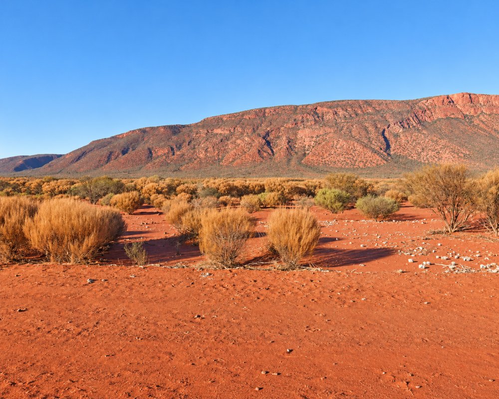
The mountain is Burringurrah to the Wajarri people, the traditional owners. Unlike Uluru, which is a single bare monolith, Mount Augustus is a huge fold of ancient sandstone and conglomerate, about 1.6 billion years old, draped over even older granite and partly clothed in mulga, wattles and tall white-barked gums. It changes colour through the day from pale pink to deep red and purple. After good winter rain the plains around it are covered in wildflowers.
Things To Do
Loop Drive
A 49 km gravel road circles the mountain and gives access to all the walks, picnic spots and lookouts. Allow at least half a day. It is usually fine for two-wheel-drive vehicles in dry conditions.
Summit Trail
The walk to the top is a hard 12 km return climb that takes six to eight hours, with steep, rocky sections and very little shade. It should only be attempted by fit, experienced walkers who start at first light and carry several litres of water each. People have died of heat exposure on this trail, and it is closed from November to February, and after 7am in March, April, September and October. Check the current rules with the parks service before you go.
Shorter Walks
Edney’s Trail climbs partway up the western end to a lookout, about 5 km return. Short, easy tracks lead to Aboriginal rock engravings at Mundee, Ooramboo and Beedoboondu, where figures and animal tracks are pecked into the rock. These are sacred sites and should not be touched.
Cattle Pool
Goolinee, or Cattle Pool, is a permanent waterhole on the Lyons River lined with river red gums. It is a peaceful spot for a picnic and for watching waterbirds, especially late in the day.
Emu Hill Lookout
This lookout a few kilometres from the mountain gives the classic full-length view and is the place to be at sunset.
History
In Wajarri tradition, Burringurrah was a boy who ran away from his initiation and was speared and beaten. He fell and died where the mountain lies, and its outline is his body lying on its side.
The explorer Francis Gregory climbed the mountain in June 1858, during an expedition through the Gascoyne, and named it after his brother, Augustus Gregory, also a noted explorer. Pastoralists followed in the 1880s, and Mount Augustus Station was established on the surrounding plains. The mountain was declared a national park in 1989.
When To Visit
May to August is the best time to visit, with warm days, cold nights and the Summit Trail open all day. After a good winter the plains around the mountain fill with wildflowers from about July to September. From September the heat builds fast, and from November to February the Summit Trail closes altogether. Summer storms and cyclone rain can close the gravel roads for days, so check the Shire of Upper Gascoyne road report before setting out.
Where To Stay
The only accommodation is Mount Augustus Tourist Park, on the station at the foot of the mountain, with powered and unpowered campsites, basic cabins and rooms.
Camping is not allowed inside the national park. The next nearest places to stay are station stays in the district and the small settlement of Gascoyne Junction, almost 300 km away.
Eat & Drink
The tourist park has a small tavern pouring cold beer and serving Shorthorn beef from Mount Augustus Station, and its shop sells essentials, diesel, unleaded and gas refills. Stocks are limited and deliveries infrequent, so bring your own food, and carry plenty of drinking water.
Getting There
Mount Augustus is reached by long gravel roads. From Carnarvon it is about 465 km via Gascoyne Junction, the first 170 km of it sealed. From Meekatharra it is about 350 km. The roads are generally suitable for well-prepared two-wheel-drive vehicles when dry, but a four-wheel drive is safer, and all routes close after rain.
Carry two spare tyres, extra fuel and water, and tell someone your plans, as there is no mobile coverage. The best time to visit is from May to September. Summer temperatures regularly pass 40 degrees.
Experiences
- Active
- Nature based
- Remote
- Self-Drive
Popular Activities
- Bird Watching
- Bush Walking
- National Park
- Off Road Driving
- Outback
About Mount Augustus
- Locality: National park
- Mount Augustus Postcode: 6705
- State: Western Australia
- Region: Exmouth & the Coral Coast
- Latitude: -24.32500
- Longitude: 116.84500
- Timezone: Australia/Perth
