
Hastings, WA
Hastings, Western Australia, might not be the first place that comes to mind when exploring the Wheatbelt region, but its tranquil rural charm and proximity to natural attractions make it a destination worth knowing. Located about 130 kilometres by road southeast of Perth, Hastings offers a peaceful escape from the city, with a journey time of about 1.5 to 2 hours by car.
Known For
- Serene countryside landscapes
- Proximity to Dryandra Woodland
- Insight into rural farming practices
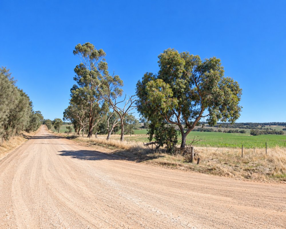
Hastings is a farming district in the Shire of Wandering, about 20 km north-east of Wandering and 30 km west of Pingelly, with the York–Williams Road along its eastern side and Codjatotine to the south.
Hastings is home to a modest population of around 40 residents, creating a sense of community and seclusion that’s hard to replicate. The median age of its inhabitants is 44, reflecting a mix of families and older individuals drawn to the peaceful environment. The small number of private dwellings and their spacious surroundings epitomize the rural Australian lifestyle.
As a rural locality, Hastings relies on nearby towns for essential services. Pingelly offers medical facilities, grocery stores, and recreational spaces. Wandering is tiny, so stock up in Pingelly or Boddington. The area’s connectivity to larger hubs ensures that necessities are never far away.
Things To Do in and around Hastings
Dryandra Woodland and Barna Mia
Hastings may be small, but its surroundings offer plenty to explore. A short drive away, the Dryandra Woodland is a haven for nature lovers, boasting one of Western Australia’s richest biodiversity areas. Visitors can walk among towering eucalypts and spot native wildlife like numbats and kangaroos.
Dryandra Woodland National Park is about 40 km south via the York–Williams Road. After dark, guided tours of the Barna Mia sanctuary show bilbies, woylies and bandicoots under red light, and the tours must be booked with Parks and Wildlife.
Boyagin Rock
About 10 km north-east, this granite dome rises 50 m above the farmland, ringed by powderbark wandoo, jarrah and marri. The 121 ha reserve, set aside in 1978, is one of the few intact patches of original bush in the Avon Wheatbelt and shelters numbats, tammar wallabies and echidnas, with picnic facilities but no camping.
Pingelly
For a cultural experience, the nearby town of Pingelly hosts community events and has charming cafes and shops. Meanwhile, outdoor enthusiasts can take advantage of walking trails and open fields, ideal for birdwatching or photography.
It has a museum in the Town Hall, Pioneer Park and the historic Moorumbine site nearby, and it marks the eastern end of the Hotham Way drive trail from Pinjarra.
Pumphreys Bridge
About 20 km south, this picnic and camping area sits on the Hotham River next to the 1888 Pumphrey homestead, a pleasant lunch stop on a drive between Wandering and Pingelly, and booked campers can stay up to 48 hours.
Where To Stay
Accommodation options within Hastings itself are limited, but the nearby towns of Pingelly and Wandering provide an array of places to stay. The Exchange in Pingelly offers pub rooms, while Wandering has a small Shire-run caravan park with cabins. Camping enthusiasts will find suitable spots within the Dryandra Woodland.
Hastings has no accommodation, shop or public camping area. The Wandering Caravan Park has two accessible cabins, 24 powered sites, 6 unpowered sites and a camp kitchen, booked and paid online, and campfires are banned from October to April except in the kitchen fire pit. Pingelly has a Shire caravan park on Sharow Street, a free 72-hour RV area for fully self-contained vehicles and an RV dump site at the Recreation Ground, while Steve’s Guest House and the Pingelly Hotel also have rooms.
Wandering Caravan Park (powered sites, camp kitchen) and Pingelly Caravan Park are the closest van stays, and Dryandra Woodland has bush camping at Congelin. Main routes in are sealed, but some local farm roads are gravel.
Eat & Drink
While Hastings lacks dedicated dining establishments, the broader area is filled with culinary surprises. The Exchange in Pingelly serves hearty pub meals, and Wandering has a small tavern but no general store. Local farmers’ markets also provide opportunities to sample fresh produce and artisanal goods.
Pingelly is the nearest place for a meal and supplies: the Exchange Tavern on Pasture Street and the Pingelly Hotel on Park Street both serve pub meals, the Pingelly Cafe on Parade Street does coffee and light meals, and the town has groceries and fuel. In Wandering, ring the tavern ahead for hours, and Brookton to the north is another option for groceries. Take water and food for a day at Boyagin Rock or Dryandra.
History
Hastings lies within the traditional lands of the Noongar people, who have a deep spiritual connection to the region. European settlement in the area began in the 19th century as farming and agriculture expanded throughout the Wheatbelt. While Hastings itself remains a small locality, its historical ties to the broader development of the Wandering district are noteworthy. Heritage trails and interpretive signs in nearby towns provide insights into the area’s past.
Noongar people trace their connection to this country, Gnaala Karla Boodja, back some 45,000 years. As a rural locality rather than a townsite, Hastings has no Landgate name entry. European farming came from 1859, when the Watts family settled near Wandering, the road board formed in 1874, and the Great Southern Railway reached Pingelly in 1889, drawing trade east.
Getting to Hastings
Reaching Hastings is straightforward from Perth. The drive down the Albany Highway and regional roads is not only quick but also scenic, with opportunities to stop at small towns and roadside attractions along the way. Public transportation to the area is limited, so traveling by car is recommended to fully explore what the region has to offer.
From Perth it is about 140 km via the Albany Highway to North Bannister, east to Wandering, then north-east on North Wandering Road, or about 160 km via the Brookton Highway to Brookton and south on the York–Williams Road. Main roads are sealed and suit caravans, some farm roads are gravel, and Transwa’s Perth–Albany coach stops in Pingelly.
Experiences
- Nature based
- Rural/Country
- Self-Drive
Popular Activities
- Bird Watching
- Driving
- National Park
- Wildlife
About Hastings
- Locality: Rural locality
- Hastings Postcode: 6308
- State: Western Australia
- Region: Margaret River & the South West
- Latitude: -32.55212
- Longitude: 116.82451
- Elevation: 340m
- Population: 37
- Median Income: $68224
- Area (Sq/km): 206.472
- Timezone: Australia/Perth
Accommodation In Hastings
Discover some of the accommodation in and around Hastings
