
Codjatotine, WA
Tucked away in the heart of Western Australia’s Wheatbelt, Codjatotine offers a peaceful retreat just 121 kilometers southeast of Perth. While small in population, this locality is big on charm and history, providing visitors with a glimpse into the agricultural and cultural heritage of the region.
Known For
- Historical insights at Codjatotine Rest Area
- Proximity to Wandering and Pingelly towns
- Scenic drives through the Wheatbelt
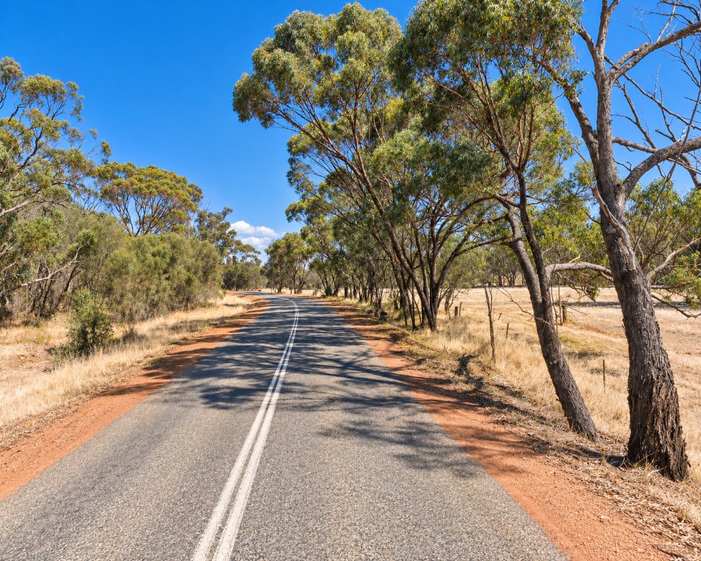
Codjatotine is a farming district on the Wandering–Pingelly Road, about 15 km east of Wandering and 30 km west of Pingelly, with Hastings to the north and Dwarda to the south-west.
Things To Do in and around Codjatotine
Codjatotine Rest Area
Though small, Codjatotine serves as a gateway to the broader Wheatbelt region. The Codjatotine Rest Area is a highlight, blending utility with culture. Its picnic facilities and historical information panels make it a preferred stop for road-trippers traversing the scenic Wandering-Pingelly Road.
Nature enthusiasts will appreciate the tranquility that envelops the area. Driving through the region, one is treated to views of rolling farmland, punctuated by native bushland—a reminder of the natural beauty that defines Western Australia.
Pumphreys Bridge
About 10 km east, this Shire picnic area sits beside the Hotham River on Pumphreys Road, across from the homestead John and Isabella Pumphrey settled in 1888. Riverside camping is booked online and limited to 48 hours, with fires only in the designated pits.
Dryandra Woodland
About 25 km south via the York–Williams Road, Dryandra is the stronghold of the numbat, WA’s animal emblem, and home to more than 100 bird species. On booked night tours at Barna Mia, red torchlight shows bilbies, woylies and bandicoots up close.
Pingelly and Boyagin Rock
For those looking to extend their exploration, the nearby towns of Wandering and Pingelly offer additional attractions, from local eateries to boutique accommodations.
Pingelly has a museum in the old Town Hall, Pioneer Park and the historic Moorumbine settlement just out of town, and Boyagin Rock, 26 km north-west of Pingelly, rises 50 m above the farmland and is covered in wildflowers in spring.
The Hotham Way
The Wandering–Pingelly Road through Codjatotine is part of the Hotham Way, a drive trail from Pinjarra to Pingelly through Dwellingup, Boddington and Wandering, with jarrah forest in the west and open wheat and sheep country and patches of wandoo woodland further east.
Where To Stay
Given its rural nature, Codjatotine itself has limited lodging options. However, the neighboring towns provide a variety of accommodations that cater to different preferences. In Wandering, you’ll find cozy cottages and farm stays where the warmth of country hospitality shines through. For those who prefer something more modern, Pingelly offers pub rooms at its two hotels, a guest house and a caravan park.
The rest area is a day stop, as overnight stays there could not be confirmed. The Shire-run Wandering Caravan Park has two accessible cabins, 24 powered sites, 6 unpowered sites and a camp kitchen, booked and paid online first. Pingelly has a Shire caravan park on Sharow Street and a free RV area for fully self-contained vehicles, with a 72-hour limit and a dump site at the Recreation Ground, and the Pingelly Hotel and the Exchange Hotel both have rooms.
Wandering Caravan Park on Cheetaning Street is the closest place to park a van, and the Codjatotine Rest Area on Wandering-Pingelly Road makes a handy roadside break. Fill up with fuel in Pingelly or before leaving the Albany Highway.
Eat & Drink
Dining in Codjatotine is about simplicity and savoring the essence of rural life. While there are no dedicated eateries within the locality, nearby towns host charming cafes, country pubs, and restaurants. In Wandering, the local pub is a favorite for hearty meals and a welcoming atmosphere. Pingelly, on the other hand, provides a mix of traditional fare and contemporary dining options, perfect for rounding out a day of exploration.
Wandering has no general store, but the Shire lists the Wandering Tavern at 31 Watts Street, so ring ahead for meal times, and its fuel bowser takes cards only. Pingelly is the better supply stop: the Exchange Tavern on Pasture Street and the Pingelly Hotel on Park Street both serve pub meals, the Pingelly Cafe on Parade Street does coffee and light meals, and the town has groceries and fuel.
History
Codjatotine is steeped in the history of the Wheatbelt, a region central to Western Australia’s agricultural identity. Early settlers here transformed the landscape, cultivating wheat and livestock to sustain their communities. While the locality itself remains sparsely populated today, the echoes of its pioneering days are preserved in landmarks like the Codjatotine Rest Area. Here, history boards narrate the story of the district’s development, making it a stop worth exploring for those intrigued by the past.
The name Codjatotine speaks to its roots in the Noongar language, reflecting the deep connections to the land held by its original custodians. These ties add a layer of cultural richness, inviting visitors to consider the area’s significance through a broader historical lens.
The district lies in the Gnaala Karla Booja region of the South West native title settlement, and the meaning of the name is not recorded. Europeans arrived in 1859, when the Watts family followed straying horses to Horse Well near Wandering, and the Pumphreys settled on the Hotham in 1888. The Great Southern Railway, opened in 1889, ran well to the east through Pingelly, which left Codjatotine a district of scattered wheat and sheep farms rather than a town.
Getting to Codjatotine
Reaching Codjatotine is straightforward, with the locality accessible by car via the Wandering-Pingelly Road. The drive from Perth, approximately 145 kilometers, takes around 1 hour 45 minutes, making it an ideal destination for a day trip or a longer rural getaway. The journey itself is an experience, as the road winds through scenic landscapes that transition from urban outskirts to expansive farmland.
The roads are sealed and suit caravans, and the Shire of Pingelly says Transwa’s Perth–Albany coach stops in Pingelly five days a week.
Codjatotine may not be a bustling hub, but its quiet allure is a reminder of the understated beauty found in Western Australia’s countryside.
Experiences
- Nature based
- Rural/Country
- Self-Drive
Popular Activities
- Caravan and Camping
- Driving
- National Park
- Wildlife
About Codjatotine
- Locality: Rural locality
- Codjatotine Postcode: 6308
- State: Western Australia
- Region: Margaret River & the South West
- Latitude: -32.67944
- Longitude: 116.82194
- Elevation: 257m
- Population: 47
- Median Income: $36400
- Area (Sq/km): 170.058
- Timezone: Australia/Perth
