
Girraween National Park, QLD
Girraween National Park lies on the New South Wales border, about 35 kilometres south of Stanthorpe by road and about 260 kilometres from Brisbane. Its name is said to mean place of flowers, and for a few weeks each spring that is exactly what it is. For the rest of the year its attraction is rock: huge domes of pale granite, tors piled one on another, boulders balanced on impossible points and creeks sliding over smooth slabs into clear pools. It is one of the most distinctive national parks in Queensland and the finest for walking in the south of the state.
Known For
- The Pyramid and Balancing Rock
- Wildflowers from late July to October
- Granite pools, cool nights and well-kept camping areas
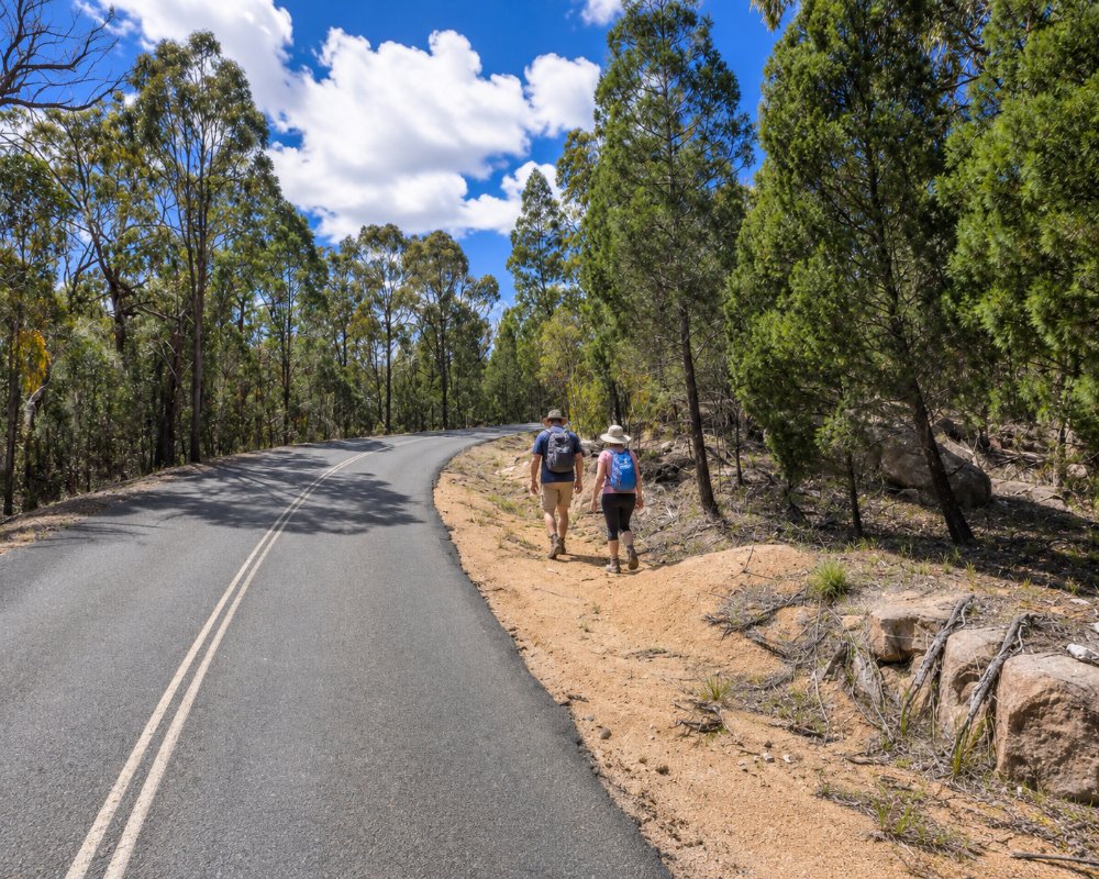
The park sits at around 900 metres on the New England Tableland, with peaks rising above 1,200 metres. Summers are mild and winters cold, with frequent frosts and the occasional fall of snow. The forest is open eucalypt woodland with a heathy understorey, quite unlike the rainforest parks nearer the coast.
Wildlife includes grey kangaroos, red-necked wallabies, possums and gliders, and this is one of the few places in Queensland where the common wombat is found. Birdwatchers look for superb lyrebirds, turquoise parrots and many honeyeaters.
Things To Do in Girraween
Granite Arch
An easy circuit of 1.6 kilometres from the day-use area crosses Bald Rock Creek and passes beneath a natural arch of boulders. It is the best short walk in the park and suits families.
The Pyramid
The park’s signature walk, 3.6 kilometres return, climbs steadily through forest and then straight up a steep, exposed granite slab to the top of a dome. At the summit is Balancing Rock, a great egg of stone resting on a tiny base, with views to the Second Pyramid and across the park. The final section needs good shoes and a head for heights, and should not be attempted when the rock is wet.
Castle Rock, the Sphinx and Turtle Rock
From the Castle Rock camping area, a track climbs to the summit of Castle Rock, 5.2 kilometres return, squeezing through a cleft to a broad platform. A longer walk of 7.4 kilometres continues to two striking formations, the Sphinx and Turtle Rock.
Mount Norman
The highest point in the park, at 1,267 metres, is reached by a track of about 10.4 kilometres return from Castle Rock, or a shorter route from the southern side. The last scramble to the top is for experienced walkers.
The Junction and Underground Creek
A gentle five-kilometre return walk follows Bald Rock Creek downstream to its meeting with Ramsay Creek, past cascades and swimming holes. In the eastern part of the park, a short track leads to Underground Creek, where the stream vanishes beneath fallen boulders, and to Dr Roberts Waterhole.
Wildflowers
From late July the wattles begin, followed by pea flowers, boronias, rock roses, bottlebrushes and orchids, reaching a peak in September and October.
Where To Stay
The park has three camping areas, Castle Rock, Kambuwal and Terrawambella, with sites for tents, camper trailers and caravans. They must be booked in advance and fill quickly in holidays and on spring weekends.
Cabins, lodges and cottages line the road into the park and the highway around Wyberba and Ballandean, and Stanthorpe has motels and many more cottages.
Terrawambella camping area has open, grassy sites suited to large caravans, camper trailers and motorhomes, and its tent area is kept for large organised groups. Kambuwal has smaller, sheltered sites among trees and granite boulders for small caravans, camper trailers and tents. Castle Rock has sites for all set-ups, including group sites and sites for people with disabilities. The names of the two newer areas honour the Kambuwal people; Terrawambella is their name for The Pyramid. There are no powered sites and generators are not allowed, so arrive with charged batteries, and display your booking tag at your site. Walkers with good navigation skills can also bush camp at remote, unmarked sites in the park.
Outside the park, Girraween Environmental Lodge near Ballandean has spa chalets with wood heaters, Girraween Country Inn has rooms and a restaurant close to the park, and Girra Vista at Wallangarra is an eco cabin looking across Girraween. For powered caravan sites, Country Style Holiday Park at Glen Aplin is about 25 km north of the camping areas. The nearest dump point is at Apex Park Reserve in Stanthorpe.
Eat & Drink
There is no food for sale in the park. Wineries, cafes and a tavern are 10 to 15 minutes away around Ballandean, and Stanthorpe has supermarkets. Carry drinking water on all walks.
Heavenly Chocolate, on Pyramids Road at Wyberba, is on the way into the park and sells handmade chocolates and European-style hot chocolate. Balancing Heart Vineyard, also at Wyberba and named Halliday’s Dark Horse Winery of the Year for 2027, serves wood-fired pizzas with its wines, and Pyramids Road Wines pours relaxed tastings in an old shed in the park’s southern foothills. The Ballandean Pub, about 15 km away, does pub meals, and Girraween Country Inn has a fireside restaurant. Nothing is sold in the park, so carry food and water.
History
The granite country is part of the traditional lands of the Kambuwal people. It was grazed and selected for orchards from the late 19th century. A Stanthorpe doctor, Spencer Roberts, campaigned in the 1920s to protect the wildflowers, lyrebirds and wombats, and the first reserves were declared in the early 1930s. The park was enlarged over the following decades and now adjoins Bald Rock National Park across the border.
Getting to Girraween
From Stanthorpe, drive south on the New England Highway for 26 kilometres and turn left at Wyberba; a sealed road runs nine kilometres to the visitor centre. From the south, the turn-off is 30 kilometres north of Tenterfield. Wallangarra, on the border, is ten minutes from the turn-off.
Experiences
- Active
- Eco Tourism
- Mountain
- Nature based
- Self-Drive
Popular Activities
- Bird Watching
- Bush Walking
- Caravan and Camping
- Mountain Biking
- National Park
- Rock Climbing
- Swimming
- Wildlife
About Girraween National Park
- Locality: Rural locality
- Girraween National Park Postcode: 4382
- State: Queensland
- Region: Southern Queensland Country
- Latitude: -28.82693
- Longitude: 151.95153
- Elevation: 893m
- Timezone: Australia/Brisbane
