
Duranillin, WA
Duranillin, a small yet fascinating town in the Wheatbelt region of Western Australia, offers visitors a glimpse into rural charm and natural beauty. Just over 220 kilometers (about a 2.5-hour drive) south of Perth, this quiet destination is steeped in history, surrounded by breathtaking landscapes, and home to a close-knit farming community.
Known For
- Lake Towerrinning
- Historical heritage
- Serene Wheatbelt landscapes
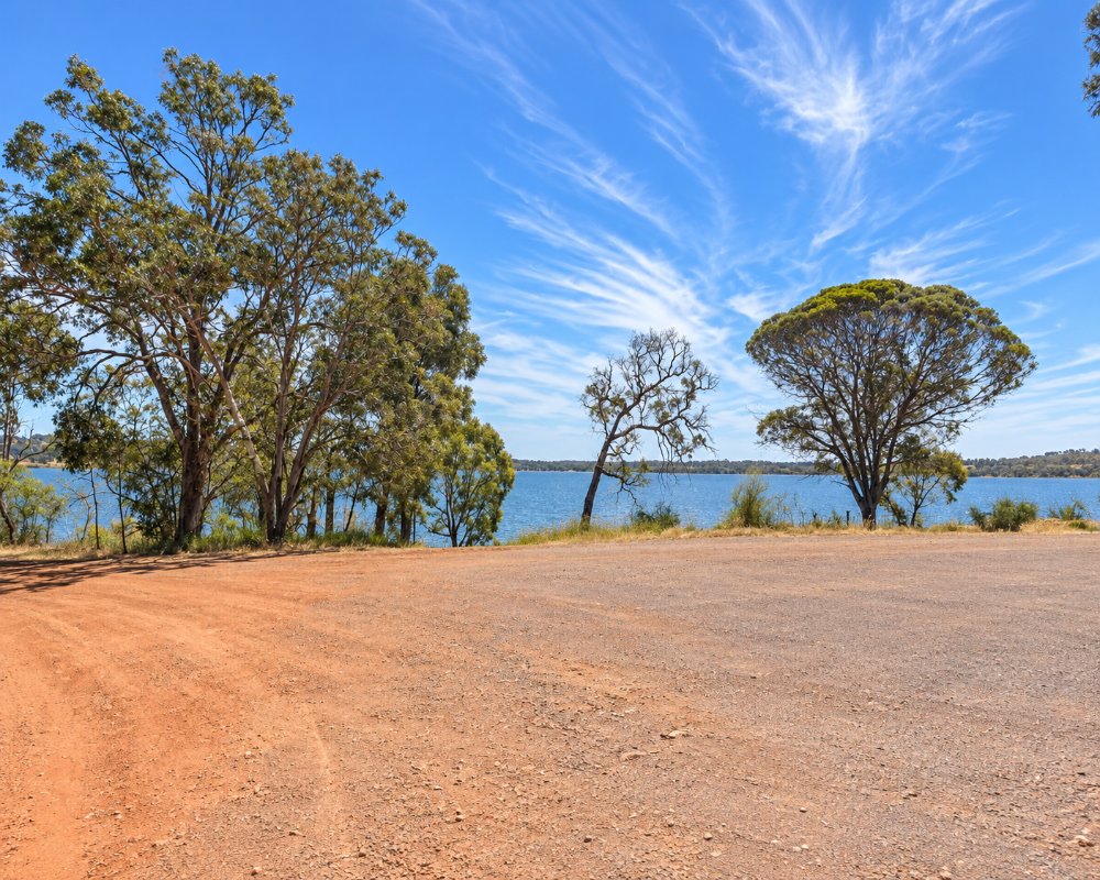
Duranillin is a small farming town 24 km south of Darkan, near where the Arthur and Beaufort rivers meet, with Cordering about 14 km west and Boyup Brook about 60 km south-west.
Things To Do in and around Duranillin
Lake Towerrinning
Duranillin’s crown jewel is undoubtedly Lake Towerrinning, a semi-freshwater lake spanning 256 hectares. A favorite among locals and visitors, the lake offers opportunities for water skiing, kayaking, swimming, and picnicking. Its clear waters and abundant birdlife, with over 57 species recorded, make it a haven for nature enthusiasts and photographers.
The lake is about 10 km south and also hosts dragon-boat racing, speedboat state championships and an ultramarathon on its shoreline tracks. It is part of the Towerrinning Lake and Moodiarrup Swamps Important Bird Area, so bring binoculars in the quieter months.
Collie–Darkan Rail Trail
For those who prefer land-based activities, the nearby Collie to Darkan Rail Trail offers a scenic route for walking, biking, and horseback riding. Stretching across the Wheatbelt’s iconic terrain, the trail invites exploration of native flora and fauna while showcasing the quiet beauty of Western Australia’s countryside.
The Heritage Trail
Landmarks like the general store (rebuilt in about 1925 after the first 1917 store burned down) and the heritage-listed railway bridge over the Arthur River harken back to its days as a railway town. Visitors can explore these locations to gain a sense of how the town once functioned as a vital part of the Wheatbelt’s economy and culture.
The West Arthur Heritage Trail, encompassing key sites across the region, provides a deeper understanding of local history. Stop by Six Mile Cottage, north-west of Darkan, or the Betty Brown Historical Centre in Darkan to connect with the past and appreciate the community’s efforts to preserve its heritage.
The Shire’s self-drive heritage trail stops in Duranillin at the one-room school behind the town, the old store and a 1949 garage on the main road, now a private home, before heading south to the lake jetties and Moodiarrup Hall.
Paddling the Arthur River
If you have your own kayak or paddleboard, the Shire suggests launching from the riverbank beside Moodiarrup Hall, a short drive south of the lake. The Arthur River is quiet here, with tall river gums and plenty of waterbirds, though parts shrink to pools in late summer.
Arthur River Heritage Precinct
About 40 minutes east on the Boyup Brook–Arthur River Road, the old 125 Mile stop at Arthur River on the Albany Highway has the 1869 Mount Pleasant kitchen, the old post office, the hall and St Paul’s Anglican Church, and the roadhouse there makes a good lunch stop.
Where To Stay
Visitors to Duranillin often choose to stay in nearby Darkan, where cozy accommodations cater to a range of preferences.
For a more rustic experience, camping at Lake Towerrinning provides a serene retreat under the stars, complete with modern facilities.
Lakeside Camping is on a family farm on the banks of Lake Towerrinning, with 14 powered sites on the water’s edge, each with its own beach access, plus unpowered bush sites and hot showers. In 2026 a powered site for two cost $35 a night and an unpowered one $28, with a pay-four-stay-five deal from May to October outside school holidays. The Shire-run Darkan Caravan Park, 24 km north, has 20 powered sites (five for vans over 7 m), 8 unpowered sites, two chalets, a camp kitchen and a dump point, and the Darkan Community Hotel reopened in 2024 for meals, though without rooms yet.
Lakeside Camping on the shore of Lake Towerrinning, about 10 km south of town, has powered sites with lake views, and Darkan Caravan Park is 24 km north. Fuel up in Darkan or Boyup Brook, where the CMCA-managed Flax Mill Caravan Park takes self-contained rigs as well as powered-site guests.
Eat & Drink
Duranillin’s general store has long been the hub for supplies, liquor and a chat, though the post office agency was given up in early 2024. While dining options in the town itself are limited, nearby Darkan offers cafes and eateries where visitors can enjoy hearty meals and warm hospitality. The region’s farming heritage influences the local cuisine, with fresh produce and seasonal delights often featured on menus.
Phone ahead before relying on the store, as its current hours could not be confirmed. For meals, drive 24 km north to Darkan, where the community-owned Darkan Community Hotel serves lunch and dinner from Wednesday to Sunday, The Great Awakening Cafe does coffee and breakfast, Darkan Roadhouse has fuel, pies and takeaway, and Fleay’s Store sells groceries. Bring a picnic for Lake Towerrinning, which has barbecues and shaded tables but no kiosk.
History
The story of Duranillin began in the late 19th century, when surveyors first recorded its name, derived from Aboriginal origins, though its exact meaning remains unknown. By 1916, the construction of the Wagin to Bowelling railway line spurred the development of the area, culminating in its designation as a townsite in 1918. Over the years, Duranillin has been a hub for timber and farming, shaping the lives of its early settlers and fostering a resilient community spirit.
This is Wilman Noongar country, and Lake Towerrinning was a corroboree ground and meeting place with good hunting. Landgate says the town took its name from the railway siding, named after nearby Duranilling Pool, first recorded by a surveyor in 1877. Under K.B. Thompson, who took over the store in 1929, it held the district’s first off-shears wool sale in 1938 and housed the telephone exchange until 1979, and the railway was the main employer until 1968.
Getting to Duranillin
Duranillin is conveniently accessible by road, approximately a 2.5-hour drive south of Perth. Travel along Albany Highway and turn off toward Darkan before heading south to reach this tranquil town. Public transport options are limited, making a private vehicle the most practical choice for exploring the region.
The full trip is about 235 km, around 2 hours 45 minutes, via the Albany Highway to Williams, the Coalfields Highway west to Darkan, then 24 km south. You can also come through Collie and Darkan, or from Kojonup via the Boyup Brook–Arthur River Road. The main roads are sealed and suit caravans, and no coach serves the town.
Experiences
- Historic/Heritage
- Remote
- Rural/Country
Popular Activities
- Bird Watching
- Caravan and Camping
- Skiing - Water
- Swimming
About Duranillin
- Locality: Rural locality
- Duranillin Postcode: 6393
- State: Western Australia
- Region: Margaret River & the South West
- Latitude: -33.51662
- Longitude: 116.80156
- Elevation: 230m
- Population: 70
- Median Income: $29848
- Area (Sq/km): 172.785
- Timezone: Australia/Perth
