
Collarenebri, NSW
Collarenebri, known as Colly, is a town of about 640 people on the Barwon River and the Gwydir Highway, 140 km west of Moree and 75 km north-east of Walgett. The name comes from a Gamilaraay word meaning place of many flowers.
Known For
- Fishing on the Barwon River
- A free riverside camp
- Remote north-western plains
Things To Do in Collarenebri
The Barwon is one of the best inland rivers for Murray cod and yellowbelly, and the weir pool in town is the favourite spot. The Aboriginal cemetery on the edge of town, where graves are decorated with broken coloured glass, is an important site; please treat it with respect. The town opened an artesian bore bath in 2024, but it has been closed since late that year for repairs, so do not count on it.
Aboriginal Cemetery
The heritage-listed cemetery on Gundabloui Road is known for graves covered in crushed and melted coloured glass and decorated with objects that stand for the person buried there. It is still a working cemetery and an important place for the local Aboriginal community, so visit quietly and do not disturb the graves.
The Rocky Ford
The town grew at a shallow rocky ford on the Barwon, the only firm crossing for stock and drays for many kilometres. Locals also fossick for agate, topaz and petrified wood in the district.
Where To Stay
A free camping area beside the river, just over the Rocky Ford Bridge on the Moree side, has showers, toilets and a dump point.
The free camp has a handful of marked sites on crushed rock, a barbecue and hot showers. The Tattersalls Hotel Motel, by the bridge, has about a dozen motel rooms with caravan parking opposite. Alex Trevallion Park in Walgett is a free council camp with a 48-hour limit, hot showers, toilets, filtered water and a dump point.
Walgett and Moree are the nearest towns with more services.
Eat & Drink
The Tattersalls Hotel serves meals, and there is a small supermarket and fuel.
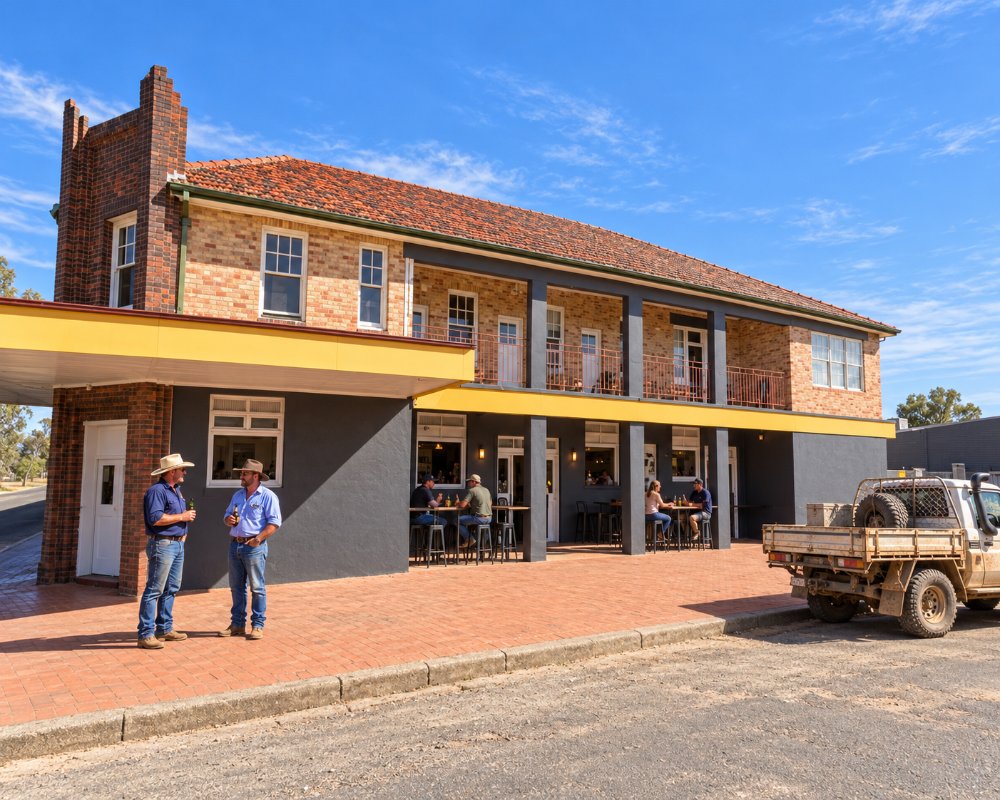
The Tattersalls Hotel was rebuilt in 1938 beside the Barwon bridge and is the place for a counter meal. For a supermarket or bakery, go to Walgett or Moree, and carry plenty of water, as summer days often pass 40 degrees. The town’s bore baths remain closed with no reopening date.
History
Collarenebri is on Gamilaraay and Yuwaalaraay country, and carved trees survive on nearby Collymongle Station. In 1860 William Earl opened the Squatters Arms at the ford, a pub later held up by Captain Thunderbolt, and the town was gazetted in 1867. In the 1976 flood about half the town was evacuated, and in 1986 Collarenebri was one of the last places in Australia to switch to an automatic telephone exchange.
Getting to Collarenebri
Collarenebri is on the Gwydir Highway, which is sealed. Side roads are black soil and close after rain.
Do not take the unsigned dirt short cut to Lightning Ridge that sat-navs suggest; go via Walgett.
Experiences
- Cultural
- Nature based
- Relaxation
- Remote
- Rural/Country
Popular Activities
- Caravan and Camping
- Fishing
- Kayaking
- Sightseeing
- Swimming
About Collarenebri
- Locality: Urban locality
- Collarenebri Postcode: 2833
- State: New South Wales
- Region: Country NSW
- Latitude: -29.54581
- Longitude: 148.57655
- Elevation: 146m
- Timezone: Australia/Sydney
