
Brunkerville, NSW
Brunkerville is a small rural locality at the northern foot of the Watagan Mountains, on the road between Freemans Waterhole and Cessnock.
Known For
- Farmland under the Watagans
- A scenic back road to wine country
- Access to the Heaton forest lookouts
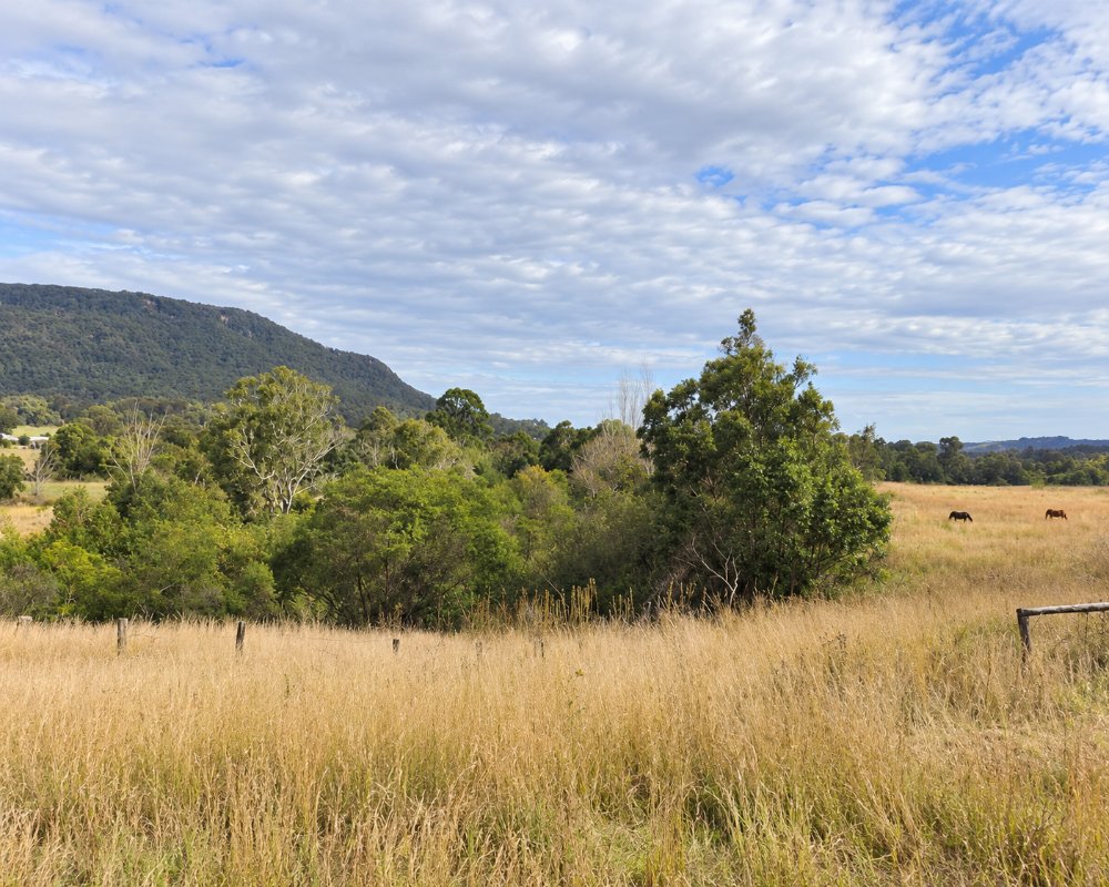
Brunkerville is a scatter of farms and acreages along the road; its small public school closed in 1962. There is no village centre. The pottery and craft shops once listed here should not be relied on.
Things To Do in Brunkerville
The drive itself is the attraction, through open paddocks with the forested range close on the southern side. Roads climb into Heaton State Forest and Watagans National Park for lookouts, picnic areas and walks.
Up to the Heaton lookouts
From Freemans Drive near Freemans Waterhole, Mount Faulk Road climbs to Heaton Road and the Heaton, Hunter and McLean lookouts in Heaton State Forest, with views north over the Hunter Valley. The bitumen turns to gravel, so check the Forestry Corporation’s closures page after storms.
The old rest stop at Freemans Waterhole
Before the freeway opened in 1987, Freemans Waterhole, 3 km south, was the main stop on the old Gap Road, with picnic grounds, tame wallabies and a steam locomotive. Almost all of it has gone, but the Oak milk bar of 1967 survives between the two service stations; it was last reported trading in 2025, so check before relying on it.
The back road to wine country
Leggetts Drive and Lake Road, through Mulbring, make a quiet alternative to the expressway between the M1 and Cessnock’s vineyards, through rolling hills between the Watagan and Sugarloaf ranges.
Where To Stay
There are a few farm stays and cottages. Cessnock and the vineyards are 20 minutes on.
For caravans, Ingenia Holidays Hunter Valley at 137 Mount View Road, Cessnock, has cabins, villas and powered sites with a pool and camp kitchen. Maitland Showground, about 35 km north, has powered sites at $30 a night. The NPWS campgrounds at Gap Creek and Bangalow in Watagans National Park are for tents beside the car, reached on gravel via Martinsville, and not for caravans.
Eat & Drink
Nothing in Brunkerville. Freemans Waterhole has a roadhouse.
Freemans Waterhole, about 3 km south, has two service stations for fuel, drinks and snacks. For a meal, Kurri Kurri, about 17 km north, has the Station Hotel’s bistro and the bowling club’s brasserie, and Toronto and Morisset are 15-20 minutes east.
History
Brunkerville lies near where Awabakal and Wonnarua country meet, under the Watagan range. The district was first known as Broken Back, and its school opened as Broken Back Public School in 1870. The name changed to Brunkerville in June 1893, probably for James Brunker, the long-serving member for East Maitland. It was a farming district of small holdings and timber getters, and the school closed in December 1962.
Getting to Brunkerville
Leave the M1 at the Toronto and Cessnock exit. Brunkerville is ten minutes west.
From Sydney it is about 130 km via the M1 to the Freemans Waterhole exit, then Freemans Drive and Leggetts Drive. The roads are sealed and suit caravans.
Experiences
- Rural/Country
- Self-Drive
Popular Activities
- Bush Walking
- Driving
- National Park
- Sightseeing
About Brunkerville
- Locality: Rural locality
- Brunkerville Postcode: 2323
- State: New South Wales
- Region: Hunter
- Latitude: -32.94884
- Longitude: 151.47876
- Elevation: 59m
- Population: 204
- Median Income: $32240
- Area (Sq/km): 14.359
- Timezone: Australia/Sydney
