
Araluen, NSW
Araluen is a small settlement in a deep, fertile valley of the Great Dividing Range, about 26 km south of Braidwood. In the 1850s and 1860s it was one of the richest alluvial goldfields in New South Wales, with thousands of diggers strung along the creek. Today it is a peaceful farming valley, known for its peach orchards and for the beauty of its setting, enclosed by steep, forested mountains.
Known For
- One of the richest goldfields of the 1850s
- Araluen peaches
- A valley enclosed by mountains
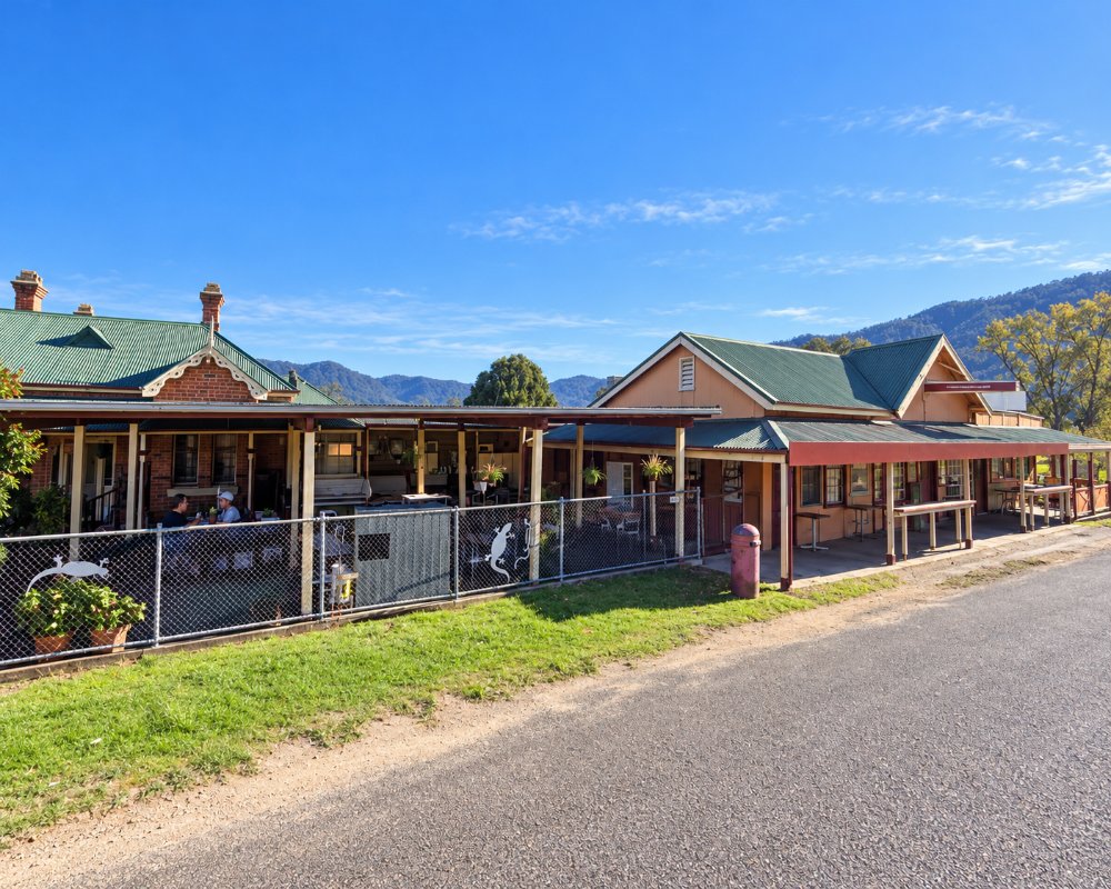
A couple of hundred people live in the valley, which is noticeably warmer than the tablelands above it. There is a pub, a hall, a church and scattered farms, and two stone-fruit orchards still work the creek flats.
Things To Do
The Drive In
The road from Braidwood crosses the tableland and then winds steeply down the range, with views into the valley that explain why it was called the Happy Valley.
Gold-Rush Relics
Mullock heaps, old water races and the scars of dredging line Araluen Creek. Two old cemeteries hold the graves of miners and their families. Gold can still be panned in the creek.
Araluen Hotel
The pub is the meeting place of the valley and a good spot for lunch.
It occupies an old general store with a long verandah of armchairs, the original Araluen Arms having burned down in 1927. It was offered for sale in early 2026, so check it is open before driving down.
Peaches
The orchards blossom in early spring, and peaches and nectarines are picked from November to early January and sold at farm gates and local farmers markets.
Camping and the River
A camping reserve beside Araluen Creek is popular in summer. Beyond the valley, the road south follows the Deua River through Deua National Park towards Moruya. It is unsealed, narrow and slow.
Araluen History Trail
A trail of ten signposted sites starts at an interpretive board at the creek campground and runs to the Church of England and Roman Catholic cemeteries, where many graves date from the rush, including that of the gold discoverer Alexander Waddell. It also takes in the Federal Hall.
The 1865 Gold Escort Ambush
On 13 March 1865 Ben Hall’s gang attacked the gold escort from Araluen as it climbed the mountain road near Majors Creek. Constable Kelly was badly wounded, but the police held off the attack and saved the gold, and the escort’s wagonette is now in the Braidwood Museum.
History
The valley is in the country of the Walbanga people of the Yuin nation. The name is said to mean place of water lilies.
Gold was found in 1851, and at the height of the rush about 4,000 people lived along the creek, with dozens of hotels and stores. The notorious Clarke brothers and their gang robbed gold shipments and travellers on the mountain roads in the 1860s. Floods repeatedly destroyed the diggings, and after dredging ended in the 1920s the valley returned to farming. The poet Charles Harpur lived in the district, and Henry Kendall named a daughter after it.
Where To Stay
There is a camping reserve by the creek and rooms at the hotel.
The free Araluen Creek Campground sits under casuarinas beside the creek, upgraded by the council with toilets, bore water, a solar barbecue and picnic tables. Pets are allowed and no booking is needed, but it suits tents, camper trailers and small vans that can handle the steep road in.
Braidwood has motels, guesthouses and hotels.
The Braidwood Showground has powered sites, showers and a dump point, and there is no dump point in Araluen. Deua National Park, south along the Araluen Road, has NPWS riverside campgrounds for self-sufficient campers.
Eat & Drink
The hotel serves meals. There are no other shops.
Harrison and Sons, a fourth-generation family farm on Araluen Road, sells peaches and nectarines in season, mainly through local farmers markets. There is no fuel in the valley, so fill up in Braidwood.
Getting There
From Braidwood, take the Araluen Road south, about 30 minutes. The descent is steep, with tight bends.
Signs near Braidwood say the road is not suitable for caravans, buses or large trucks. Through to Moruya, the road along the Deua River is narrow, partly unsealed and sometimes closed by landslips, so check Live Traffic NSW. There is no public transport.
Experiences
- Historic/Heritage
- Nature based
- Remote
- Rural/Country
Popular Activities
- Bush Walking
- Caravan and Camping
- Driving
- Fossicking
- National Park
- Sightseeing
About Araluen
- Locality: Rural locality
- Araluen Postcode: 2622
- State: New South Wales
- Region: Country NSW
- Latitude: -35.64693
- Longitude: 149.81215
- Elevation: 155m
- Timezone: Australia/Sydney
