
Smithton, TAS
Smithton is the main town of Circular Head, the far north-western corner of Tasmania. It sits on the estuary of the Duck River, 85 km and about an hour west of Burnie, where the Bass Highway comes to an end.
About 3,900 people live here. It is a working town, built on dairying, beef, potatoes, timber and seafood, and it is the place to fill the tank and the fridge before heading into the Tarkine or out to Marrawah and Arthur River. Stanley is 20 minutes to the east. Woolnorth and Cape Grim, at the north-western tip of the state, are about half an hour to the west and can be seen only on a tour.
Known For
- Service town for the far north-west
- Gateway to the Tarkine
- Dairy, beef and seafood country
Things To Do in Smithton
Circular Head Heritage Centre
The heritage centre shares a building in Nelson Street with the visitor information centre. Its displays cover the geology and fossils of the district, Aboriginal artefacts, old farm machinery and family history. The best-known local find is the skeleton of a giant extinct marsupial dug from a nearby swamp in 1920.
Tier Hill Lookout
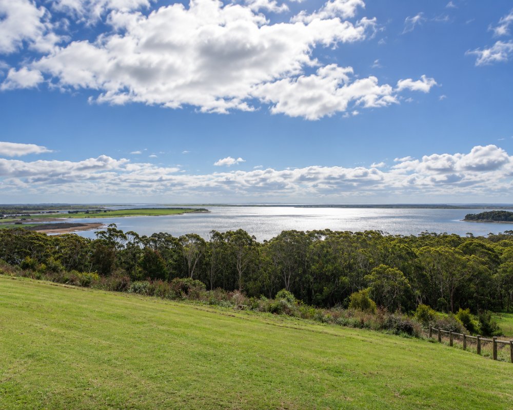
A short drive from the main street, the lookout gives a wide view over the town, the Duck River estuary and the islands off the coast.
The Duck River
The river and its foreshore are used for fishing and walking, and oysters are farmed in the bay; a local oyster grower has a cafe.
Farm and Food Tours
The visitor centre can arrange visits to a robotic dairy and a small cheese maker.
Dismal Swamp
The forest adventure park with its long slide into a sinkhole, 30 km west of the town, has been closed since 2020. In 2026 governments announced funding to revive it, but no reopening date had been set.
Where To Stay
Smithton has hotels, a motel and a caravan park.
The Tall Timbers Hotel on the edge of town has hotel rooms and a bistro, and the Bridge Hotel sits beside the river near the main street. The River Breeze caravan park on Montagu Road has powered sites, cabins and a dump point. Tall Timbers also lets fully self-contained vehicles park free for up to 72 hours between October and May. The council campground at Montagu, on the coast north-west of the town, is open in the warmer months and closed each October. A public dump point was moved to East Esplanade in 2026. The town has supermarkets and several fuel outlets, and this is the last full range of services before the Tarkine.
Eat & Drink
Both hotels serve meals, the oyster farm has a cafe, and there are cafes and takeaway shops in the main street.
History
The far north-west is the country of the North West people, among them the Peerapper and Manegin clans. The Van Diemen’s Land Company arrived at Circular Head in 1826. A post office called Duck River opened in 1873 and was renamed Smithton in 1895, and the settlement was declared a town in 1905. The great Mowbray Swamp was drained for dairy farms, and timber tramways and later railways reached out to Marrawah and Trowutta.
Getting to Smithton
Follow the Bass Highway west from Burnie through Wynyard; the road is sealed all the way and easy with a caravan. Smithton is 132 km from the ferry at Devonport, about an hour and 35 minutes.
Experiences
- Historic/Heritage
- Rural/Country
Popular Activities
- Shopping
- Sightseeing
About Smithton
- Locality: Urban locality
- Smithton Postcode: 7330
- State: Tasmania
- Region: North West Coast
- Latitude: -40.8415
- Longitude: 145.1232
- Elevation: 12m
- Timezone: Australia/Hobart
