
Yunta, SA
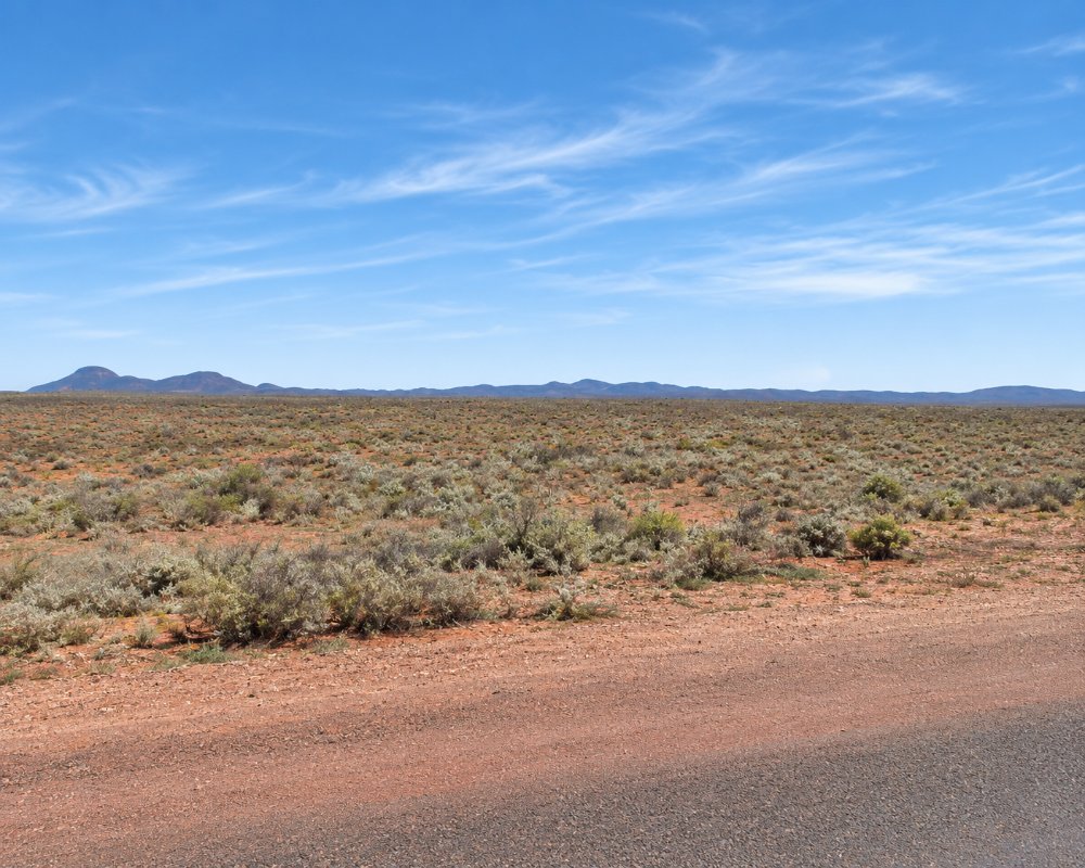
Yunta is a town of about 60 people on the Barrier Highway, 81 kilometres north-east of Peterborough and 195 kilometres from Broken Hill. Saltbush plains stretch to the horizon on every side.
It is the main fuel and meal stop on the South Australian half of the highway.
Known For
- A break on the road to Broken Hill
- Outback roadhouses and a country pub
- The gravel road north to Arkaroola
Things To Do in Yunta
The Town
A park beside the highway has picnic tables and relics of the narrow-gauge railway that once carried ore from Broken Hill to Port Pirie.
Gold Rush
Yunta was founded in 1887 after gold was found at Teetulpa, to the north, and more than 5,000 diggers passed through in a few months. Little is left on the field.
Picnic Races
Races and a gymkhana are held each May.
Waukaringa
About 35 km north of Yunta by gravel road, Waukaringa was a gold town proclaimed in 1888 that had about 750 people by 1890. It was abandoned in the 1950s. The ruins of the old hotel still stand, along with the stone chimney of the Alma and Victoria mine, which is on the South Australian Heritage Register. The site is surrounded by station country, so stay on the road, leave gates as you find them and do not climb the walls.
Where To Stay
The Yunta Hotel, which reopened under new managers in August 2026, has rooms.
A rest area opposite the hotel has toilets, and overnight stays are allowed for a donation. One of the roadhouses and the hotel also have space for caravans.
The Yunta Truck Stop on Railway Terrace has a couple of caravan sites with toilets and hot showers, and travellers who are not staying can pay for a shower. The donation rest area opposite the hotel suits self-contained vans for a night. Arrive with full water tanks, especially in summer, when days average about 34 degrees in January.
Places to stay are few between Peterborough, about 81 km south-west, and Broken Hill, about 195 km east: Yunta’s hotel and truck stop, and the small park beside the hotel at Cockburn on the border, about 150 km east. Most travellers stop at Yunta or Peterborough for the night. Heading north on the gravel road to Arkaroola, plan the whole trip before you leave and carry enough water, food and fuel for about 300 km, as there is nowhere to stop for supplies on the way.
Two heavy-vehicle rest areas on the highway east of Yunta, at Winnininnie and Bindarrah, are being rebuilt in 2026 to take road trains, and they will also be open to cars and caravans. The Bindarrah stop is closed while the work is done, so check before you plan a break there.
Eat & Drink
The hotel opens daily for meals, and two roadhouses sell fuel and takeaway.
Yunta is a stop for fuel and a meal rather than a dining town. The Yunta Hotel, beside the highway, serves counter meals and cold drinks and is the place for a sit-down dinner. The two roadhouses, the Yunta Truck Stop on Railway Terrace and the Shell, sell fuel, takeaway food, coffee and drinks. They are the main fuel stop on the highway between Peterborough and Broken Hill, so fill up here heading east. The post office and rural transaction centre also offers internet access. On race day the picnic races bring a bar and catering to the racecourse.
There is no supermarket. Stock up at Peterborough or Broken Hill, which both have supermarkets, and carry plenty of drinking water.
History
Yunta is in the country of the Ngadjuri people. In July 2023 the Federal Court recognised their native title over a large part of the Mid North, including the Yunta area. By 1866 the district was part of the Tattawappa and Yanta pastoral run, and early records spell the name Yanta. The town was proclaimed on 13 January 1887, as more than 5,000 diggers passed through on their way to the goldfields at Teetulpa and Waukaringa. It became a railway town on the narrow-gauge line that carried Broken Hill ore from Cockburn towards Port Pirie. The standard-gauge line that replaced it in 1970 still runs through town. From 1934 Yunta was the base of Harry Ding, an outback trucker and mail contractor remembered across the stations to the north.
Getting to Yunta
The Barrier Highway is sealed, and continues east through Olary to the border at Cockburn. A gravel road runs about 300 kilometres north to Arkaroola with no fuel or services; ask at a roadhouse about its condition. Travellers coming from New South Wales must not bring fresh fruit or fruiting vegetables into South Australia, and vehicles are checked at Oodla Wirra, further west.
Experiences
- Caravan and Camping
- Historic/Heritage
- Remote
- Rural/Country
- Self-Drive
Popular Activities
- Caravan and Camping
- Driving
- Outback
- Sightseeing
About Yunta
- Locality: Rural locality
- Yunta Postcode: 5440
- State: South Australia
- Region: Flinders Ranges and Outback
- Latitude: -32.58013
- Longitude: 139.5595
- Elevation: 305m
- Timezone: Australia/Adelaide
