
Ngarkat Conservation Park, SA
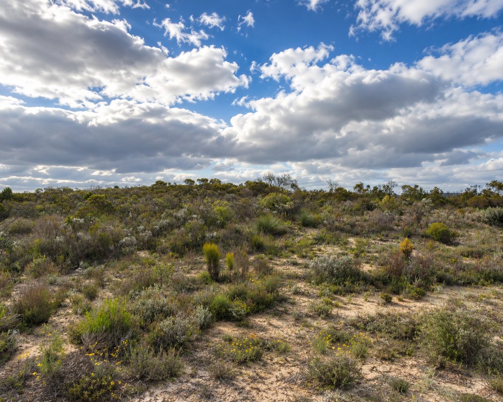
Ngarkat Conservation Park covers about 270,000 hectares of mallee, heath and sand dunes between the Mallee Highway and the Dukes Highway, running east to the Victorian border. It is the largest area of native vegetation left in the settled part of South Australia, about 200 kilometres from Adelaide.
The park takes its name from the Ngarkat people. It is dry, sandy country with no surface water apart from a few soaks and old wells, and almost all of it can be reached only by four-wheel drive. For those equipped for it, Ngarkat offers real solitude, big skies and one of the best known sand tracks in the state.
There is no mobile phone reception in or near the park, no drinking water and no fuel. Fill up and stock up at Pinnaroo, Lameroo, Tintinara, Keith or Bordertown before going in.
Known For
- The Border Track and other four-wheel drive routes
- Bush campgrounds in mallee and heath
- Malleefowl, orchids and spring wildflowers
Things To Do in Ngarkat
Pertendi Hut
The main part of the park open to ordinary cars is Pertendi Hut, off the sealed Ngarkat Highway between Pinnaroo and Bordertown. A short walking trail loops through the mallee from the campground, and it gives a fair taste of the country.
The Border Track
The track follows the fence along the Victorian border over a long series of soft dunes. Its northern section is one-way, from north to south, and is open only from 1 April to 31 October; the closure is sometimes extended in dry years. It is rated very difficult. Lower your tyre pressures, carry recovery gear and travel with another vehicle. The Centre Track is the alternative in summer.
Walks
Short walks lead to lookouts and soaks across the park: Mount Shaugh, the highest point, and Mount Rescue are each about two kilometres or less, Tyms Lookout is five kilometres and the Scorpion Springs loop is eight. Bucks Camp and Box Flat have ruins from sheep runs abandoned in the 1890s.
Wildlife and Wildflowers
Malleefowl build their mounds around Scorpion Springs, and emus, western grey kangaroos and pygmy possums live in the heath. More than 50 kinds of orchid have been recorded. August and September are best for flowers, and March and April are also pleasant. Summer is extremely hot.
Bees
Beekeepers have worked this country for generations, and hundreds of hive sites are leased in the park. Bees gather at any water in the warmer months.
Nanam Well and Coxs Windmill
The restored Nanam Well, lined with native timber, was dug in the pastoral days of the 1870s and was once more than 58 metres deep; it is the last of its kind in the Pinnaroo district. A 2.5 kilometre walk links it with Pine Hut Soak, and another track follows an old stock route to the windmill at Coxs Windmill campground. Both are reached by four-wheel drive from Pinnaroo along Rosy Pine Road.
Fishponds and Baan Hill
The Fishponds are a claypan locked between dunes that holds water after wet spells and draws wildlife from all around; a 500 metre walk leads to it. At the northern edge of the park, south of Lameroo, Baan Hill (said “Bain”) has a picnic ground with tables and a toilet. Further south, Gosse Hill has a one kilometre return walk to a lookout over the dunes. More than 120 bird species have been recorded across the park.
Where To Stay
Camping is allowed only at the marked campgrounds and must be booked and paid for online, along with a vehicle entry fee, before you arrive. Pertendi Hut, with three sites, toilets and tables, is the only campground suited to two-wheel drives and the only one listed for caravans. Comet Bore can be reached by ordinary car in dry weather and takes tents and camper trailers.
The rest, including Pine Hut Soak, Box Flat, Bucks Camp, Rabbit Island Soak and the Border Track camps, are for four-wheel drives with tents or off-road campers. Facilities are minimal: a toilet at some, untreated water at one or two, no bins. Dogs, generators and chainsaws are not allowed, and fires are permitted only in season in the rings provided. Pinnaroo, Lameroo and Tintinara have caravan parks.
The park has 11 campgrounds in all. Pine Hut Soak takes up to 12 vehicles, with toilets, tables and non-potable water, and suits groups. Coxs Windmill has six small, secluded sites for tents, Box Flat four, Bucks Camp and Rabbit Island Soak two each, and Nanam Well a single site with a toilet. Comet Bore, just off the Ngarkat Highway, has room for 15 vehicles and plenty of space for children to kick a football. On the Border Track, The Pines and The Gums are seasonal pull-over sites that close with the one-way section from 1 November to 31 March, while Doggers Hut, on the two-way section, is open all year.
Every campground must be booked and paid for online before you arrive, and there is no phone coverage to do it once inside. Bring your own firewood, as collecting it in the park is banned, and check the fire restrictions before lighting a campfire. Dogs are banned because fox baits are laid all year.
For a bed, the Lameroo Hotel Motel and its Lakeside Caravan Park, or the Pinnaroo Motel and cabins, are the nearest. On the Dukes Highway side, the Motel on Becker in Tintinara has motel rooms with a 24-hour key kiosk.
Eat & Drink
There is nothing in the park. Bring all food and at least several litres of water per person per day.
There is no food, water or fuel in the park. The closest meals on the northern side are in Pinnaroo, about 28 kilometres north of the park edge, where The Groundsman on Railway Terrace South serves coffee and fresh food (check its opening days) and the highway roadhouses sell food and fuel around the clock. The Lameroo Hotel Motel serves lunch and dinner from Monday to Saturday. There is no fuel on the Ngarkat Highway between Pinnaroo and Bordertown.
History
The Ngarkat people lived around the soaks and native wells of this country. Pastoralists tried to run sheep here from the 1870s but gave up within 20 years, beaten by rabbits, dingoes and poor feed. The park was proclaimed in 1979 and enlarged in 2004 when three neighbouring parks were added. Bushfires started by lightning burn large areas every few years.
Getting to Ngarkat
From Pinnaroo, take the Ngarkat Highway south for 28 kilometres to the Pertendi Hut area. From Lameroo, Baan Hill Road leads south to the park edge, and from Tintinara and Keith several gravel roads enter from the south-west. The park closes on days of catastrophic fire danger.
Experiences
- Caravan and Camping
- Eco Tourism
- Nature based
- Remote
- Self-Drive
Popular Activities
- Bird Watching
- Bush Walking
- Caravan and Camping
- National Park
- Off Road Driving
- Wildlife
About Ngarkat Conservation Park
- Locality: Rural locality
- Ngarkat Conservation Park Postcode: 5302
- State: South Australia
- Region: Murray River Lakes and Coorong
- Latitude: -35.76304
- Longitude: 140.87685
- Elevation: 140m
- Timezone: Australia/Adelaide
