
Wyrrabalong National Park, NSW
Wyrrabalong National Park is a small coastal park in two parts on the Central Coast. The northern section covers the peninsula between Tuggerah Lake and the ocean, from The Entrance North to Norah Head. The southern section takes in the cliffs and headlands between Bateau Bay and Forresters Beach. Together they protect about 600 hectares, including the last large stand of coastal red gum forest in the region.
Known For
- The Red Gum Forest
- Crackneck Lookout and the Coast walking track
- Quiet ocean beaches and lake shore
Things To Do in Wyrrabalong National Park
Red Gum Trail
In the northern section, a network of flat, sandy tracks loops through forest of Sydney red gums, with their twisted pink and orange trunks, over an understorey of burrawangs and cabbage palms. The main circuit takes about an hour and a half, and side tracks lead to the shore of Tuggerah Lake. It is a cool, shady walk on a hot day.
Pelican Beach and Tuggerah Beach
Short tracks cross the dunes from Wilfred Barrett Drive to long, empty ocean beaches used by surfers and beach fishers. They are not patrolled.
Crackneck Lookout
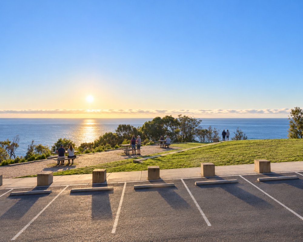
In the southern section, a sealed road from Bateau Bay climbs to the park’s best known viewpoint, looking north along the coast. It is an excellent place to watch for whales from June to November, and there are picnic tables and barbecues.
Coast Walking Track
From Crackneck the track follows the cliff tops south for about three kilometres to Wyrrabalong Lookout and Forresters Beach, through heath, banksia and patches of rainforest. Allow about three hours return, or half that one way with a car at each end.
Birds and Wildlife
Sea eagles and ospreys hunt along the cliffs, and the forest holds lorikeets, honeyeaters and, in the lake margins, waterbirds. Wildflowers are best in late winter and spring.
Red Gum Trail Lookout and Lillypilly Loop
The Red Gum trail is a 3.4 km loop with a lookout over Tuggerah Lake to the ranges, and the shorter Lillypilly loop and the Pelican Beach Road lookout, with picnic tables, are also in the northern section. The park is open from 5.30am to 8pm in daylight saving and to 6pm the rest of the year, and dogs are not allowed.
Where To Stay
There is no camping in the park.
For the southern section, Blue Lagoon Beach Resort at Bateau Bay sits at the start of the Coast walking track, with beachfront powered sites and cabins. For the northern section, Two Shores Holiday Village, a BIG4 park on Tuggerah Lake at The Entrance North, is right beside the park, and the Pullman Magenta Shores Resort, beside the golf course, has hotel rooms and villas.
The Entrance, Bateau Bay and Toukley have holiday parks, motels and apartments, and a golf resort sits on the edge of the northern section at Magenta.
Eat & Drink
There is no food or drink for sale in the park. There are picnic tables at the Bateau Bay Beach picnic area, Crackneck Lookout and the Pelican Beach Road lookout, but toilets only at the Bateau Bay Beach picnic area, so carry water on the walks. For the southern section, Bateau Bay Square has Woolworths, Coles and Aldi, and the Shelly Beach surf club cafe and the Village Kiosk at Toowoon Bay are a few minutes north. For the northern section, The Entrance, just over the bridge, has the widest choice of cafes, restaurants, clubs and takeaways on this part of the coast, and Toukley’s shops and supermarkets are at the northern end of Wilfred Barrett Drive.
For a picnic with a view, pick up fish and chips from The Salty Cod on Bateau Bay Road and carry them up to Crackneck Lookout, and the Bateau Bay Hotel on Lumby Drive is the nearest pub after a walk.
History
The park is in the country of the Darkinjung people, and Wyrrabalong is an Aboriginal name for the headland north of Forresters Beach. Sand mining and housing had claimed much of this coast before local residents won protection for what was left, and the park was declared in 1991.
Getting to Wyrrabalong National Park
For the northern section, cross the bridge at The Entrance and follow Wilfred Barrett Drive; track heads are signposted from roadside car parks. For the southern section, follow Hilltop Street in Bateau Bay to Crackneck Lookout. Both are about an hour and a half from Sydney.
Experiences
- Eco Tourism
- Nature based
- Relaxation
Popular Activities
- Beach
- Bird Watching
- Bush Walking
- Fishing - Beach
- National Park
- Surfing
About Wyrrabalong National Park
- Locality: National Park
- Wyrrabalong National Park Postcode: 2261
- State: New South Wales
- Region: Central Coast
- Latitude: -33.31334
- Longitude: 151.51952
- Timezone: Australia/Sydney
