
Bloomfield and Wujal Wujal, QLD
The Bloomfield River reaches the sea in a remote valley about halfway between Cape Tribulation and Cooktown, where rainforest ranges come down to mangroves and empty beaches. On its southern bank is Wujal Wujal, a small Aboriginal community, and on the northern side are the scattered settlements of Bloomfield, Degarra and Ayton. For most travellers this is the turning point of the Bloomfield Track, the rough coastal route north from the Daintree.
Known For
- Bloomfield Falls, also called Wujal Wujal Falls
- Kuku Yalanji culture and art
- The northern end of the four-wheel-drive Bloomfield Track
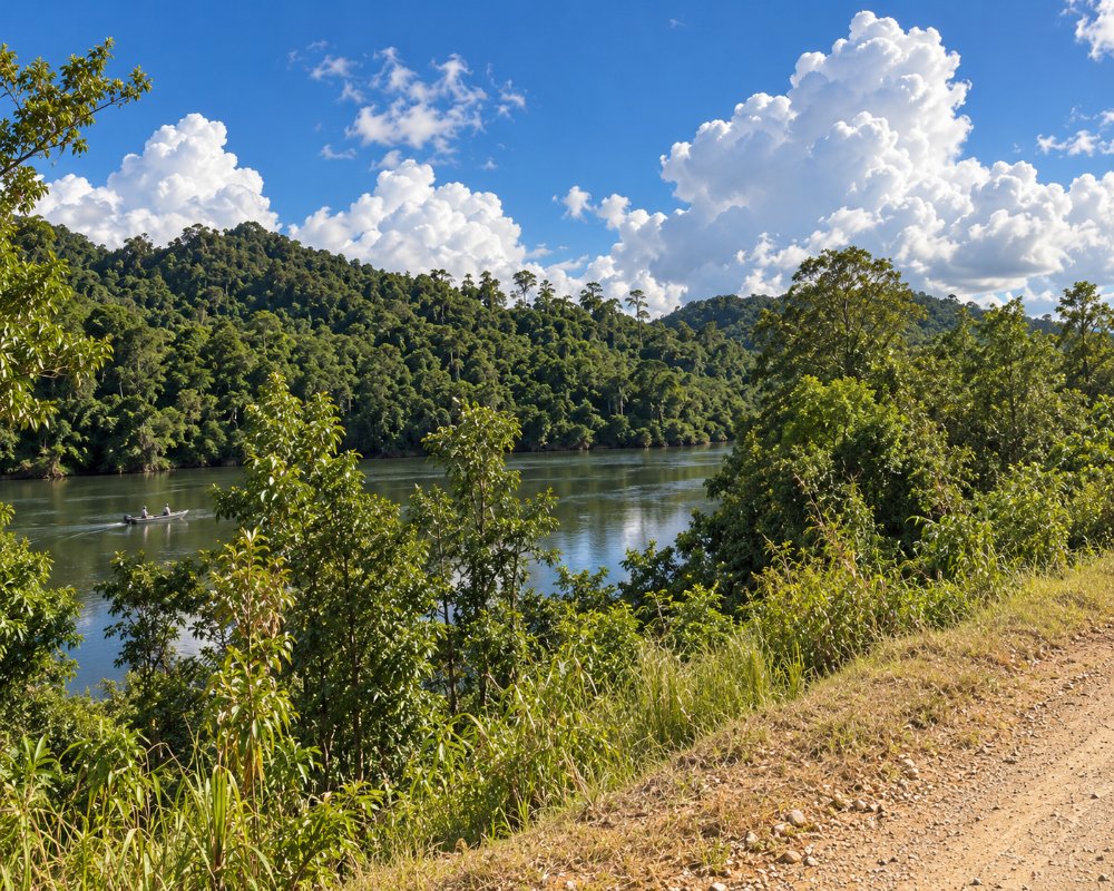
Wujal Wujal has about 300 residents, a store, an arts centre and a council office. Across the river bridge the road turns towards the coast, passing farms, a few lodges and the tiny village of Ayton on Weary Bay. The whole valley was devastated by record flooding after Cyclone Jasper in December 2023, when the community was evacuated by helicopter, and rebuilding has continued since.
Things To Do in Bloomfield and Wujal Wujal
Bloomfield Falls
A short drive and walk upstream from the bridge, the river drops about 40 metres over a broad rock face into a deep pool. The falls are a sacred place for the Kuku Yalanji people. Members of a local family have for many years led short guided walks here, explaining its stories, bush foods and medicines. Do not swim: large crocodiles live in the river below the falls.
Bana Yirriji Art Centre
The art centre at Wujal Wujal shows and sells paintings, prints, ceramics and woven work by local artists; its building was destroyed in the December 2023 flood and it has worked from interim premises since. Opening days vary, so check before making a special trip.
Weary Bay and Ayton
James Cook named Weary Bay in 1770, after his crew had spent a day towing the damaged Endeavour with the ship’s boats. The long beach is backed by coconut palms, and the store at Ayton is a traditional stop for a drink.
Fishing
The river and its mouth are known for barramundi, mangrove jack and mud crabs. Boats can be launched at Ayton, and local guides run fishing and crocodile-spotting trips. Ayton is also the nearest launching point for the Hope Islands, two coral cays offshore.
The Bloomfield Track
The 30-odd kilometres of road south to Cape Tribulation, only partly sealed on the steepest pinches, crosses two steep ranges and several creeks and is for four-wheel-drive vehicles only. It may close after rain. North of the river the road to Cooktown is sealed for most of the way and suitable for ordinary cars in dry weather.
Visiting the Falls
The walk from the car park to the viewing point at Wujal Wujal Falls is an easy 30 minutes return, under a kilometre over a rocky path. There is no access in the wet season, roughly November to March, and the road may also be cut by floods then. Several of the community’s waterfalls are women’s sacred sites and only one is open to the public, so stay on the marked track and respect any signs; the council recommends seeing them with a local guide.
The CREB Track
The CREB Track, named after the Cairns Regional Electricity Board power line it was built to service, is a steep 4WD route of about 70 km from the Daintree River near Daintree Village through the ranges to China Camp and Wujal Wujal. It opens only in the dry season after council crews clear the washouts and fallen trees (the 2026 opening was delayed to mid-July by a long wet), and Douglas Shire listed it as open in November 2026. It is harder than the Bloomfield Track and, like it, is not for trailers, campervans or caravans.
Where To Stay
There is no visitor accommodation in Wujal Wujal itself. On the Bloomfield side there are cabins and camping at Ayton (Bloomfield Cabins and Camping, which took in the old Bloomfield Beach Camp) and self-contained cabins near Weary Bay.
Places are few and some were damaged in the flood, so confirm before you travel. Cooktown and Cape Tribulation have a wider choice.
Bloomfield Cabins and Camping, on ten acres at Ayton (half of it rainforest), has cabins, safari tents, a self-contained two-bedroom cottage and powered and unpowered sites with a camp kitchen and clean amenities; it is pet-friendly, has new accommodation for 2026 and is about an hour from Cooktown on sealed road. Bloomfield Escape, at 9 Weary Bay Road, has a handful of air-conditioned, self-contained cabins (one accessible) in 8.5 acres of fruit-tree gardens a short walk from Weary Bay beach, and hires boats and runs reef and island charters. Mount Louis Station has a holiday home on its cattle property, and Yindilli Camping Ground is a bush camp beside Bairds Creek on the CREB Track at China Camp, reached through Wujal Wujal.
The Lions Den campground and Rossville Retreat are 30 to 40 minutes north. Caravans should come in from Cooktown via Rossville on the sealed road, never over the Bloomfield Track or the CREB Track. The nearest dump point is in Cooktown, on Hope Street.
Eat & Drink
Supplies are limited to the community store, the Ayton store and the art centre cafe. Wujal Wujal has alcohol restrictions, with limits on what may be carried through the community, so check the current rules.
Food here is simple and seasonal. In the dry season, Bloomfield Cabins and Camping at Ayton runs the Hideaway, a licensed cafe and restaurant, along with a Saturday-night outdoor cinema (check its Facebook page for days). The Bloomfield Middle Shop, at 3427 Rossville Bloomfield Road, sells fuel, takeaway food and basic groceries. At Wujal Wujal, the Bana Yirriji Art Centre has a small cafe that opens when there is demand. The Lions Den Hotel at Helenvale, about 40 minutes north, is the nearest pub, with meals seven days and pizzas all day.
Wujal Wujal has alcohol restrictions, so check the limits before carrying any through the community. Self-caterers should shop in Cooktown or Mossman before arriving.
Fuel: the Bloomfield Middle Shop has unleaded, premium and diesel; the Wujal Wujal Service Station at 1 Hartwig Street has a card-operated bowser, gas and ice and is open weekdays only (the council reported it temporarily closed for flood repairs at one stage, so check). Otherwise, fill up in Cooktown or at the Daintree side before the track.
History
This is the country of the Kuku Yalanji, Kuku Nyungkal and Jalunji peoples, and Wujal Wujal is one of the few communities in Queensland where people still live on their ancestral land. Timber cutters and a sugar plantation arrived on the river in the 1880s, and a Lutheran mission was founded in 1886. The community gained its own council in 1980 and took its present name, said to mean many falls.
Getting to Bloomfield and Wujal Wujal
From Cooktown, drive south through Rossville, about an hour and a half. From Cape Tribulation, take the Bloomfield Track if you have a suitable vehicle. Otherwise the inland route from Cairns via Mount Molloy takes about five hours.
Experiences
- Cultural
- Remote
Popular Activities
- Caravan and Camping
- Driving
- Fishing
- Off Road Driving
- Rainforest
- Wilderness
About Bloomfield and Wujal Wujal
- Locality: Rural locality
- Bloomfield and Wujal Wujal Postcode: 4895
- State: Queensland
- Region: Cairns & Great Barrier Reef
- Latitude: -16.0135
- Longitude: 145.2630
- Elevation: 192m
- Timezone: Australia/Brisbane
