
Mount Molloy, QLD
Mount Molloy is a tiny town at an important road junction in the hills behind Port Douglas, about 40 km north of Mareeba. Here the road from the coast meets the inland route north, and the Mulligan Highway from Mareeba carries on to Cooktown. Once a copper and timber town, it is now a quiet stop with a big old pub, a popular free camping area and some of the best birdwatching country in Australia on its doorstep.
Known For
- The last town on the Mulligan Highway before the long run to Cooktown
- The grave of prospector James Venture Mulligan
- Birdwatching around Julatten
The town has a single main street of high-set timber buildings, shaded by big trees. It sits on the boundary between the wet rainforest of the coastal ranges and the dry woodland of the interior, which is why so many bird species overlap here.
Things To Do
National Hotel
The two-storey timber pub in the middle of town, with its wide verandas, dates from the early 1900s and is the social centre of the district. It is a classic north Queensland country hotel and a good lunch stop.
Mulligan’s Grave
James Venture Mulligan, the Irish-born prospector whose discovery of gold on the Palmer River in 1873 set off the rush that led to the founding of Cooktown, Cairns and Port Douglas, spent his last years in Mount Molloy and died here in 1907. He is buried in the small cemetery south of town, and a monument to him stands in the main street.
Sawmill Steam Engine
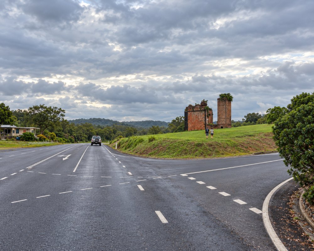
A large steam engine at the southern entrance to town is the heritage-listed remnant of Johnston’s sawmill, which processed rainforest timber here for much of the twentieth century.
War Memorial
Behind the memorial hall is a war memorial that includes a replica of the Long Tan Cross, commemorating the Australian soldiers who fought in the 1966 battle in Vietnam.
Birdwatching
The Julatten area, ten minutes east, is famous among birdwatchers. Abattoir Swamp has a boardwalk and bird hide, and the road up Mount Lewis climbs into high-altitude rainforest that holds several species found only in the Wet Tropics. In summer, buff-breasted paradise kingfishers arrive from New Guinea to nest.
History
Mount Molloy is in the country of the Western Yalanji people.
The town is named after Patrick Molloy, a teamster who found copper at Rifle Creek in the 1880s while searching for stray bullocks. The mine was developed in the 1890s, and in the early 1900s John Moffat’s Irvinebank company took it over, built a smelter and laid a private railway to connect with the Cairns line near Mareeba. Copper prices fell and the smelter closed after only a few years.
Timber replaced mining. Sawmills cut cedar, kauri and maple from the nearby ranges until the declaration of the Wet Tropics World Heritage Area in 1988 brought rainforest logging to an end. Cattle grazing is the main local industry today.
Where To Stay
The National Hotel has pub rooms, and there are a few cabins and bed and breakfasts in the district, including lodges at Julatten that cater for birdwatchers.
The Rifle Creek rest area on the southern edge of town is one of the best-known free camps in the far north, with toilets, showers and room for caravans. Stays are limited to a couple of nights and a donation is requested.
The National Hotel has around ten budget pub rooms upstairs (confirm it is trading before you plan on them). For birdwatchers, Kingfisher Park Birdwatchers Lodge at Julatten, about 10 minutes east, has self-contained units and villas from late May to mid-December only (no camping, no children under 12), and Birdhaven Cottage nearby sleeps four.
Caravanners mostly use the Rifle Creek rest area, which is busy through the dry season with vans heading to or from Cooktown; arrive early afternoon for a shady spot. A dump point is reported at the rest area. For a powered site, the nearest caravan parks are in Mareeba, about 40 km south, or at Mount Carbine, about 30 km north (ring its caravan park first). North of town the Mulligan Highway is sealed and suits any van, but distances are long: about 225 km to Cooktown with fuel at Mount Carbine, the Palmer River Roadhouse and Lakeland. The Rex Range road east to Mossman is steep and winding, so vans should take it slowly.
Eat & Drink
The pub serves counter meals, and a cafe and takeaway in the main street are popular with travellers on the Cooktown run. There is fuel and a small store. For more choice, head to Mareeba or down the range to Mossman and Port Douglas.
Mount Molloy’s food is on Main Street, which is also the Mulligan Highway. The two-storey National Hotel is the traditional stop for a counter meal and a cold beer on the veranda; its publicans, who bought it in 2019, have brewed their own Mt Molloy Lager. The cafe and takeaway at 23 Main Street has long been known for its oversized burgers. Both were offered for sale in recent years and neither could be confirmed as trading in 2026, so check before you rely on them. Mareeba, 40 km south, has the nearest full range of cafes, pubs and supermarkets, and Mossman is about 40 minutes down the range.
Supermarkets and fuel: there is no supermarket; the Mount Molloy Servo and Post Office at 39 Main Street sells fuel and basic supplies, and the Mt Molloy Service Centre is on Brown Street. Fill up here or in Mareeba: the next fuel north is at Mount Carbine, about 30 km away.
Getting There
From Cairns, drive via Kuranda and Mareeba, about 105 km and an hour and a half. From Port Douglas or Mossman, the Rex Range road climbs up through Julatten in about 40 minutes.
Mount Molloy is the last town before the long run north. The Mulligan Highway is sealed all the way to Cooktown, about 225 km away, with fuel at Mount Carbine, the Palmer River and Lakeland.
Experiences
- Historic/Heritage
- Rural/Country
- Self-Drive
Popular Activities
- Bird Watching
- Bush Walking
- Caravan and Camping
- Driving
- Sightseeing
About Mount Molloy
- Locality: Rural locality
- Mount Molloy Postcode: 4871
- State: Queensland
- Region: Cairns & Great Barrier Reef
- Latitude: -16.67557
- Longitude: 145.33004
- Elevation: 402m
- Timezone: Australia/Brisbane
