
Cherrybrook, NSW
Cherrybrook is a leafy residential suburb in the north-west of Sydney, about 27 kilometres from the city centre, between Castle Hill and Pennant Hills. Built mostly in the 1980s and 1990s on former orchards, it is known for its tree-lined streets and good schools rather than for sights, but it has a metro station and sits on the edge of a large bushland national park.
Known For
- Bush tracks in Berowra Valley National Park
- A village shopping centre and parks
- A metro station with fast links to the city
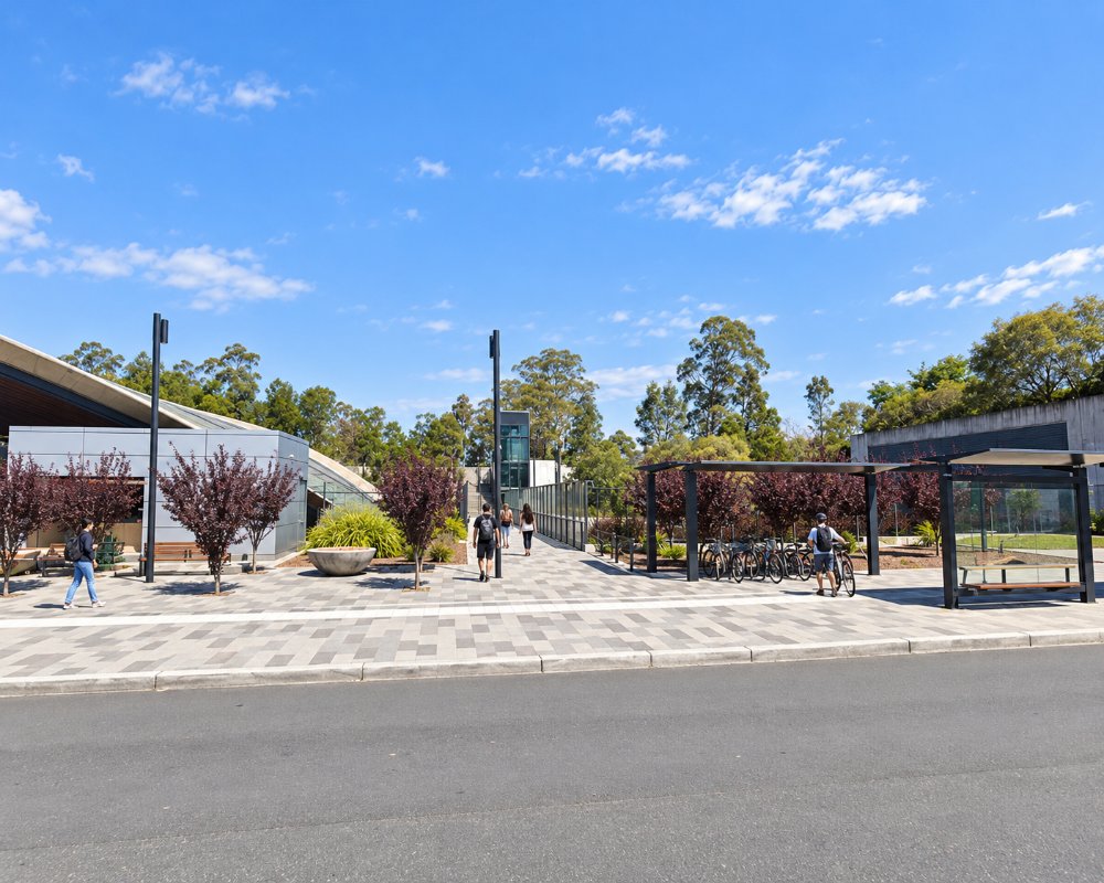
The suburb spreads across a series of ridges and gullies north of Castle Hill Road. Its shopping centre is in the middle, and the metro station is on the southern edge. To the north the houses end at the bush.
Things To Do in Cherrybrook
Berowra Valley National Park
The northern edge of Cherrybrook drops into the valley of Berowra Creek. Tracks from the ends of suburban streets lead down to the creek and connect with the Great North Walk, which can be followed north towards Galston Gorge. The Lakes of Cherrybrook, a chain of small ponds in a reserve, make an easy walk for families.
Parks and Sport
Greenway Park is the main sporting and recreation area, with ovals, an aquatic centre, a skate park and a playground. Many smaller reserves follow the creek lines through the suburb.
Nearby
Cumberland State Forest and the long-running koala sanctuary are five minutes south in West Pennant Hills, and the shops, restaurants and heritage park of Castle Hill are one stop away by metro. The garden nurseries of Dural are ten minutes north.
Callicoma Walk
Hornsby Council’s 5.1 km Callicoma Walk loops from the Lakes of Cherrybrook down into Berowra Valley National Park and back, taking about 3 hours (grade 3). It follows the Great North Walk for part of the way and passes the Callicoma Caves rock overhangs and Coachwood Grotto, named after the trees in the gullies. It can also be started from the corner of Francis Greenway and Macquarie drives.
The Lakes of Cherrybrook
The ponds were made when a local creek was dammed for farm water, and the park around them has picnic tables, a free electric barbecue, a playground and drinking water. Remnant Blue Gum High Forest, a critically rare plant community, surrounds the lakes.
Where To Stay
There is no visitor accommodation in Cherrybrook.
Hotels can be found at Castle Hill, the Norwest business park and Hornsby.
The nearest hotel is Peppers The Hills Lodge at Castle Hill, one metro stop west, a boutique hotel with a restaurant and day spa. Hornsby, to the north-east, has motels, and Punthill Norwest and Quest Bella Vista are apartment hotels four metro stops west. For caravans and campervans, the nearest tourist park is Discovery Parks – Lane Cove at Macquarie Park, by way of the M2, with its powered sites running as unpowered for now.
Eat & Drink
The village shopping centre has cafes, bakeries and a range of casual restaurants, with Chinese, Indian and Korean food well represented. Castle Hill has a far larger choice.
Cherrybrook Village on Shepherds Drive is the local centre, with more than 50 stores. For coffee and cake there are Caffe Cherrybeans, Pattisons Patisserie, The Brook Eatery and C9 Chocolate and Gelato, and casual meals come from Zeus Street Greek, Kamado, Haru Sushi, Lil Cilantro and Mad Mex. Woolworths, Martelli’s Fruit Market, George’s Fine Meats, Costi’s Catch and Han Mart cover the shopping. For pubs and bigger restaurants, go to Castle Hill, about 5 km west.
History
Cherrybrook is Dharug country. In 1839 Joseph Harrison and his wife planted an orchard here and called their cottage Cherrybrook, after the cherry trees beside the creek. The district grew citrus and stone fruit for more than a century. Subdivision began in 1959, and the suburb took the name of the old farm.
Getting to Cherrybrook
The metro runs from the city to Cherrybrook station in about 35 minutes. By car, use the M2 motorway and Pennant Hills Road or Castle Hill Road.
Experiences
- City
- Nature based
Popular Activities
- Bush Walking
- Food and Wine
- National Park
- Shopping
About Cherrybrook
- Locality: Suburb
- Cherrybrook Postcode: 2126
- State: New South Wales
- Region: Sydney
- Latitude: -33.7216
- Longitude: 151.0443
- Elevation: 153m
- Timezone: Australia/Sydney
