
Mount Gravatt, QLD
Mount Gravatt is a suburb on the south side of Brisbane, about ten kilometres from the city centre, taking its name from the wooded hill that stands above it. The summit lookout offers a wide view back to the city skyline, and the forest reserves around it give a taste of the bush without leaving the suburbs.
Known For
- The Mount Gravatt summit lookout
- Bush walks in Toohey Forest
- Westfield Mt Gravatt shopping and dining
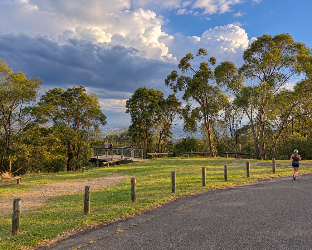
The hill rises to nearly 200 metres between Logan Road and the South East Freeway. The older suburb and its shopping strip lie on its eastern side, and to the south is Upper Mount Gravatt, where one of the largest shopping centres in the city stands beside a busway station. Toohey Forest and a university campus spread across the ridges to the west.
Mount Gravatt is not a major tourist stop, but the lookout is a pleasant detour, especially when combined with a meal in nearby Sunnybank.
Things To Do in Mount Gravatt
Mount Gravatt Lookout
A road winds to the summit, where a lookout faces north-west over the suburbs to the towers of the city, Mount Coot-tha and the ranges beyond. It is particularly good at sunset and after dark. The summit has a cafe, picnic tables, barbecues and a playground, and the surrounding reserve is home to koalas, gliders and many birds.
Summit Walking Tracks
Several tracks climb the hill through open eucalypt forest. The 1.2 km Summit Track from Gertrude Petty Place at the foot of the hill takes about 40 minutes each way, and loop trails on the slopes pass interpretive signs about the plants, wildlife and Aboriginal history of the area. The paths are well made but steep in places.
Toohey Forest
West of the freeway, Toohey Forest covers about 260 hectares of bushland threaded with walking and cycling tracks. Sandstone outcrops, grass trees and wildflowers in spring make it an attractive place to walk, and picnic areas at its edges have barbecues and shelters. A network of paths connects it with the university campus and the Mount Gravatt reserve.
Shopping
Westfield Mt Gravatt, at Upper Mount Gravatt, has department stores, more than 400 shops, a cinema complex and an outdoor dining precinct. The older strip along Logan Road has independent shops, op shops and cafes with a more local feel.
Markets and Sport
A large weekly market at the Mount Gravatt Showgrounds sells fresh produce, plants and food on Sunday mornings. The Queensland Sport and Athletics Centre at Nathan, just to the west, hosts athletics meetings and concerts.
Where To Stay
Mount Gravatt has a modest selection of accommodation, mostly along the main roads.
Motels and apartment hotels on Logan Road and near the shopping centre at Upper Mount Gravatt provide straightforward rooms with parking, convenient for the motorway, the university and the hospitals of the south side.
Hotels at Eight Mile Plains, five minutes south, serve the nearby technology park and are well placed for drivers heading to the Gold Coast.
For a holiday stay, the city centre and South Bank are 15 minutes away by busway.
Brisbane Holiday Village, on Holmead Road at Eight Mile Plains about 6 km south of the lookout, is the closest holiday park to the south side. It has two- and three-bedroom cabins, Airstream glamping vans, and powered, unpowered and ensuite caravan sites as well as campsites. It also has a lagoon pool, a children’s splash pool, mini golf, a tennis court, a playground and a restaurant, with free activities in the school holidays. Longer stays are available too, which suits people visiting the hospitals or the university.
In Sunnybank, about 5 km south-west, the Sunnybank Hotel on McCullough Street has motel-style rooms behind its bistro and sports bar. It is across the road from Sunnybank Plaza and within walking distance of dozens of restaurants, a good choice if dinner is the reason for the trip.
Mount Gravatt Outlook Drive winds up the hill from Shire Road to a summit car park, and the gates are open from 6am to 11pm. The lookout is easier to visit without a caravan in tow, so leave the van at your park.
Eat & Drink
The cafe at the lookout serves breakfast, lunch and coffee with the view. Logan Road has a line of inexpensive restaurants, including long-established Indian, Thai, Vietnamese and Italian places, along with pubs and bakeries.
The dining precinct at Westfield has a wide range of restaurants and bars open into the evening. The Asian food capital of Sunnybank, with hundreds of restaurants, is five minutes further south and is the better choice for dinner.
Lovewell, the cafe at the summit, is a social enterprise that trains and employs women rebuilding their lives. It serves breakfast and lunch, including salads, burgers and calamari, in an indoor room and on an outdoor deck that looks across the south side. Down on Logan Road, Hallowed Grounds Espresso is a cafe full of vintage bric-a-brac, much of it for sale, and Little Glass Room Espresso Bar serves Thai dishes alongside the usual breakfasts.
Little Black Pug is an all-day cafe that welcomes dogs. Mini-Fritz is a small German beer garden and eatery on the main road, and the Newnham Hotel on Newnham Road at Upper Mount Gravatt has a family bistro, a beer garden, a sports bar and a children’s play area. For something sweet, The Whisk Fine Patisserie at Upper Mount Gravatt makes French-style pastries, macarons and chocolates.
The showgrounds on Logan Road also host Mt Gravatt Street Food, a night market of food trucks and stalls with a licensed bar and live music. Supermarkets are at Westfield Mt Gravatt and along Logan Road, and fuel is easy to find on the main roads.
History
Mount Gravatt is in the country of the Yuggera and Turrbal peoples, for whom the hill, known as Kaggur-madul, was a significant place. It was named in 1840 after Lieutenant George Gravatt, who briefly commanded the Moreton Bay settlement.
Farms and a small village grew along Logan Road, the main route south, and the hill was reserved as a public park in 1893. Suburban housing spread after the Second World War, and the area changed again with the building of the freeway, the university and the shopping centre from the 1970s.
Getting to Mount Gravatt
The South East Busway and the Brisbane Metro run from the city centre to Upper Mount Gravatt station in about 15 minutes, and other buses follow Logan Road through the older suburb. There is no railway.
By car the lookout is about 15 minutes from the centre by the South East Freeway. The summit road closes to vehicles at night, though walkers can still reach the top.
Experiences
- City
- Nature based
- Relaxation
Popular Activities
- Bush Walking
- Cycling
- Shopping
- Sightseeing
- Wildlife
About Mount Gravatt
- Locality: Suburb
- Mount Gravatt Postcode: 4122
- State: Queensland
- Region: Brisbane
- Latitude: -27.54226
- Longitude: 153.07386
- Elevation: 183m
- Timezone: Australia/Brisbane
