
Harrietville, VIC
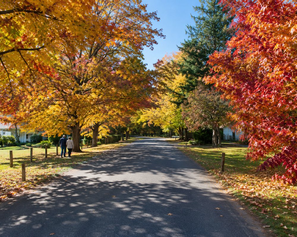
Harrietville lies at the head of the Ovens Valley, about 345 km north-east of Melbourne, where the Great Alpine Road begins its long climb to Mount Hotham. It is a small village of old miners’ cottages, a pub, a bakery and riverside camping, surrounded by steep forested mountains.
It is the starting point for the walk to Mount Feathertop, Victoria’s second-highest peak, and the end of the Great Valley Trail from Bright.
Known For
- The climb to Mount Hotham
- The walk to Mount Feathertop
- The Tronoh dredge holes and the Great Valley Trail
Things To Do in Harrietville
Mount Feathertop
Mount Feathertop, 1,922 metres, is reached by the Bungalow Spur, about 11 km each way from Harrietville, or by the Bon Accord Spur. It is a hard climb with superb views from the top, and Federation Hut, near the summit, has camping.
Tronoh Dredge Holes
The Tronoh Dredge Holes, on the Victorian Heritage Register, were dug by a giant gold dredge, said to have been the largest in the southern hemisphere, which worked here from the 1940s until 1954. The ponds are now a peaceful spot for a walk.
Great Valley Trail
The Great Valley Trail, opened in 2022, is a 26 km sealed path between Harrietville and Bright, crossing the river near the Harrietville Trout Farm.
The Chinese Hotel Concert
A concert is held each June at the old Chinese Hotel, a reminder of the many Chinese miners who worked the valley.
Gateway to Hotham
Mount Hotham is 32 km up the Great Alpine Road. In the snow season, from about early June to mid-October, chains must be carried from the start of the climb, and there is no chain hire on the mountain.
When To Visit
Summer and autumn are the best seasons for walking, riding and Feathertop. Winter brings snow to Hotham and Feathertop, and Harrietville is the last village before the mountain.
Where To Stay
The Harrietville Snowline Hotel has 16 motel units, and there are cabins, cottages and B&Bs in the village.
For caravans and campers, the Harrietville Caravan Park and Cabins on Camping Park Road sits beside the west branch of the Ovens River, and there is free camping at the Smoko Streamside Reserve. Harrietville is the end of the line for caravans in winter: the climb to Hotham is not suited to towing in the snow season.
The Harrietville Hotel Motel at 169 Great Alpine Road, the village’s lower pub, has motel rooms beside its bistro and bar, and the Snowline Motel, run with the top pub, is open as usual. Lavender Hue is a four-star B&B on the bank of the Ovens River, with a studio loft for two, a kitchenette, a riverside balcony and a continental breakfast of espresso and hot croissants. The Harrietville Caravan Park at 20 Camping Park Road has cabins and caravan sites by the river, and it is the last caravan park before the climb to Mount Hotham.
Smoko, about 8 km back towards Bright on the Ovens River, is a free riverside camping area; bring your own drinking water. For walkers, Federation Hut near the summit of Mount Feathertop has a campsite, but it is a long, steep walk in, and you will need to carry everything. There is no dump point in Harrietville; the nearest is at the NRMA Bright Holiday Park on Cherry Lane in Bright, about 25 km north-west.
Eat & Drink
The Harrietville Snowline Hotel has an open fire and a pub menu, and the Harrietville Bakery is known for its pretzels and vanilla slice. The Harrietville Hotel Motel, the lower pub on the main road, also serves lunch and dinner.
The Snowline Hotel’s pub, now known as The Snowy Pub and called the “top pub” by locals, reopened for the season in late October 2026; it is known for Sunday roasts, steaks and fish and chips, with two open fires and local beer and wine. It usually opens from Wednesday to Sunday. The Harrietville Hotel Motel, the lower pub at 169 Great Alpine Road, serves dinner every night and lunch from Friday to Sunday, with a bar open every day.
In winter, the snow-season cafes and bars at Mount Hotham, 32 km up the Great Alpine Road, are the next stop. Bright, about 25 km north-west, has the widest choice, from Bright Brewery on the river to Beechworth Bakery Bright and Sixpence Coffee Roasters, and the Wandi Pub at Wandiligong is a 25-minute drive. Harrietville has no supermarket or fuel. Buy groceries at the IGA or Woolworths in Bright and fill up there before the climb to Hotham.
History
This is the Country of the Dhudhuroa, Taungurung and neighbouring peoples. The goldfield was reported in 1858 and rich reefs were found in 1860. The village is said to be named after Harriet Luke, probably the first European woman in the district. Many Chinese miners worked the valley, and dredging continued until 1954. Bushfires burnt the surrounding ranges in 2003 and 2013.
Getting to Harrietville
Harrietville is about 345 km north-east of Melbourne, around 3 hours 45 minutes’ drive via the Hume Freeway, Wangaratta and the Great Alpine Road through Bright. In winter, coaches run from Melbourne and Bright to Mount Hotham via Harrietville.
Experiences
- Active
- Historic/Heritage
- Mountain
- Nature based
- Rural/Country
Popular Activities
- Bush Walking
- Caravan and Camping
- Cycling
- Fishing
- Fishing - Trout/Fly
- Gold prospecting
- Mountain Biking
- National Park
- Sightseeing
- Swimming
About Harrietville
- Locality: Urban locality
- Harrietville Postcode: 3741
- State: Victoria
- Region: High Country
- Latitude: -36.89203
- Longitude: 147.06402
- Elevation: 505m
- Timezone: Australia/Melbourne
