
Woodenbong, NSW
Woodenbong is a small town on the Mount Lindesay Road, just off the Summerland Way, about 10 km south of the Queensland border and 60 km north-west of Kyogle. It sits in a high valley surrounded by the remnants of ancient volcanoes, with the tiered summit of Mount Lindesay on the skyline, and it is a handy base for the border ranges and their national parks.
Known For
- Views of Mount Lindesay
- Githabul country
- Border-ranges forests and waterfalls
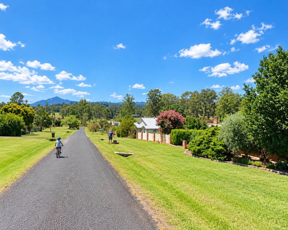
About 400 people live in Woodenbong, which has a pub, a few shops and a well-kept camping ground. The name is thought to come from a Githabul word, though its meaning is uncertain. In 2007 the Githabul people’s native title over large areas of the surrounding forests and parks was recognised.
Things To Do
Mount Lindesay
The mountain, 1,177 metres high, rises in a series of cliffs like a layered cake and is one of the most striking peaks in the region. It is best seen from the highway north of the town. Climbing it is a serious rock scramble and is discouraged out of respect for its cultural significance.
Tooloom Falls and Tooloom National Park
Tooloom Falls, about 25 minutes south-west near Urbenville, and the World Heritage rainforest of Tooloom Scrub in Tooloom National Park are the main natural attractions of the district.
Border Ranges and Koreelah
Forest roads lead east towards the Border Ranges National Park and west to Koreelah National Park, where a campground sits beside a creek and small gorge.
Scenic Drives
The Mount Lindesay Highway north to Beaudesert, and the road west through Legume to Killarney and the Queen Mary Falls, are among the most scenic in the border country.
Woodenbong Camp Ground and pool
The camp ground on Unumgar Street sits next to the memorial pool, an outdoor gym and a skate park, with free electric barbecues, a sheltered camp kitchen, showers, washing machines and a free grey-water dump point. Dogs are welcome.
Koreelah National Park
About 40 minutes west towards Legume, the easy Gorge walking track follows Koreelah Creek past rock pools where you can swim, and Koreelah Creek campground is a small, remote bush camp; the last part of the road is gravel.
History
Woodenbong is in the country of the Githabul people.
The explorer Allan Cunningham and the commandant Patrick Logan both travelled through the district in the 1820s. Cattle runs followed, then timber-getters after the red cedar and hoop pine. The village grew in the early 1900s as land was opened for dairy farms, though a police station stood here by 1888. An Aboriginal reserve at Muli Muli, just outside town, remains a Githabul community.
Where To Stay
Woodenbong has a hotel and a camping ground with powered sites, run by local volunteers for the Woodenbong Progress Association.
The camp ground has 20 sites, powered at about $15 a day and unpowered at about $10, and it is pet friendly; book through the Progress Association’s number on the council page. The Woodenbong Hotel has pub rooms, and the Crown Hotel at Urbenville, 12 km south-west, has rooms and camping for caravans.
Kyogle has motels.
Eat & Drink
The hotel serves meals, and the village has a small store.
The Woodenbong Hotel has hearty pub food in an old country dining room, and the Crown Hotel at Urbenville is open seven days. For a supermarket and fuel, go to Kyogle or Beaudesert before heading onto the park roads, which have no services.
Getting There
Woodenbong is on the Mount Lindesay Road just off the Summerland Way, about two hours from Brisbane via Beaudesert and an hour from Kyogle.
Experiences
- Cultural
- Nature based
- Rural/Country
- Self-Drive
Popular Activities
- Bush Walking
- Caravan and Camping
- Driving
- National Park
- Sightseeing
- Swimming
About Woodenbong
- Locality: Urban locality
- Woodenbong Postcode: 2476
- State: New South Wales
- Region: North Coast NSW
- Latitude: -28.39104
- Longitude: 152.61204
- Elevation: 408m
- Timezone: Australia/Sydney
Accommodation In Woodenbong
Discover some of the accommodation in and around Woodenbong
