
Carrieton, SA
Carrieton is a tiny township on the RM Williams Way in the southern Flinders Ranges, about 310 km north of Adelaide and midway between Orroroo and Hawker. With a population of only a few dozen, it is a quiet, tidy place set in wide, dry sheep country, and it comes to life once a year for one of South Australia’s best-known rodeos.
Known For
- The Carrieton Rodeo
- A quiet stop on the RM Williams Way
- Ruins of abandoned farming settlements
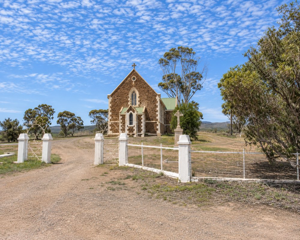
The town has a pub, a general store, a community-run caravan park and a handful of stone buildings from the 1880s. It lies north of Goyder’s Line, in country that proved too dry for the wheat farmers who settled it, and the surrounding plains are scattered with the ruins of their homes and villages.
Things To Do
Carrieton Rodeo
Held each year on New Year’s Eve, the rodeo draws competitors and thousands of spectators for bull riding, bronc riding and barrel racing under lights.
Historic Buildings
A short walk around town passes the old police station, churches, the hotel and other buildings from the boom years of the 1880s.
Johnburgh
About 24 km north-east by gravel road, the near-deserted township of Johnburgh is a striking reminder of the settlers who pushed too far into marginal country.
Yanyarrie Whim and Moockra Tower
Out of town are an old horse-powered whim once used to raise water from a well, and Moockra Tower, a rocky outcrop with views across the plains to the ranges.
Scenic Drives
The RM Williams Way is a peaceful alternative route into the Flinders Ranges, with views of the Horseshoe Range and plenty of emus and kangaroos.
History
Carrieton is in the country of the Nukunu and Ngadjuri peoples.
Pastoral runs were broken up for farming in the 1870s during a run of unusually wet years. The town was surveyed in 1879 and named after Lucy Caroline Jervois, a daughter of the Governor. The railway arrived in the early 1880s. Drought soon returned, most of the farms failed and the land reverted to grazing. The railway closed in the 1980s.
Where To Stay
The community-owned Carrieton Caravan Park, in the former school on Fourth Street, has powered lawn sites, a camp kitchen, showers, a laundry, a cottage, a bunkhouse and a dump point. The pub, now trading as the Yanyarrie Pub, has been adding rooms; check before relying on it.
More accommodation is available at Orroroo, 40 km south, and Hawker to the north.
The Carrieton Progress Association owns and runs the caravan park in the old school, which taught local children from 1882 to 1997. The grounds keep the school buildings and gardens. The office is staffed through the day, every building has wheelchair access, and the amenities block and the cottage each have a separate accessible shower and toilet. Small groups and pets are welcome. There are indoor and outdoor kitchens, a laundry, barbecues and a community room with a wood heater, and the town swimming pool opens from October to March. The town fills up for the rodeo on New Year’s Eve, so book well ahead if you want a site that night.
For a station stay, Almerta Station, on Almerta Road at Yanyarrie north of town, has creek-side bush camping and shearers’ quarters for groups. Its station tracks suit most vehicles, and a spring on the property holds water all year. Bendleby Ranges, in the same district, has cottages, shearers’ quarters, powered sites and bush camps, with 4WD and mountain-bike tracks. Station tracks can close after rain, so ring ahead. The Flinders Ranges Campdraft, held over a weekend in autumn, usually the weekend before Easter, has free camping and showers for those attending.
Eat & Drink
The Yanyarrie Pub, the former Carrieton Hotel, opens from Thursday to Sunday; ring ahead for meals. The community store sells basic supplies. Fuel is sold at the community store on weekdays only, and Orroroo’s fuel station closed in 2025, so fill up at Hawker, about 70 km north, or Peterborough. The pub at Cradock, on the way to Hawker, is another stop.
Food in Carrieton is simple and run by the community. The pub, recently renovated, pours beer on tap and serves country meals. Its days can change with the seasons, so ring ahead, especially early in the week. The Carrieton Community Store is owned by the Progress Association and stands in a building that began as a butcher’s shop in the early 1880s. It makes good coffee, stocks a surprisingly wide range of groceries and has the post office counter and gas bottles. It opens on weekdays only, with short hours early in the week, and is closed on weekends and public holidays.
Event days bring their own food. At the rodeo on New Year’s Eve, the rodeo club runs a bar and food stalls known for fresh steak sandwiches. The Flinders Ranges Campdraft in autumn has a canteen, a licensed bar, a Friday-night barbecue and a Saturday-night roast dinner.
For more choice, Orroroo, about 40 km south, has two hotels and cafes such as Two Farmers Daughters, and Hawker, about 70 km north, has more shops and places to eat. Do your main grocery shopping at the supermarkets in Orroroo or Hawker.
Getting There
Carrieton is on the sealed RM Williams Way, which leaves the main road at Jamestown and rejoins the route to the Flinders at Hawker. It is about three and a half hours from Adelaide via the Clare Valley.
Experiences
- Caravan and Camping
- Remote
- Rural/Country
- Self-Drive
Popular Activities
- Bush Walking
- Caravan and Camping
- Cycling
- Driving
- Outback
- Sightseeing
About Carrieton
- Locality: Rural locality
- Carrieton Postcode: 5432
- State: South Australia
- Region: Flinders Ranges and Outback
- Latitude: -32.42464
- Longitude: 138.52915
- Elevation: 438m
- Timezone: Australia/Adelaide
